Three Sisters Wilderness in Oregon
Early July is the wrong time to visit this area, most trails will have snow and the trails that I wanted to hike had extra snow and …………………. a billion mosquitos trying to eat me. But I am definitely coming back next year at the correct time.
I stayed in the town of Sisters, Oregon. It is the prettiest small town that I have seen and I would love to live there one day. Logistics note: you cant pump your own gas in Oregon, WTF.
With that in mind, I highly recommend to drive the scenic route in McKenzie Highway if you are coming from the west. A nice attraction is the Dee Wright Observatory. Earlier in the 20th century someone decided to use actual lava rocks to create a two story structure with small windows pointing to the main peaks in the area: Mt Washington, South Sister, Mt Jefferson. The area is a complete lava field that came from one of the peaks and nature has not reclaimed it yet. Notice the two islands of green; that is not reclaimed, the lava field flowed around them:
There is a easy trail that takes you inside the lava field and it makes a pretty good effort of explaining features of the lava field.
Ok, I had some hikes planned and after the first day I realized that the snow fields were going to make two of the hikes impossible, so I improvised.
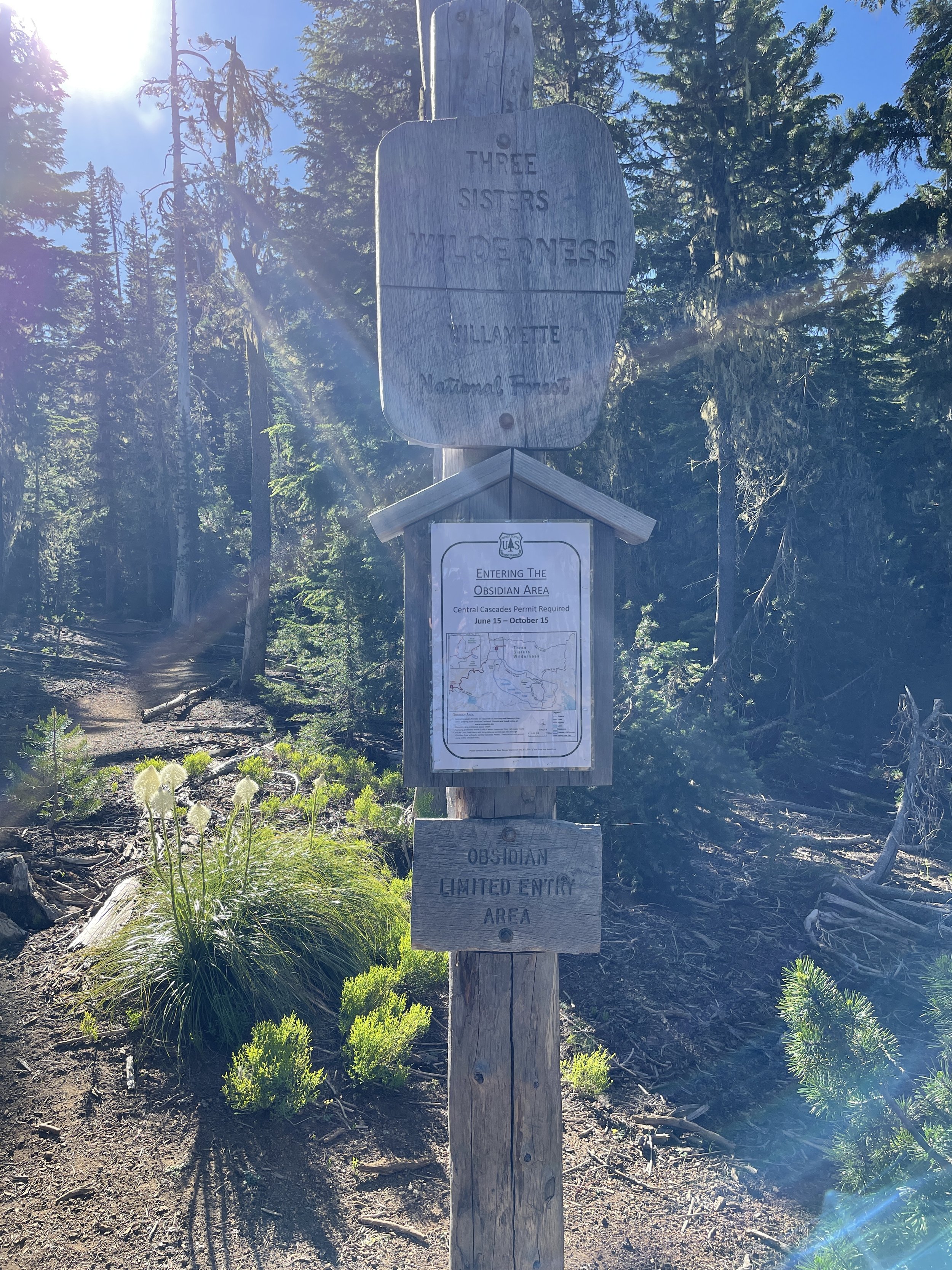
The first hike I planned was a loop for the Obsidian trail (you need a permit to hike most of these trails).
It was more like a lollipop loop and I was going counterclockwise. You start in a forested area and immediately start getting elevation, along with an army of mosquitos. No matter how much repellent I used, the bastard found weak areas around my shoulders and went to town on me. You don’t want to hike with that many mosquitos, its no fun at all.
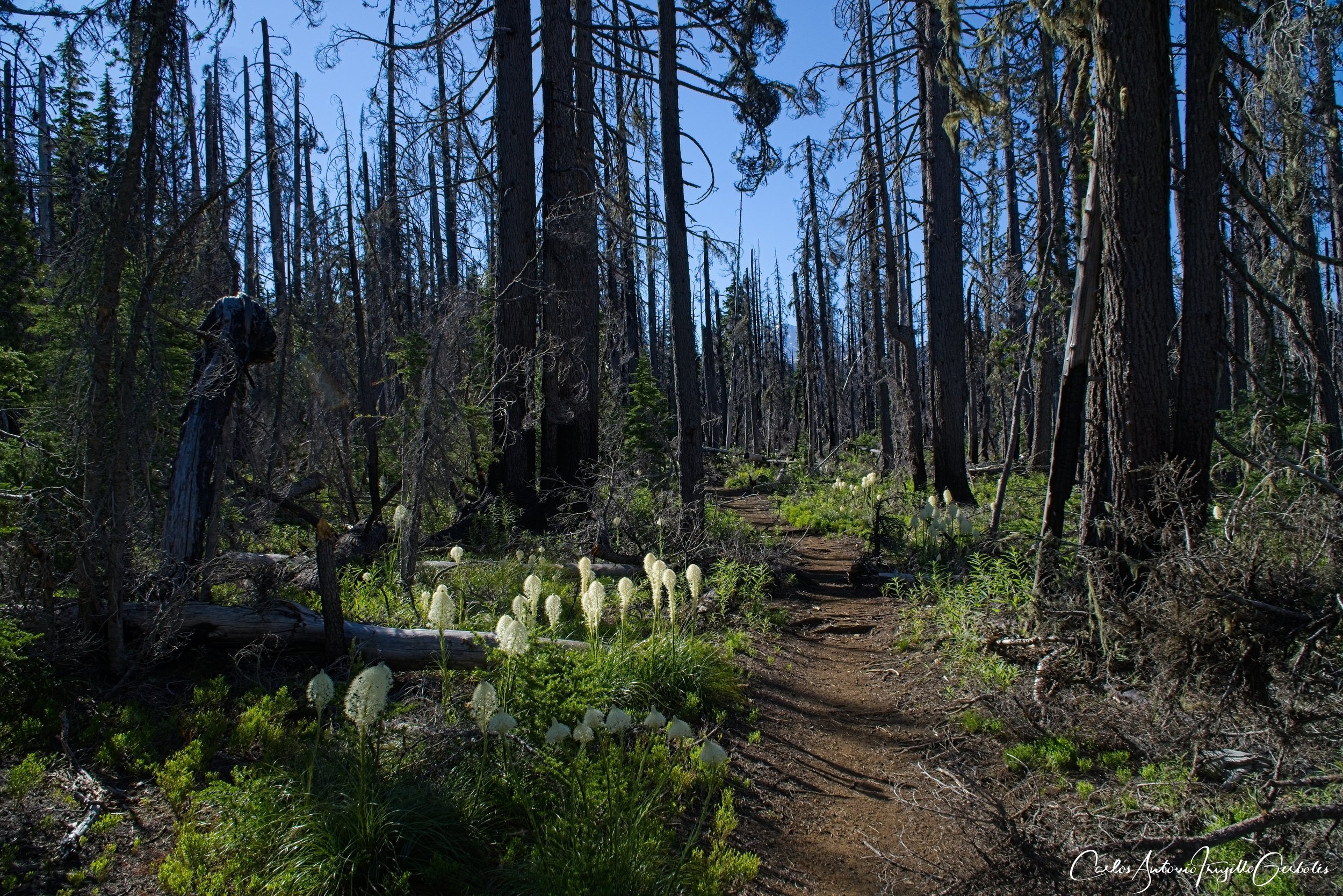
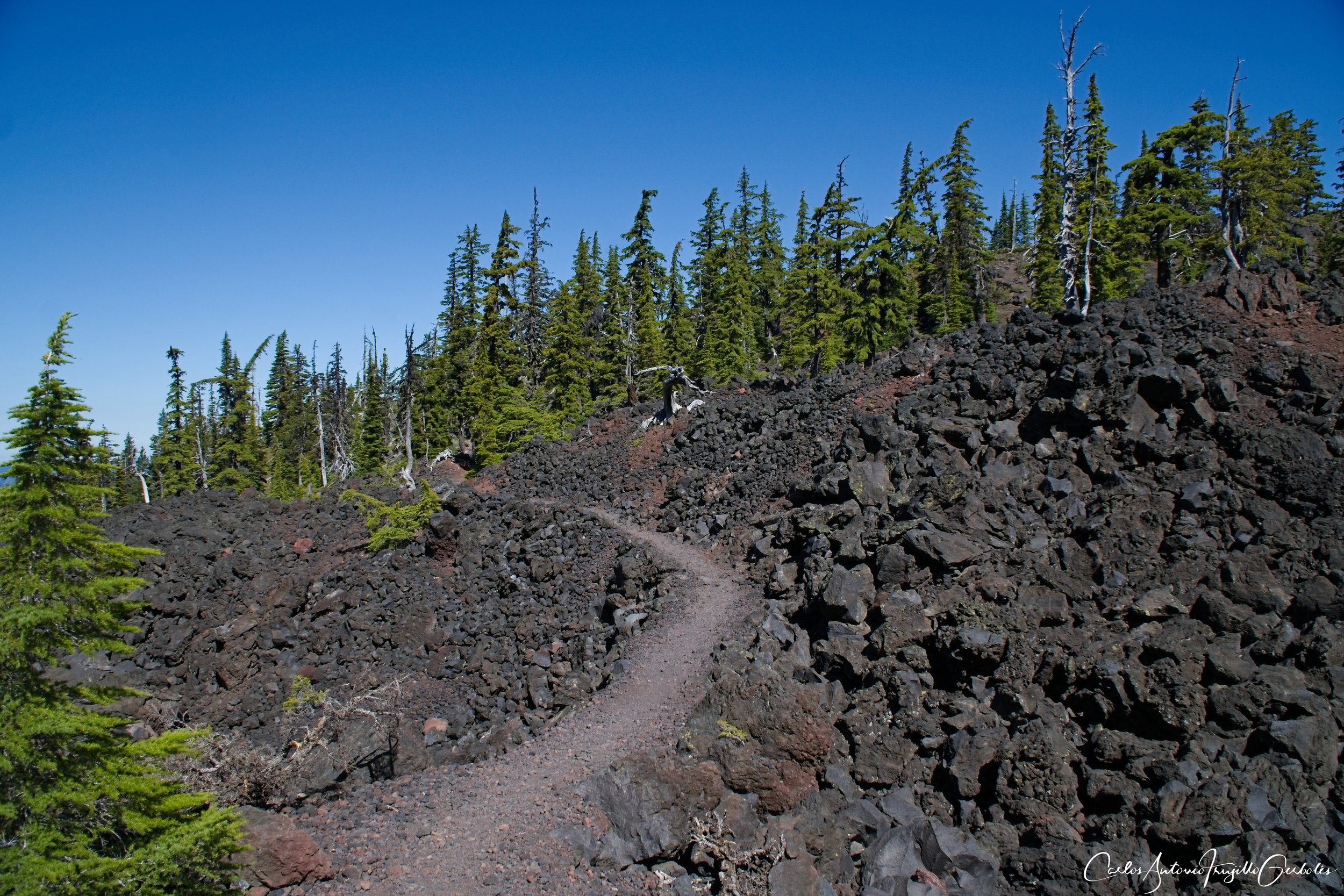
After the small forested area I entered a lava field where the mosquitos were finally gone:
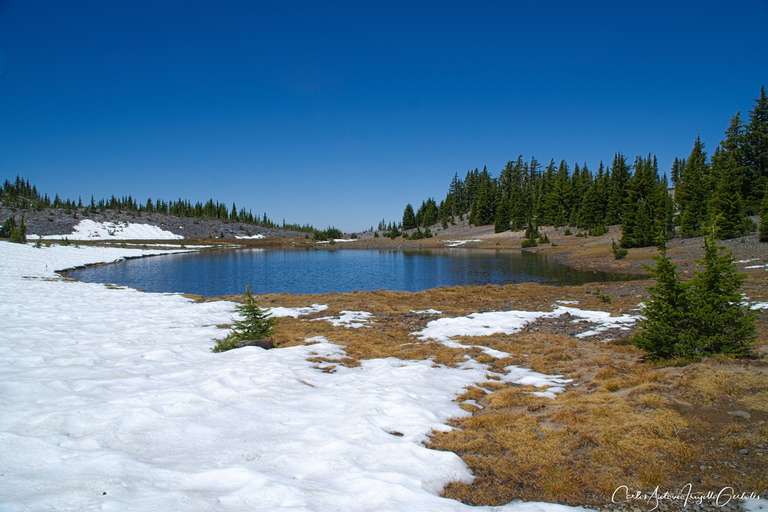
Then I started to see snow and eventually lost the trail when I went back into the forested area. I gave up and double tracked to the start of the lollipop hoping the snow on that side was not that bad. It turned out there was lots of snow there but in that area I could see the footprints of people that were backpacking in the area so I never lost track of the trail. At this point South Sister starts to peek in the horizon:

You are still going up and briefly forget what the trail is named for ……….. eventually you reach a gigantic field of obsidian rocks. I ran into a returning backpacker that told me the story: Indian tribes would travel to this area to specifically collect obsidian stones; either to be used for weapons or to trade with other tribes.
There is a small lake in there and I decided that was enough of a hike for the day and turned around. I plan to return next year at a better time and complete this loop. The fact that there is a limited number of permits to this trail and the uniqueness of the obsidian rocks, I highly recommend this hike.
The second hike that I did manage to do was going to Moraine lakes and the Green lakes, starting at the Devils Lake trailhead. Another trail that you need permits for. The trail starts on a brutal one mile uphill hike, no mercy at all. You will then reach an intersection: one path takes you to the lakes, the other path to the trail towards the top of South Sister. I was planning to go up South Sister but the snow fields scared me and I decided to skip it.
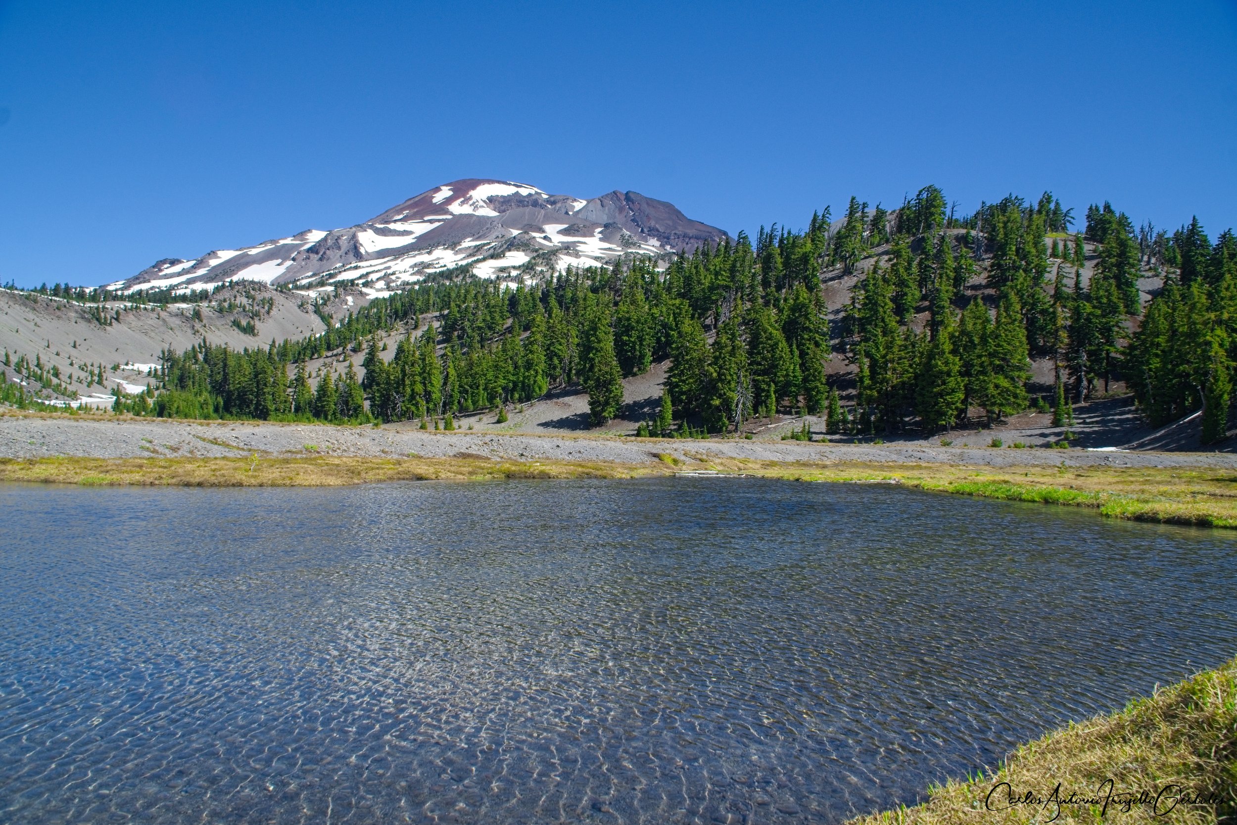
Once you are past the South Sister intersection, the trail levels and the views of South Sister are lovely.

The first lake is Moraine Lake and you need to stick to the left of the trail at an obvious intersection. There are campsites on the other side of the lake and you can see people at a distance.

You then leave the trail and start on a trail that will intersect with the main Green Lakes trail. There are two trails going North, I took the west trail and had to get to the east trail which takes me to Green lake and that is that connector trail that is in a boring forested area.

This trail is very popular so if you are doing this on a weekend, be ready to run into a lot of people. I prefer trails to be less populated. This time I was hiking it in the middle of the week and the traffic was minimal. Since I started the hike at Devils Lake, I wasn’t going to have enough time to explore all the Green lakes, so I found the first one and turned around.
This is another hike that I highly recommend; besides the first mile, the trail is mostly level.

And for the final day I had to find a hike that replaced the ones I couldn’t make so I decided to hike a bit in the Mount Jefferson Wilderness area, around Three Fingered Jack. Parts of the area is still recovering from forest fires from a few years ago (I asked some people on the trail and told me the fires took place around the Bush II administration). Square lake is nice and you can find some rocks that overlook the lake and take a rest. At a distance you can still see North Sister.
There are no permits for this trail but you need a parking permit; I used my National Parks Annual Pass (you just put it on the windshield of your car) …………. or maybe I am confusing this with my UINTAS hikes :/

I took two videos showing the lake and the Sisters at a distance:
This hike creates a 20 mile loop around Three Fingered Jack and parts of the trail are the PCT. I think I made it almost to Jack lake and turned around. There is not that much elevation and very few people on the trail.
I am definitely coming back next year and for sure I will hike South Sister and MacArthur Tam to No Name Lake, both with great views.