Alpine lakes in the Uintas
I spent three days hiking in the Uintas Wilderness, a couple of hours drive east of Salt Lake City, this past August. I loved it and this place is one reason I want to retire in Utah.

I planned three hikes: (1) Amethyst Lake, (2) the Naturalist Basin, and (3) the area around Ibantik Lake.
Amethyst Lake is a destination hike, meaning that there are not that many features along the trail to explore and many people use it as an overnight backpacking destination to the lake. There is very little elevation gain and the trip is about 6 miles one way.

You are hiking most of the time within earshot of a creek and at some point you will get to see a short nice falls. I didnt see that many people on the trail.
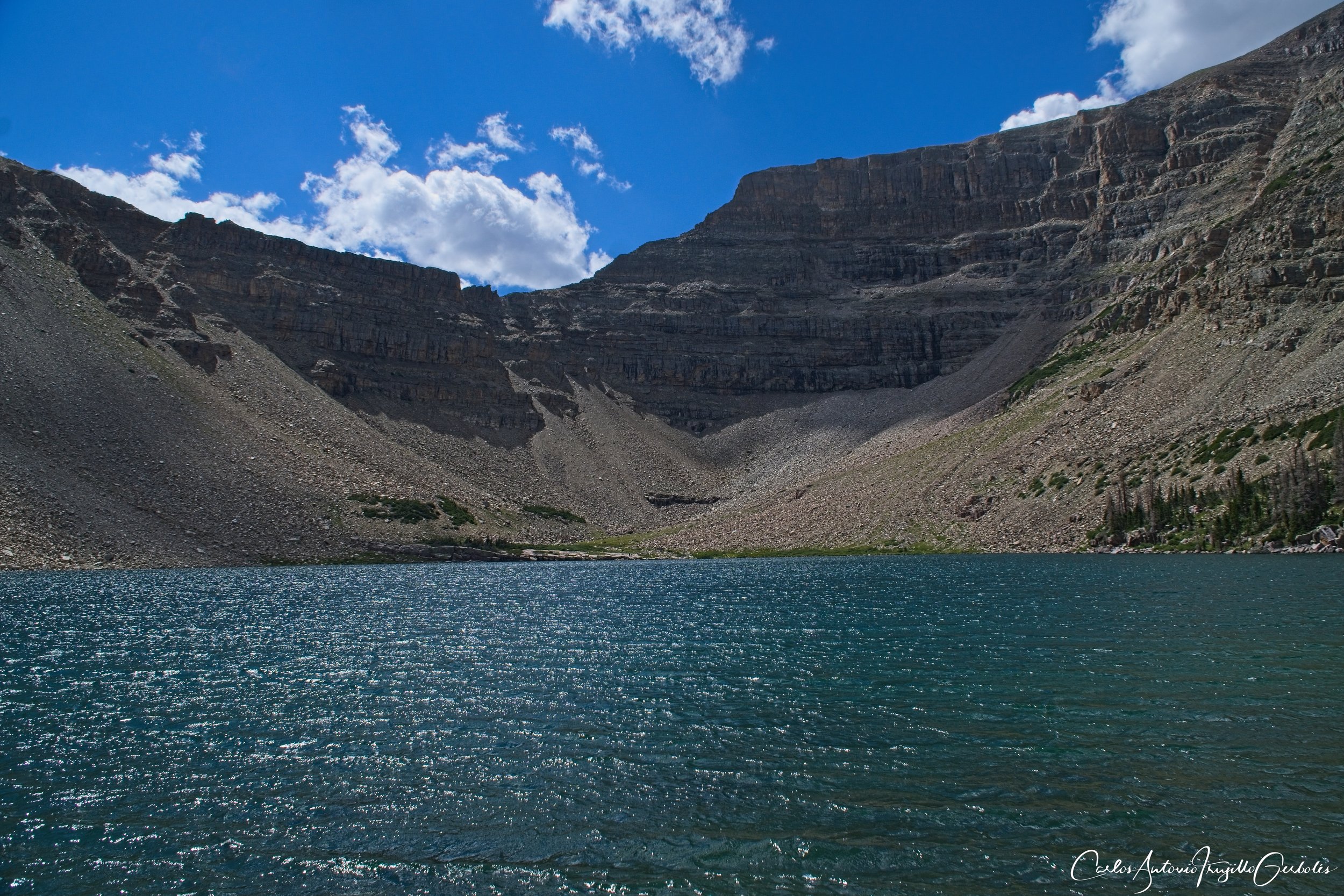
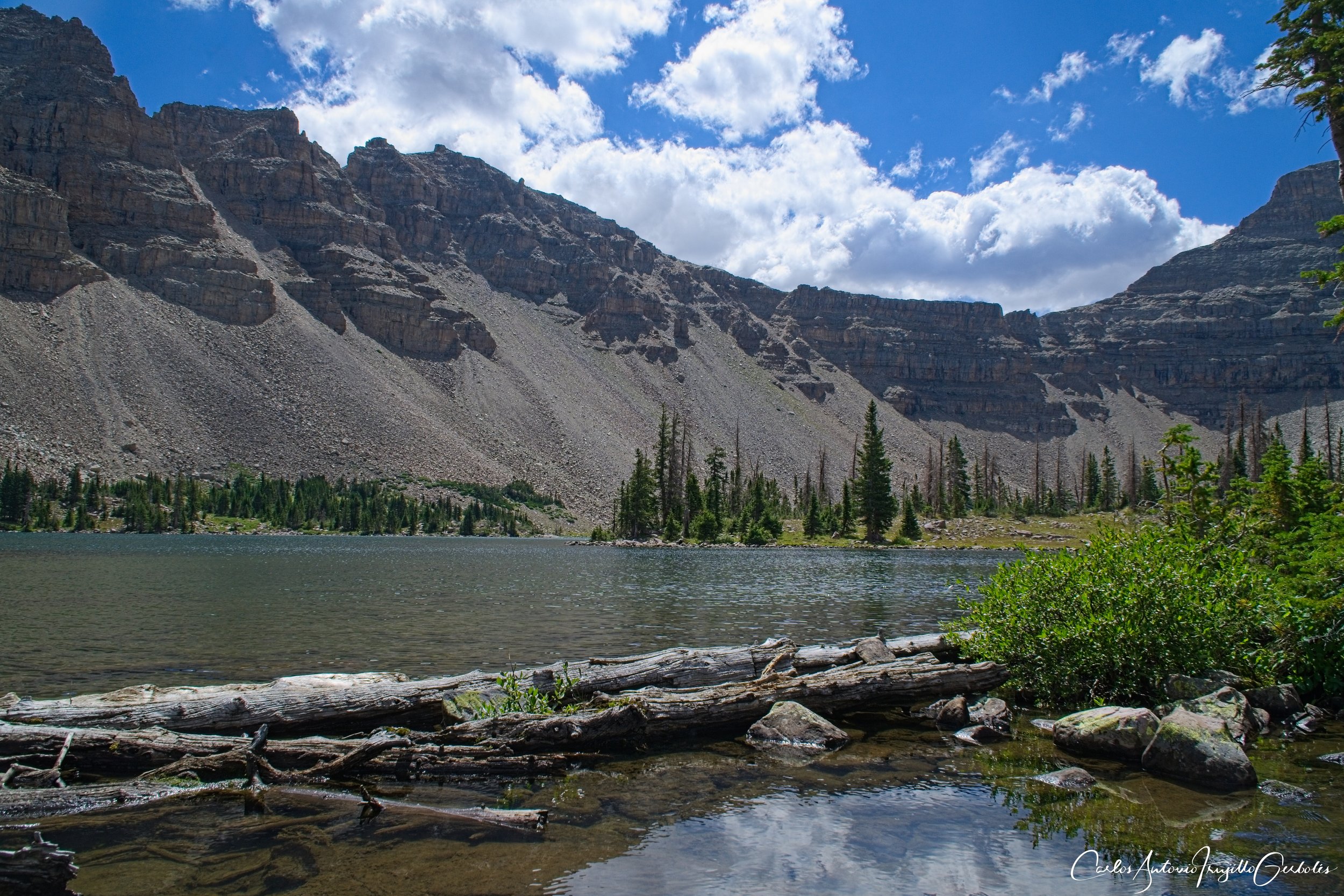
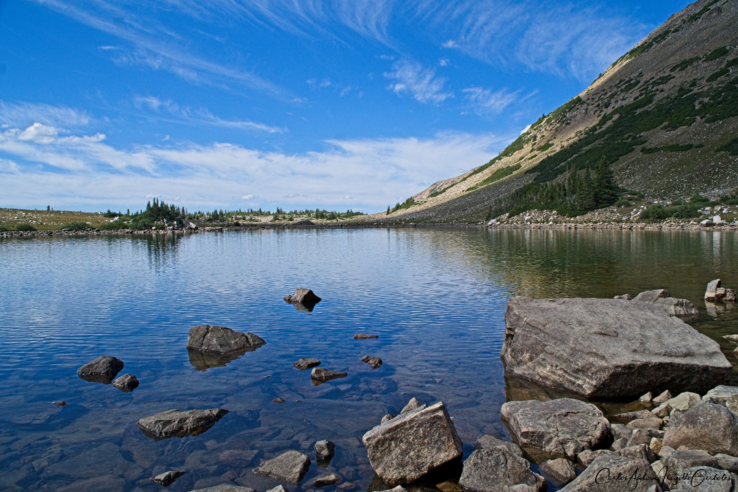
The lake is excellent and large. It is surrounded by peaks and you can walk around it and explore.
I couldn’t stop taking videos and pics, specially of a small inlet. Enjoy:
The water is so clear …………….

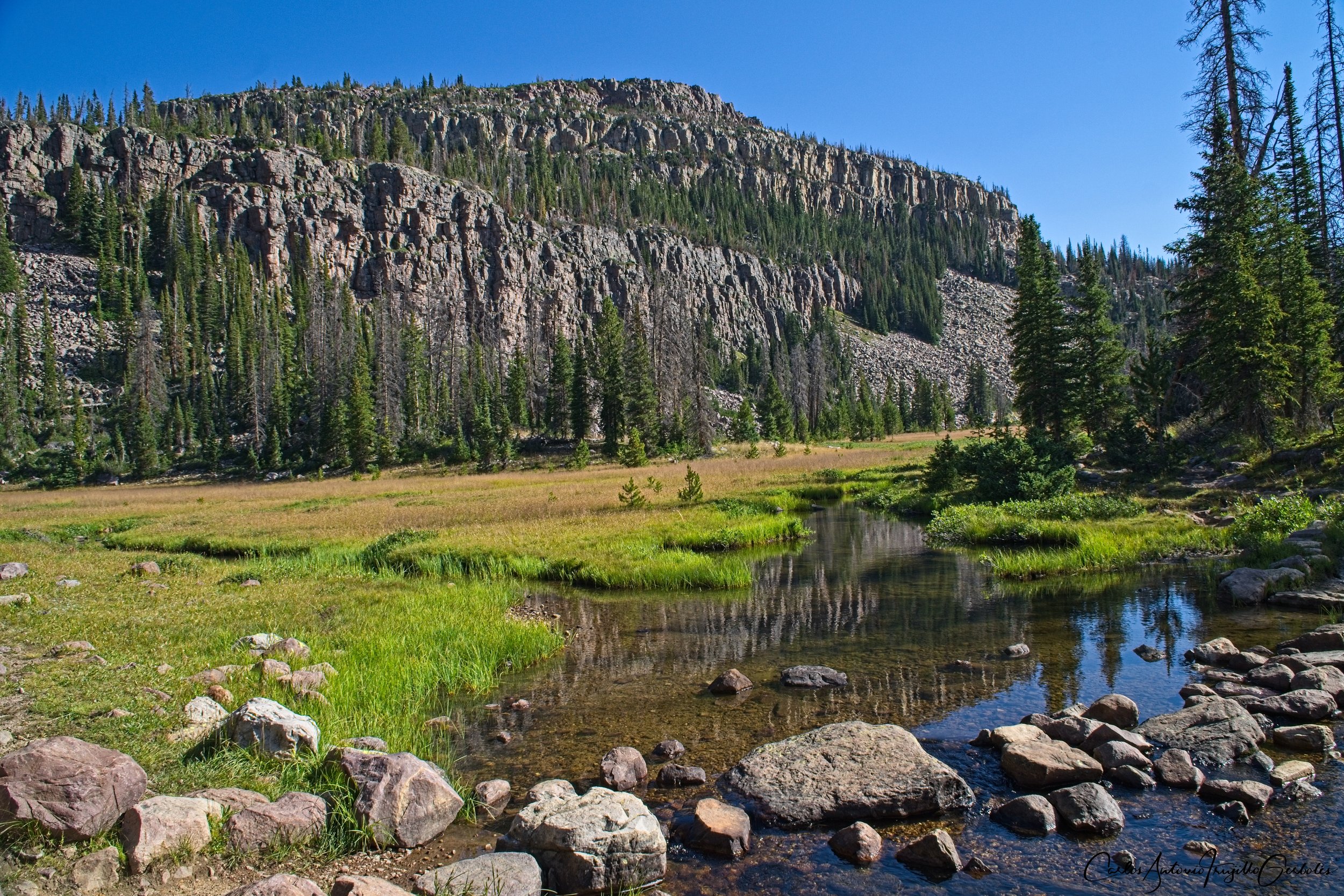
It’s not all travel next to a creek, the trail opens for some meadows:


And on the way back, I ran into this dude:

For this hike the destination is key, not the journey. I recommend that you attempt to circumnavigate the lake.
The next hike was the extremely popular Naturalist Basin and I can understand why it is so popular. This is an extremely popular backpacking route due to all the alpine lakes you can camp next to. Most of the people I ran into were backpackers.
Now, the route from Shaler Lake to Blue Lake is off trail, so you are bushwacking in some areas, but next to the lakes you can see some social trails.

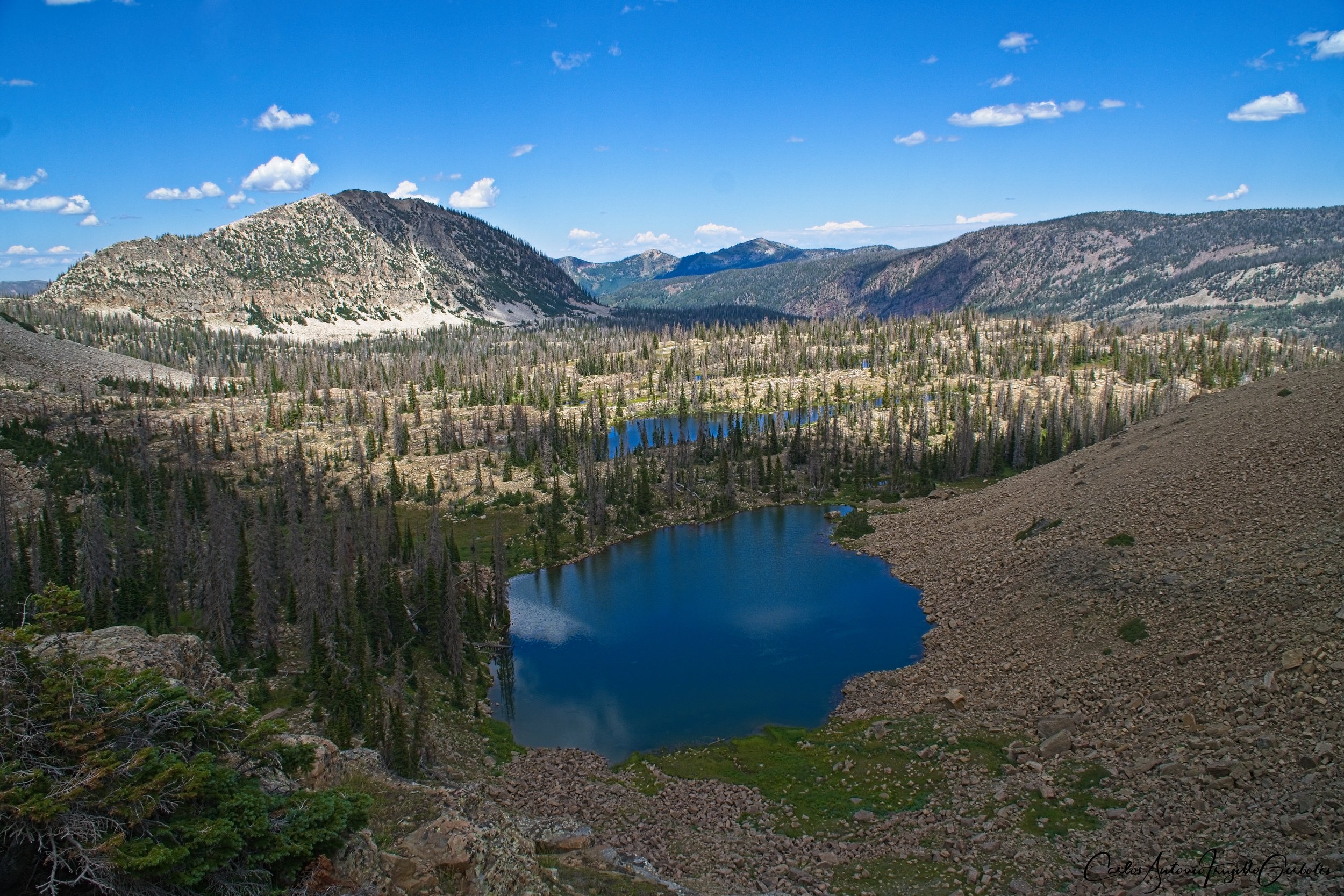
The loop that I am showing can easily be done as a day hike, but the real magic is to camp next to one of the lakes. The lower part of the basin is so beautiful; the upper part is at the upper shelf. From the topo map you can see where the upper shelf is. At the intersection of the loop is the actual Naturalist Basin. The upper shelf that I am referring to is behind that rock wall in the image below:
The first lake of interest is Jordan Lake and it is the largest lake. You will hike along the shore of the lake for a while.

This is what made no sense to me: there is an established trail that attempts to reach the upper shelf but it ends halfway there and then I had to use the GPS to orient myself. I believe that I lost to it a social trail since I could see backpackers to my right, so I think I cut north on the trail too early instead of continuing east.
Ok, this is what I think I am going to make a mess of the pictures and which lake is which. I can’t be sure I am labelling the lakes correctly, but here they are:

Shaler Lake is in a hole, for a lack of a better work, so taking a pic of it wasn’t working for me. And a premature turn North from Jordan Lake didn’t help. At that point I wasn’t sure of timing and decided not to find a way down to the lake. Anyway, at that point I turn West and start looking for the next lake: Faxon. I wanted to hike on the north shore of the lake so I had to navigate a talon field, where this picture was taken.
The next lake is Le Conte. At the far side of the image is where I came from (Faxon). There is a social trail that follows the lake shore and then it is gone into heavy brush. At that point I decided not to stick to the North shore since I would have to navigate a larger talon field.

The next lake is Walcott Lake and you can see a social trail next to the lakeshore. Small lake.
The final lake on the upper shelf, which has a trail from the lower shelf is Blue Lake and my off trail travel ended at that lake. From there it is a very step (but short) trail to the Morat Lakes. I think there are social trails besides the main trail since it was confusing and I took the steepest route; maybe if I came from the Morat lakes the trail would have been more visible.
This is a view from that vantage point.


The trail goes between those lakes. At the start of the hike I passed these backpackers and now I ran into them making camp next to the lake. They had a cute husky dog roaming around the place.
This is an absolute must lollipop loop hike and no matter how many times I come back, I will do this hike again and again.
The last hike was Ibantik Lake as part of a loop hike. I read that Ibantik Lake was a backpacking destination and another highlight of the hike would be The Notch, where you get elevation and see the valley below towards Wall Lake.

The first lake that you are going to reach is Wall Lake, which offers a nice background of peaks behind it.

Wall Lake, pretty stuff.
Once you leave Wall Lake you start going up (no big deal) and reach The Notch, which more or less separates the valley you came from to the valley you are about to down to. You turn around and you get this nice view. The day was sunny and clear and you just sit on a rock and admire the view.

So you hike from The Notch down to Ibantik Lake. If I remember correctly, I ran into lots of bees. You finally reach Ibantik Lake and compared to all other lakes, it is small. I would see backpacking camps, but I would not like that view. The lake is too small, in my opinion, to camp at.

So at that point I realized I reached the lake pretty fast and decided to extend the hike and keep going towards Meadow Lake, which was a great decision on my part since the lake is beautiful. I saw no one there, everyone was turning around at Ibantik Lake.

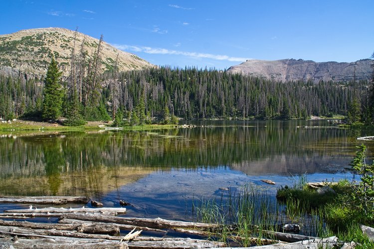
Since I carry a GPS, I can tell there is more stuff close to the trail that I might want to explore and returning from Meadow Lake I found two small and pretty ponds.

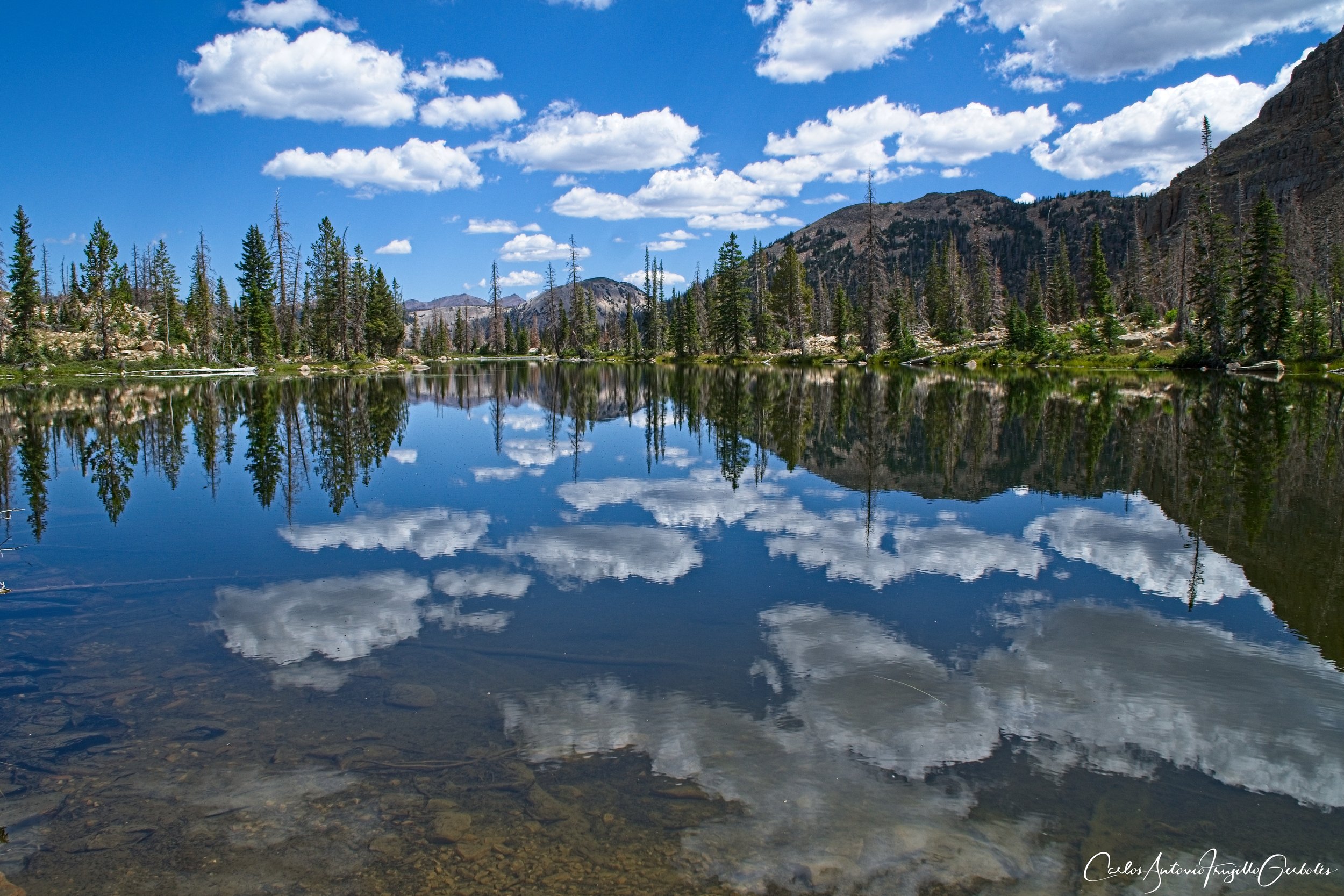
I turned around and then took the trail that took me to Twin Lakes, Clyde Lake, Watson Lake, and Petit Lake. But before that I lucked and found this beautiful cloud reflection:
There are various loops in this area. I ran into a trail runner that lost the map on her iPhone so I gave her my paper copy of my topo maps.
Petit Lake
Clyde Lake
All of these lakes (I missed taking video of the Twin Lakes) are pretty unique. On this part of the trail I ran into quite a few people. Again, this is a popular destination due to how many lakes you can reach easily.
There are bigger loops to the West and it is worth exploring (next time):

Final Thoughts: I love alpine lakes and this area is full of them. Just be mindful that this area is very popular for both backpackers and casual hikers driving from Salt Lake City. I will probably return in 2024 to find more lakes and then find a nice place to backpack.