Pitchstone Plateau and the Phantom Fumarole
The moment someone mentioned this area to me, I knew that I needed to hike to it.
I found an article from scientist measuring temperatures at various areas in the park: the feature known as Phantom Fumarole vigorously discharges steam and gas at a temperature ~137°C …. Phantom Fumarole is notable for having the highest radiant emittance (27 W/m2) as well as one of the highest fumarole temperatures in Yellowstone (~137°C). As you can see, the radiant emittance has no equal in the park. These guys couldn’t get close enough to the feature due to the heat and dangerous terrain.

Radiant emittance is the power per unit area radiated by a surface.
With this information and the remoteness of the area, I knew I had to be super careful approaching this feature.
There is very little information on the internet about the Phantom Fumarole, so this was my chance to write a good report and get hits on google searches.
The trailhead parking area is small, very few people hike that trail and most are backpackers. You need to reach the Pitchstone Plateau so you start going uphill, no big deal except that I did this in early July and the mosquitoes were out in full force.
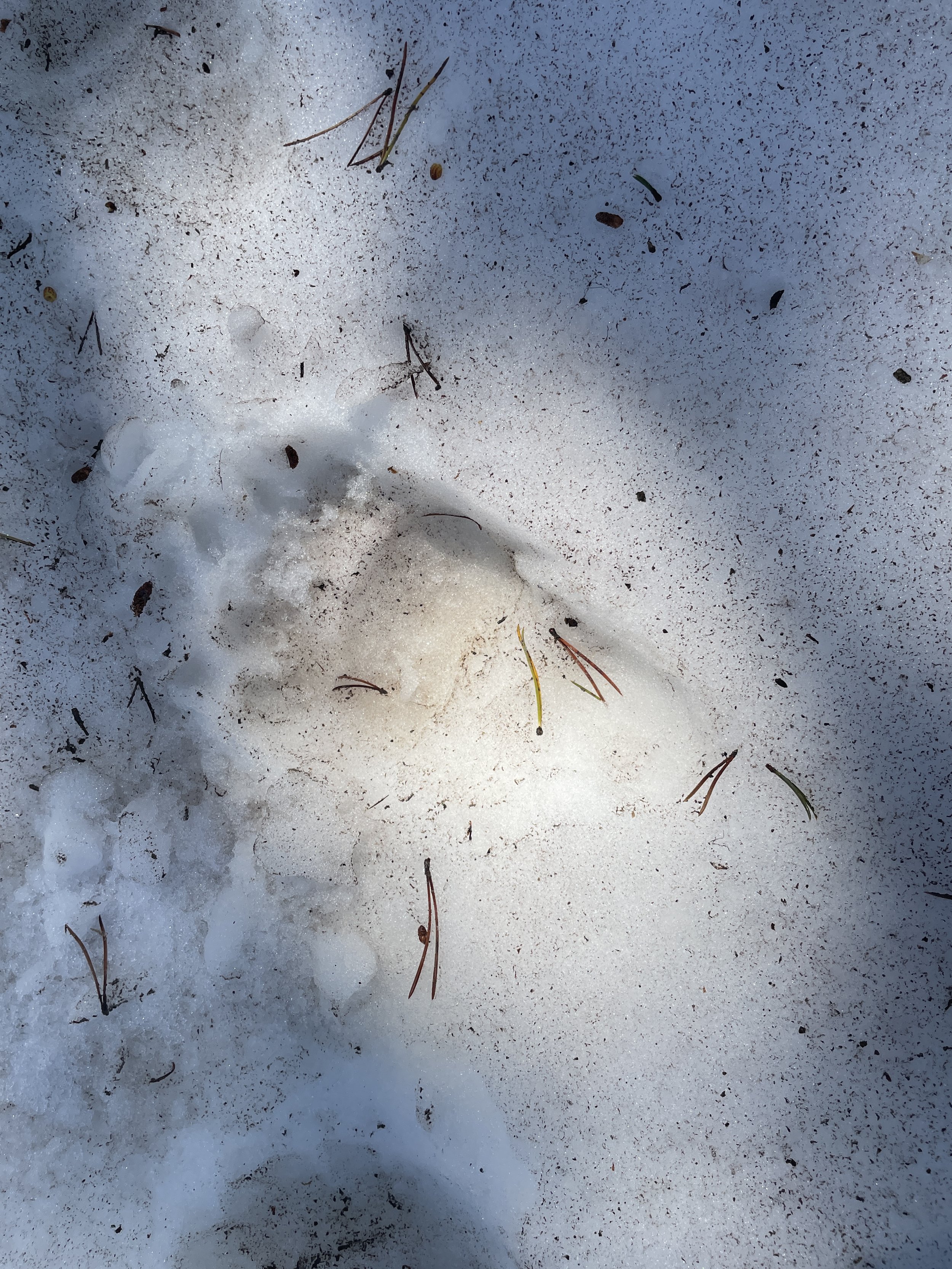
At this point the trail was not cleared of downed trees (the park report stated that the trail was not cleared so I expected that). Once into the forest and getting close to the Fumarole I encountered a few patches of snow and bear prints. I had to be careful, so far I haven’t seen anyone else on the trail, but the trees were not that dense so I could easily see any critters getting close to me.
At about mile 4, you leave the forested area, there is a nice meadow to the right.
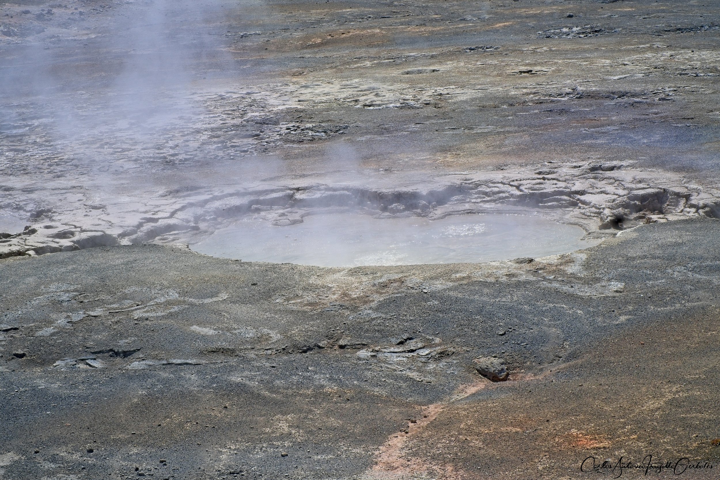
And less than half a mile after that meadow you arrive at the Phantom Fumarole. I took videos and pictures from two vantage points: (1) the area next to the trail and (2) opposite to the trail there is a forested area where it is safe to stand on and it is a lot closer to the main vents ……….. see below:

Since it was early in the season, there was still water in the vent areas so it was bubbling instead of just pure gases. It would be interesting to visit the area when it is dry and then you can hear the gases coming out of the vents.
This is what you see from the side of the trail:
Now I am moving towards point 2:
I can’t emphasize enough that this is a dangerous area and no one will rescue you. Do not step on areas void of vegetation, with good lenses (I also carry binoculars) you can see all the vents up close.

And after reaching (2), I took a lot of videos …………… FROM A SAFE DISTANCE !!!!!!!!!!!!!
These images are from the (2) point of view (edited for mood):


The vents at the southern part of the area can’t be seen from a proper vantage point so there is no way to see them.
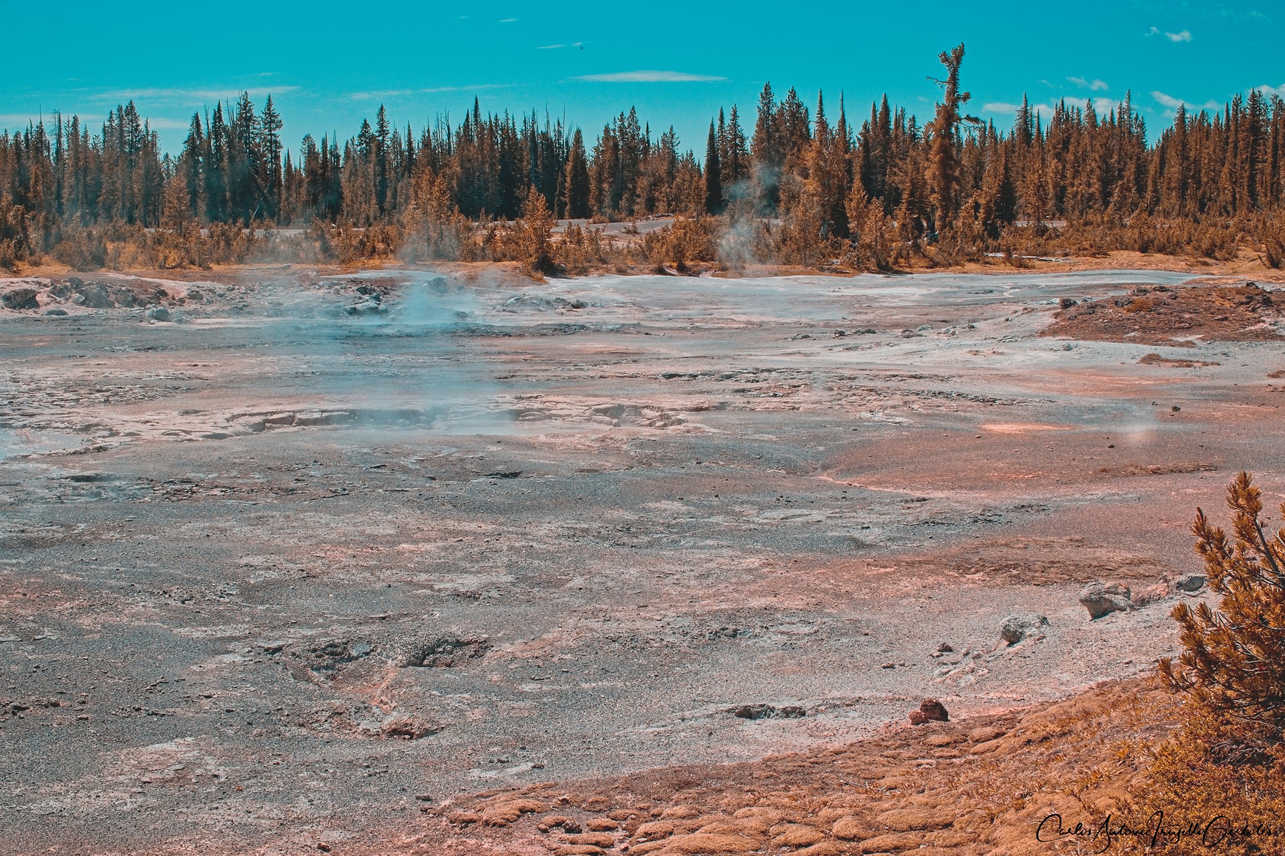
And a complete view of the whole area:
I then completed circling the area and took this video from the south:

As a reference, I was taking the videos for area (2) from the tree line behind the smoke.
If you then return to the trail, you will have a last look at the fumarole if you continue on:


At this point, I spent about 45 minutes in the area and turned around. A bit past the snow patch area I ran into three backpackers and that was all the people I saw on the trail that day.
This was great and I would consider coming back if I can get confirmation that there is no water on the vents, that would make images and videos have more details that the smoke is obscuring.
My post in Substack