hiking the Hilite trail in Island in the Sky, Canyonlands
I had an extra day on my recent trip to Utah and by accident I noticed a third trail that takes you from the top of Island in the Sky down to the White Rim road, the Hilite trail.
The trailhead is on the road to Upheaval Dome. There is a pull out for at least four cars, but I don’t remember if there is a sign, I think there is one.
This is a trail that is full of rock cairns and it is very important that you pay attention because it is not a popular trail so if you get lost there won’t be a lot of people around to help you. The trail start approaching a small wash that you will follow for a bit until a rock cairn tells you that it is time to exit the wash. Problem here is that some people miss the cairn and you can see footprints that will confuse you. I carried a GPS with me so I knew where to exit the wash and on the lookout for that rock cairn.
Just like the other two trails that take you down to the White Rim road you will reach the top of the mesa and then start going down fast. In this trail, there is no trail ………………. yes, there is no trail in most areas so it is very important that you keep an eye for the great amount of rock cairns that help you navigate what is a big debris field. In some places there is a definite trail and in some keep an eye for a cairn and if you don’t see it, you are off trail.

At some point you are going to reach a plateau, but not the bottom. The trail is going to take you left along a ledge so please be careful since the drop is still significant at this point and in some places it can get scary. Still there are rock cairns, so please follows them.
Rock cairns will mark the spot where you need to leave the ledge and start going down. You will start seeing a trail down to your right, it is just a matter of finding the rock cairns that mark the place where to start going down. While going down I noticed this fascinating area that clearly revealed the rock layers for the ages. I wonder how many thousands of years this rock layer is revealing.

An finally you are going to arrive to the wash that will take you to the White Rim road and this is where you can easily gets hopelessly lost. I do not recommend doing this hike without a GPS because in the wash there are not enough cairns to mark all the side washes that you are not to take. Going down, the rule is to go left on any intersection. I saw no one until I finally left the wash and reached the White Rim road, which is marked by a sign for the trail.
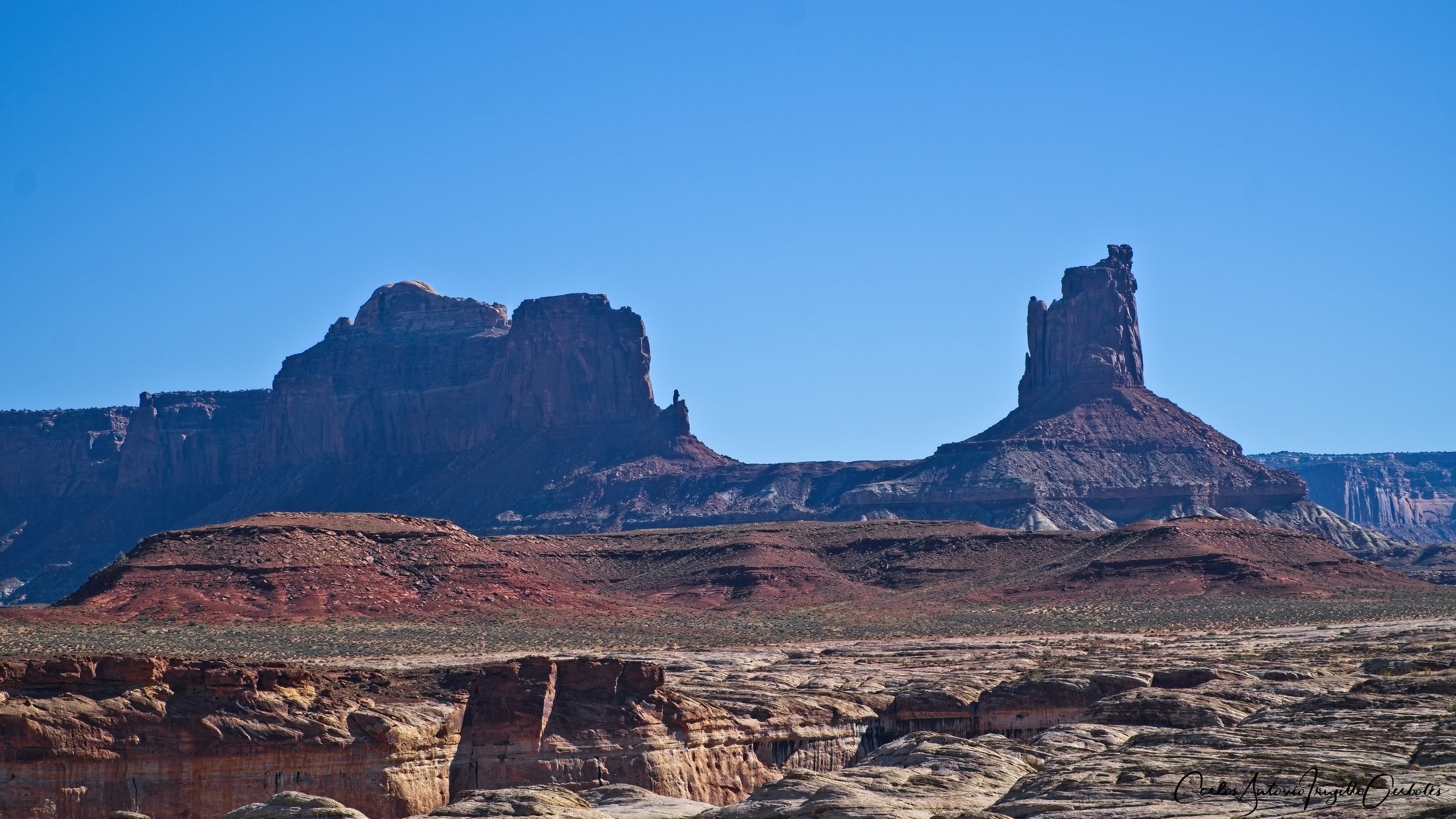
There are lots of cool large rock formations that you can either see turning around when coming down or wait until the return trip.

Now you can explore all you want. I decided to follow the White Rim road to the right since that will take me to a view point of the Green River. I ran into some cyclist and cars on the road. I then left the road and hiked to the edge to get a view of the river.

And at this spot I stopped for lunch. It was so tranquil, no one around, the best place in a sunny day.
When leaving the road to reach a viewpoint please be careful not to step on the cripto soil.
The return part of the tricky one, you can easily take the wrong wash and in a couple of places the wrong wash looks better than the real wash. The rule to follow is to take the wash on the right. There is a place when you will probably miss the wash: the correct wash is a small spur to the right of the main wash that you were hiking on and it makes no sense to take it. Again, I do not recommend hiking this trail without a GPS.
Even though you are hiking on a wash, the views are excellent. You can even find False Kiva at a distance.

The precautions that I mentioned about following rock cairns apply on the way up. You should be able to always see one or be ten steps away from seeing one.
Fun fact, I missed this granary on the way down:

I loved this trail, it is challenging and the views all over the place are amazing.