Gebre Lake and Observation Pt in YellowstoneNP
This is a very nice hike that combines my two favorites: lakes and elevation views.

If we use the Canyon Village as a reference, just drive north towards Washburn Mountain and find a parking area about a mile up the road. The parking lot more than adequate since this is an easy hike if you just stick with visiting the lakes. On the day I hiked this area, all campsites along Grebe and Wolf Lake were closed due to bears so I know I had to be careful since I was hiking alone.
My idea was to hike the lakes and on the way back to go up Observation Point.
You start the hike in a forested area and I am pretty sure that on the way back there was a moose close to the trail, so keep an ear open to the sounds. Again, I modified my approach to bears and in that closed area I would talk to myself, not yelling. I want the bear to hear me, that is it.
You will leave the forested area into a meadow that then reaches Cascade Lake. I am not sure if I caught it in the video, but there were people fishing in the lake.
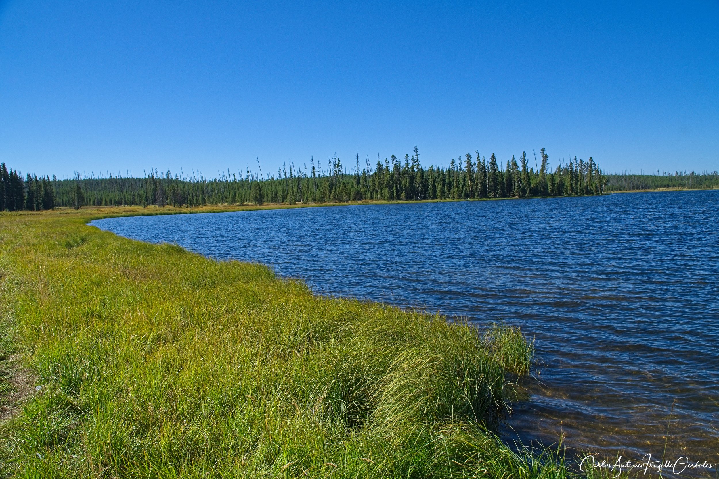
Just before you reach the foot of the lake, there is a Y that takes you to the lake or up to Observation Point. The images below are close to the head of the lake (I confuse foot and head) looking back from where to came. Those hills are not where Observation Point is; you have to take a sharp left and go up another hill that can’t be seen here.


You then are going to enter another forested area (even though I saw people at the lake, no one was going further up the trail) so again I was aware of my surroundings.
You reach Grebe Lake and it is a large lake. I had designs on Wolf Lake but between the bear roaming in the area (forested) and wanting to hike to Observation Point, I decided to spend a few minutes looking at people fishing in the lake (you can see then on the video below) and then turn around.
The fishermen were on that inlet to the right in the image below:
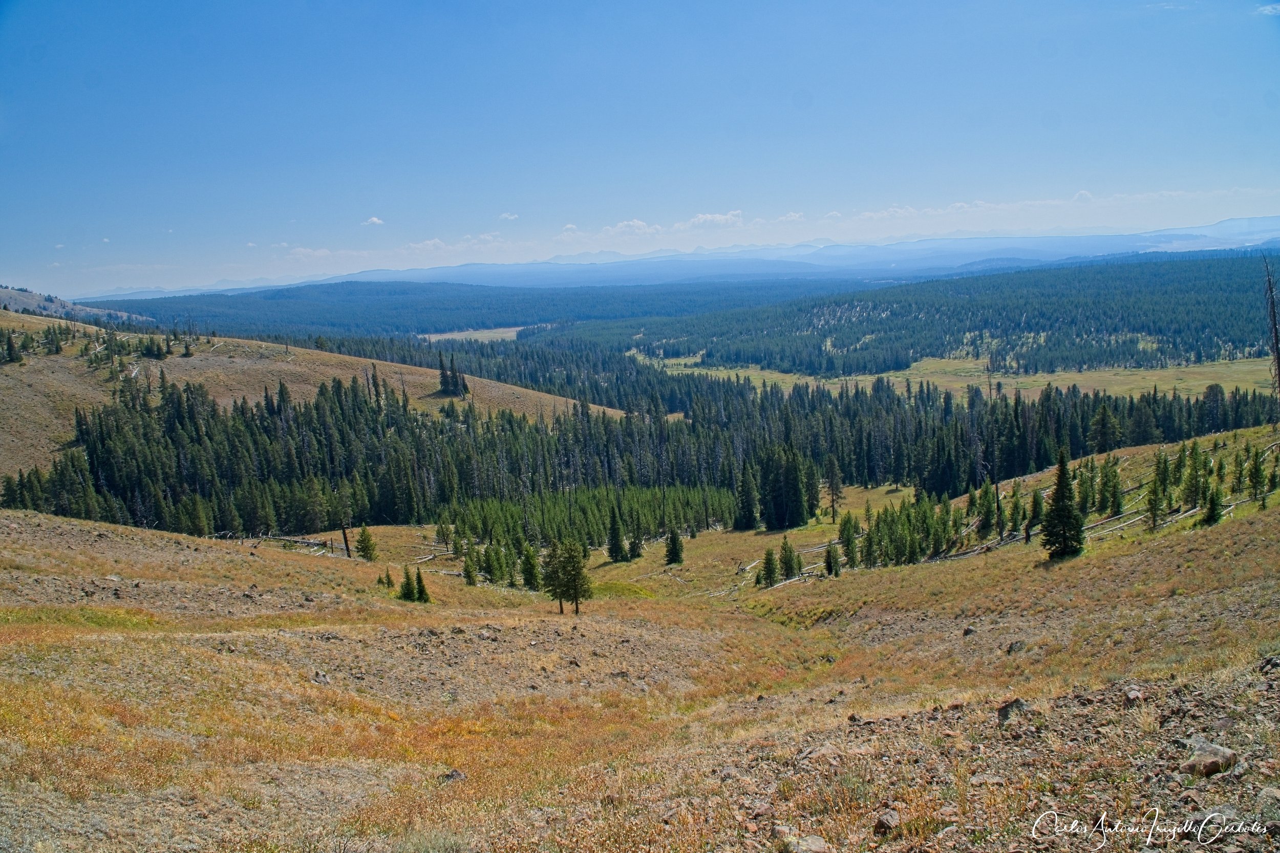
Now to Observation Point. And it was a hike where I saw no one on the trail. It gain elevation pretty quick and you never know where it ends since you go on a series of switchback thinking that it is “that” peak or “that” other peak. This is a view of the valley where I came from before I lost a view of it.
Eventually you reach the top and the fire lookout:

The views of the lake from the fire lookout are amazing and it is best seen on videos:
I decided to do a quick off trail hike; I have noticed a large meadow when I drove on the park road and I did a quick investigation on caltopo and google maps (plus a call to the rangers) of an area called Elk Park:

If are driving from West Yellowstone to the Norris Geyser area, you will run into two areas with large meadows to your left: the first one is Gibbons Meadows and other is Elk Park. I decided against Gibbons Meadows since I saw on the map thermal areas that would impede my movements.
No matter what, the river that controls that area is the Gibbon River. I followed the river North. I did explore crossing areas to the West and then came back East (after realizing I didn’t have my bear spray with me) and crossed it. I later found out that there was no need to cross it; you can go around it on the East side (it can be seen on the map, but I wasn’t sure I would get pushed into a forest).

It didn’t really matter since the river is shallow and slow enough to cross at lots of places. I noticed people going to up the river fishing while I was hugging the shore.
It is just a quick and relaxing hike and since there is no trail you just go anywhere you want.

On the image below, the river turns West and I decided to hike North on that meadow.

I eventually reached a potential thermal area and turned around.
I think you can also hike in Gibbons Meadows, but the hike will not be that long since you will reach thermals areas fast and for that you need a good GPS with those areas well defined if you want to explore them.