a guide to long day hikes in Yellowstone
It occurred to me that I have quite a few individual posts about long day hikes in Yellowstone and I think I should have a page that catalogs them and provides a short explanation and review of the hikes. If I do my SEO correctly, this should be a easy guide to find on google for those people that hike past the first mile in Yellowstone.
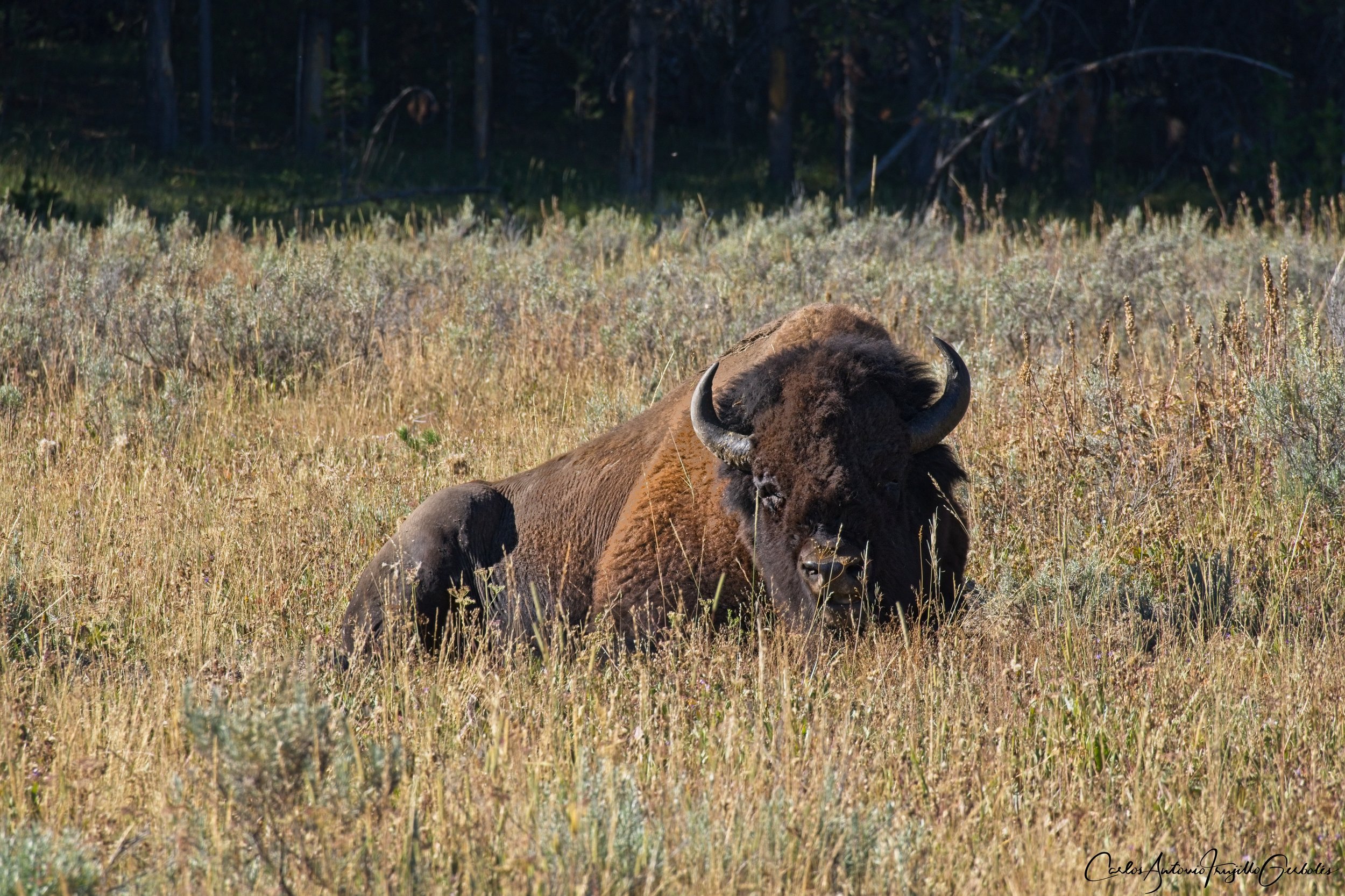
Warning: in many of these hikes you will find your group to be by yourselves and you need to be bear aware and alert to your surroundings. The park recommends groups of 3-4 people for many of these hikes and I will make a note of those recommendation on my description of the hikes. I have done all these hikes solo, but I know what I am doing.
I will group them in a way that I can show 2-3 in a map and a short description and opinion. I will start in the Mammoth area and then group them as I drive on the park road. The more I hike in Yellowstone, the more hikes I will add. For the ones that I have hiked, I have a blog dedicated to the specific hike, just use the search box in the webpage.
These are all day hikes, not backpacking routes.
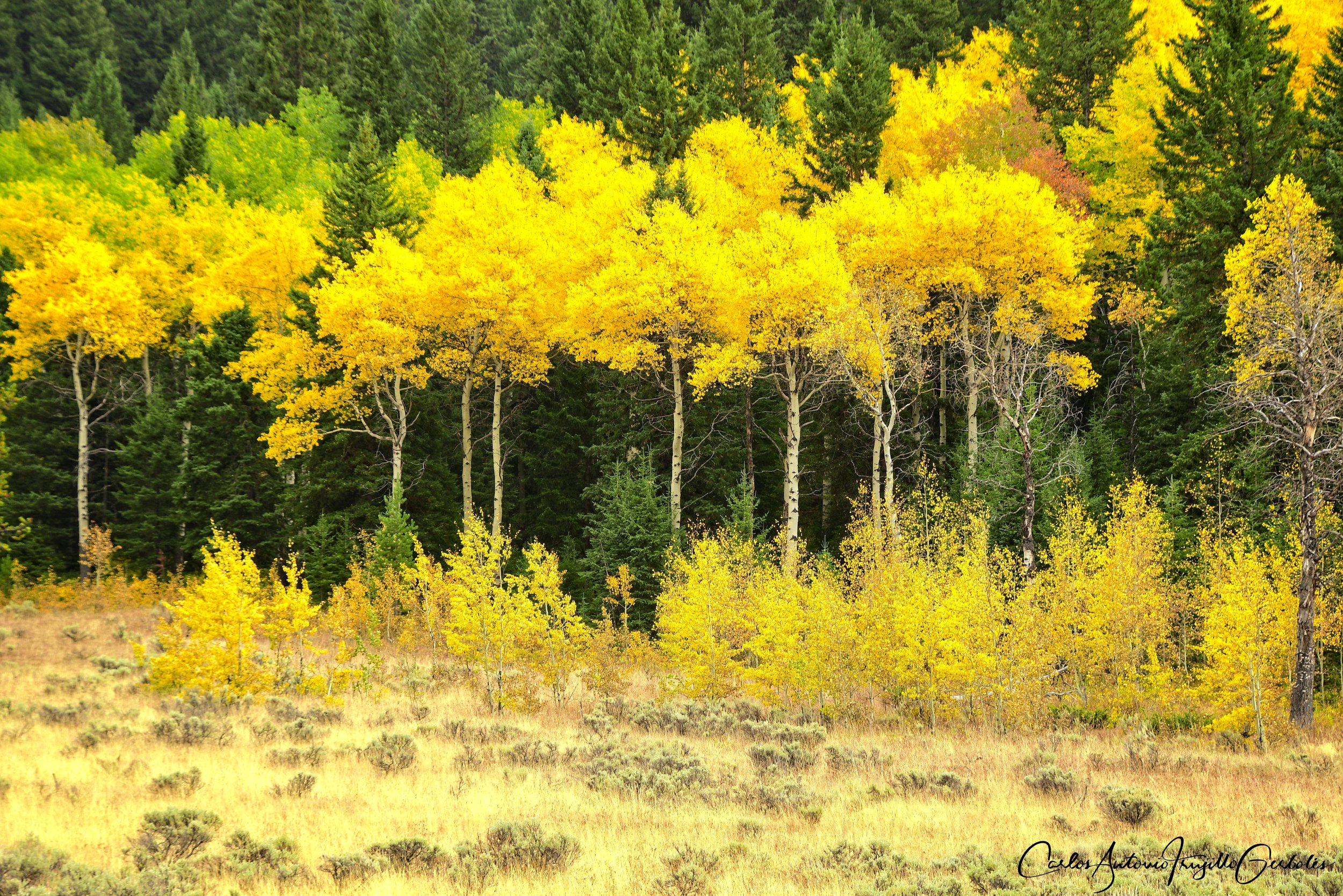
Bunsen, Fawn, Sepulcher, Bighorn

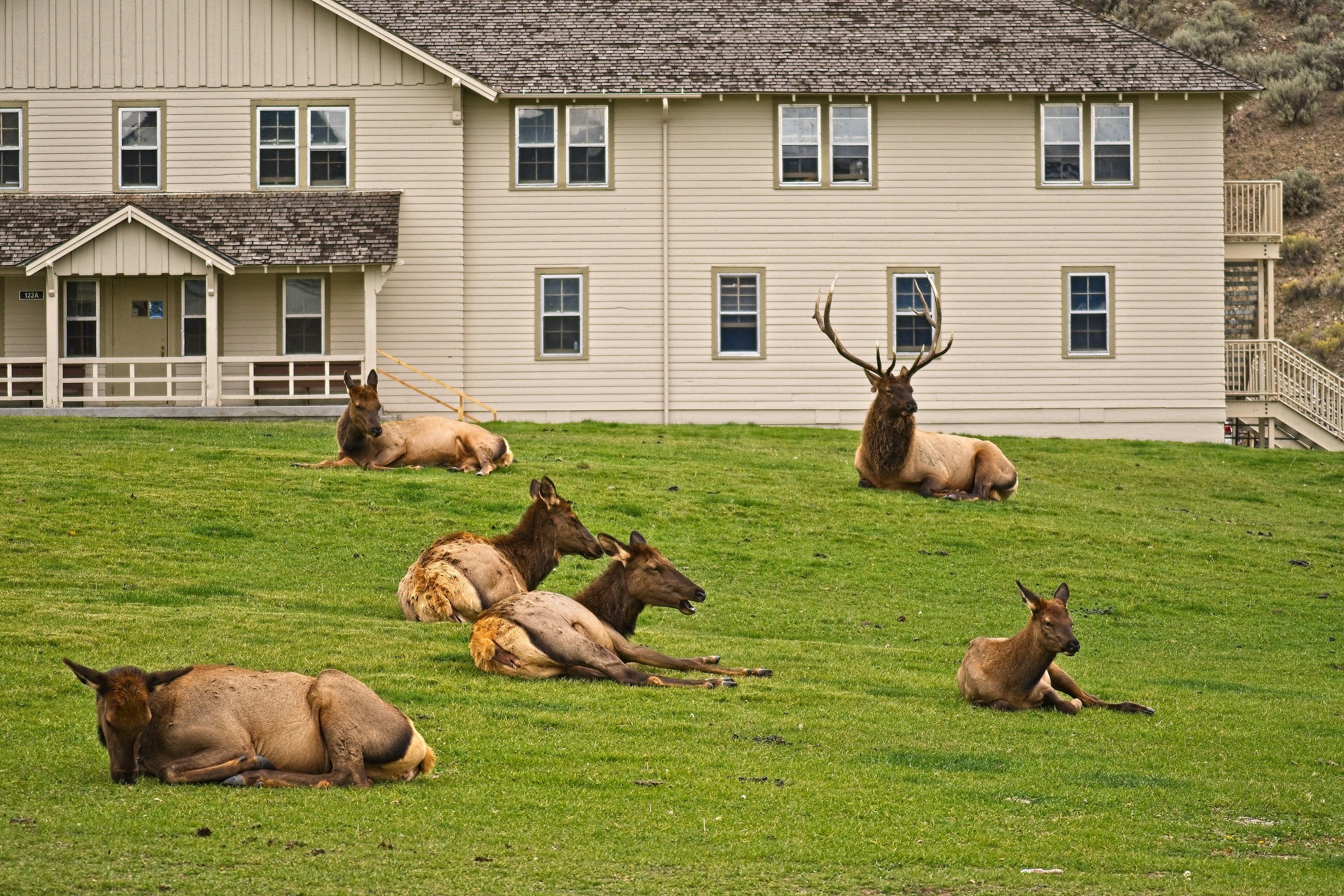
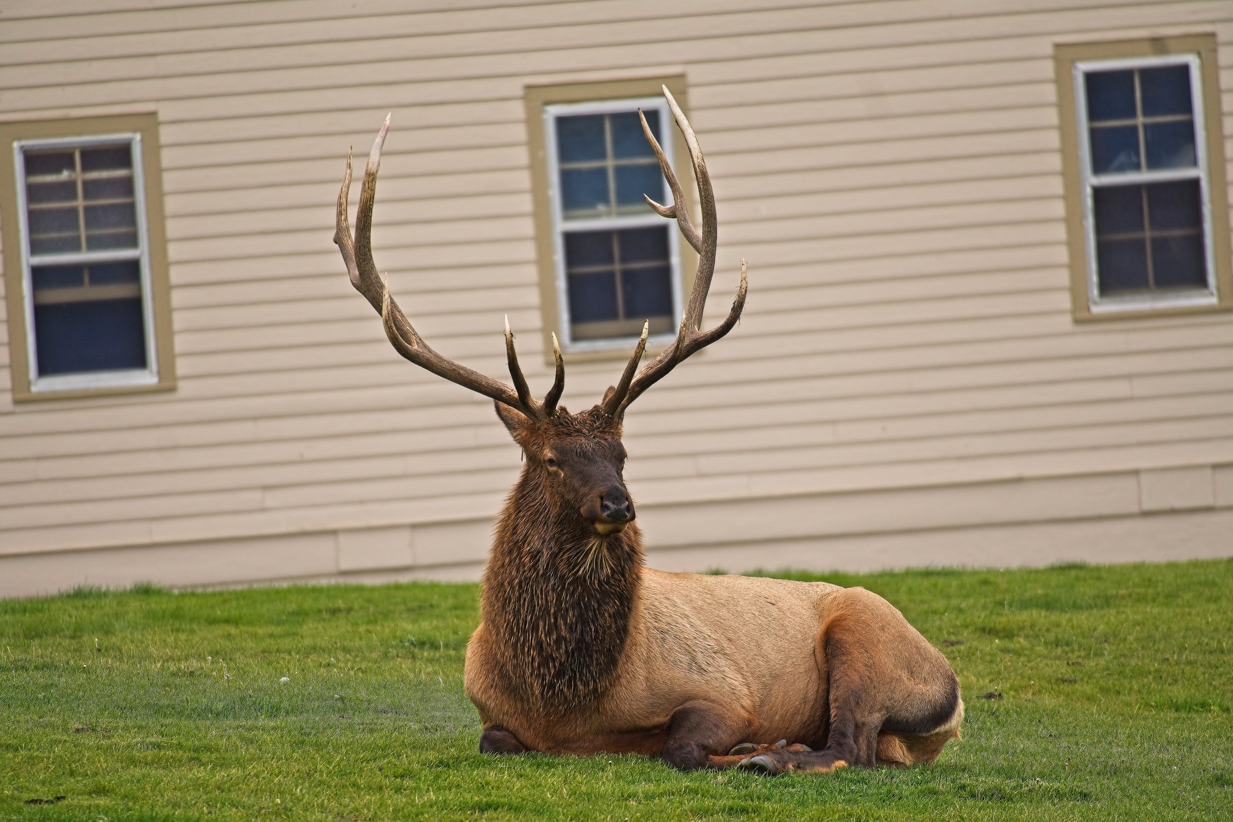
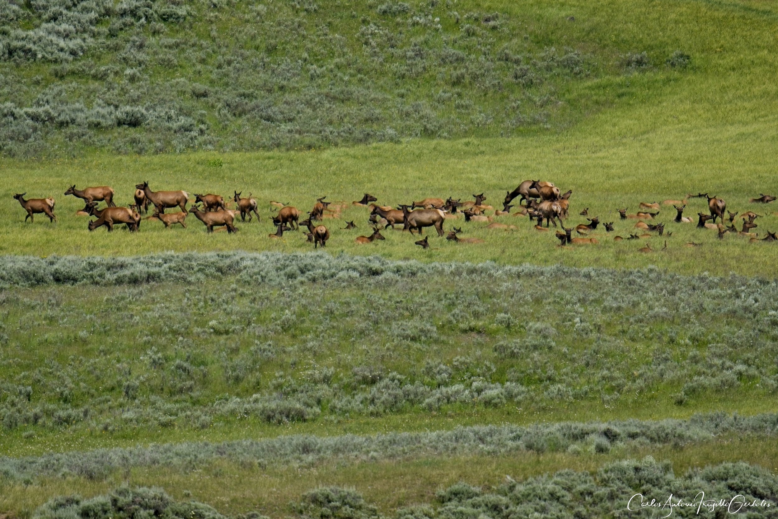
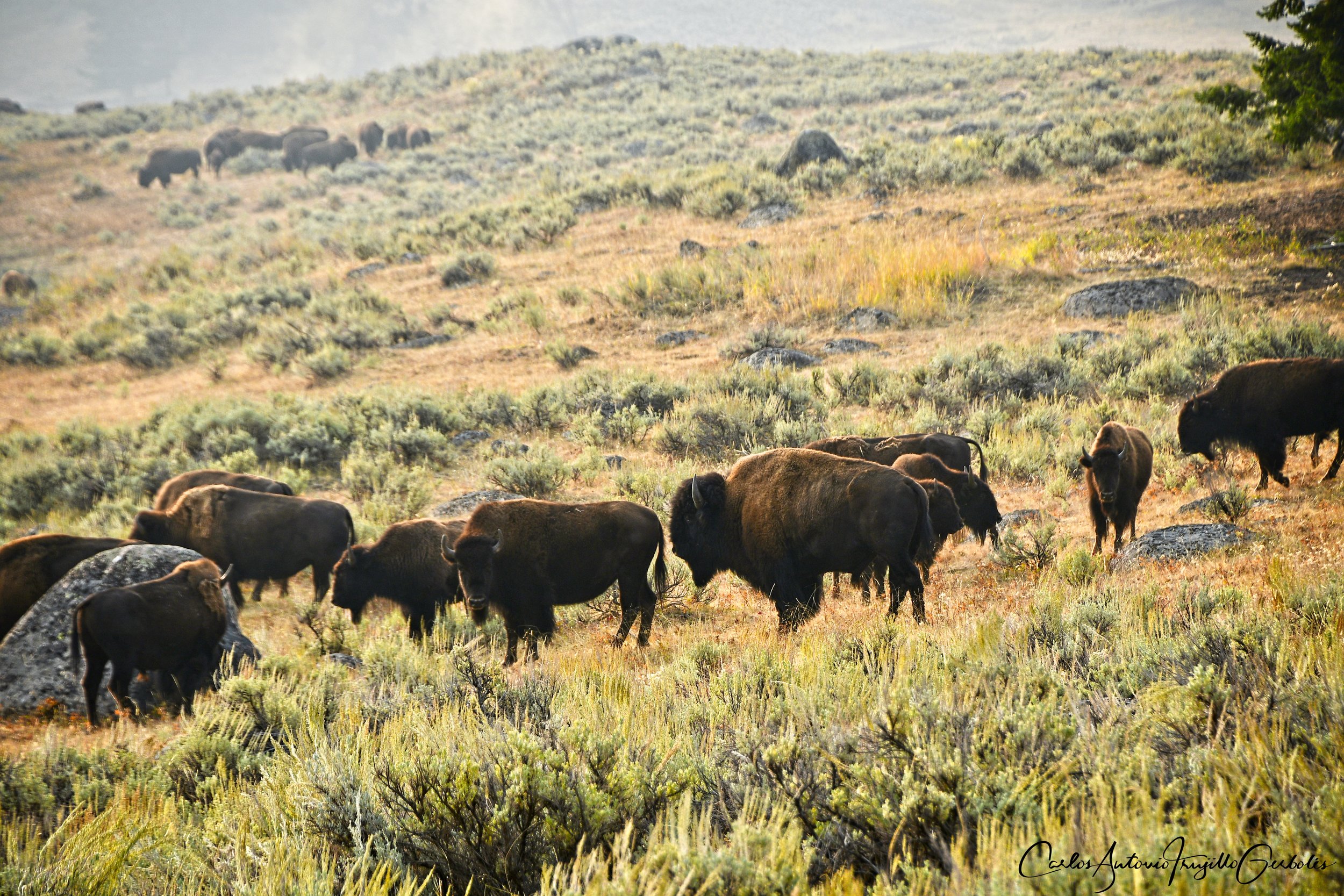
The best way to start in this area is to stay in Gardiner and just drive into Mammoth; that way on the way back from the hike you can stop at the Mammoth Terrace and take a stroll on the boardwalks. In fall this area in Mammoth will be full of elk, especially groups of females gathered by large bulls. These guys don’t screw around, anything that gets close to their harem is a direct challenge to them, people and cars alike. I have done these hikes staying in West Yellowstone too; it is a longer drive but a drive within the park is never boring.
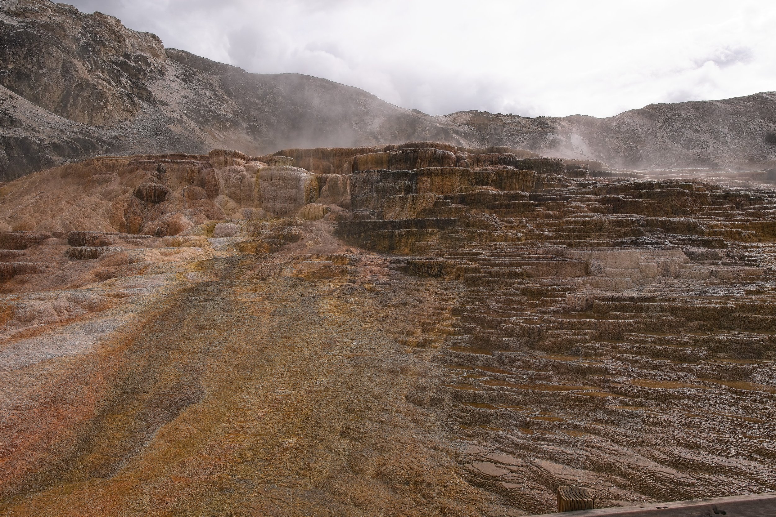
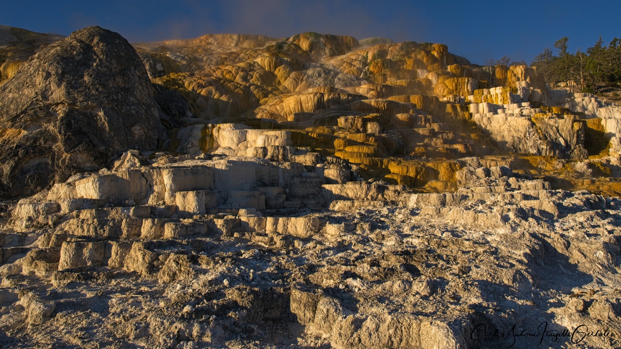
Now, the first hike starts next to the Mammoth Hot Springs, so you can get a nice parking spot next to the terrace and on the way back you don’t need to fight for a parking spot. This one I recommend to stay in Gardiner.
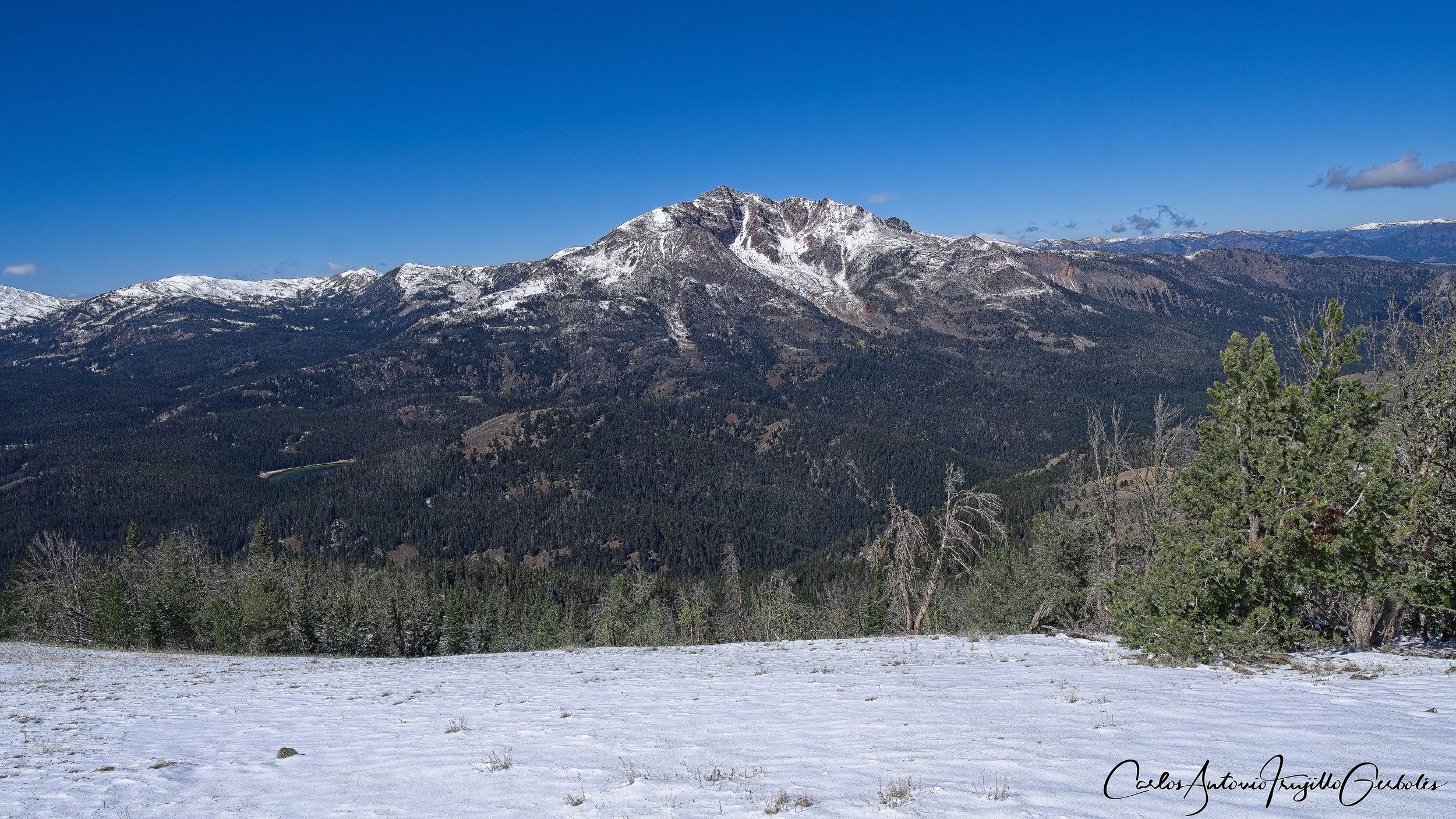
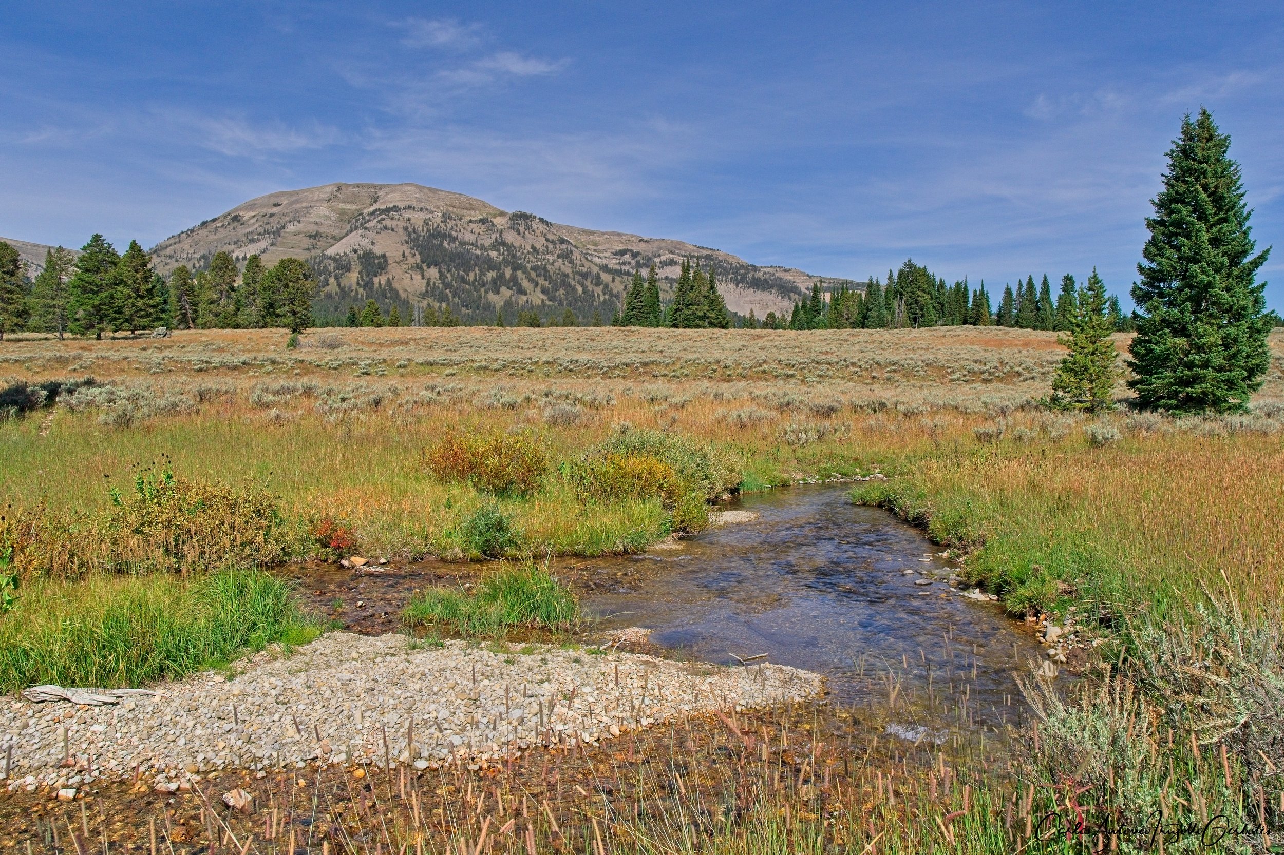
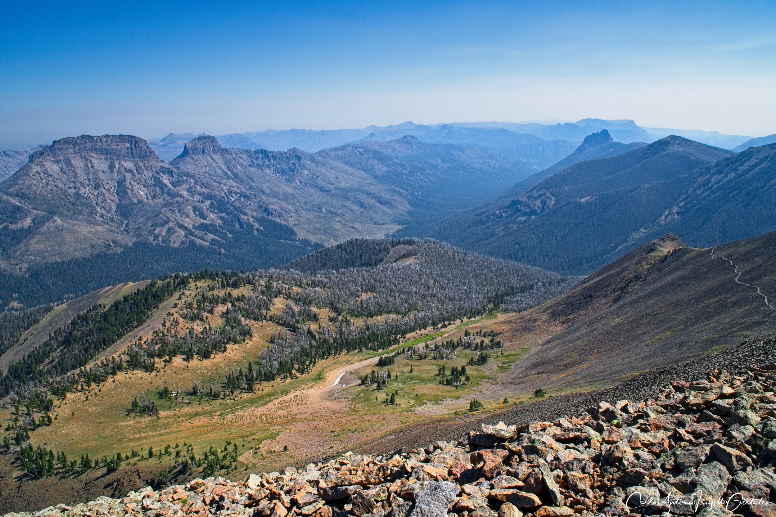
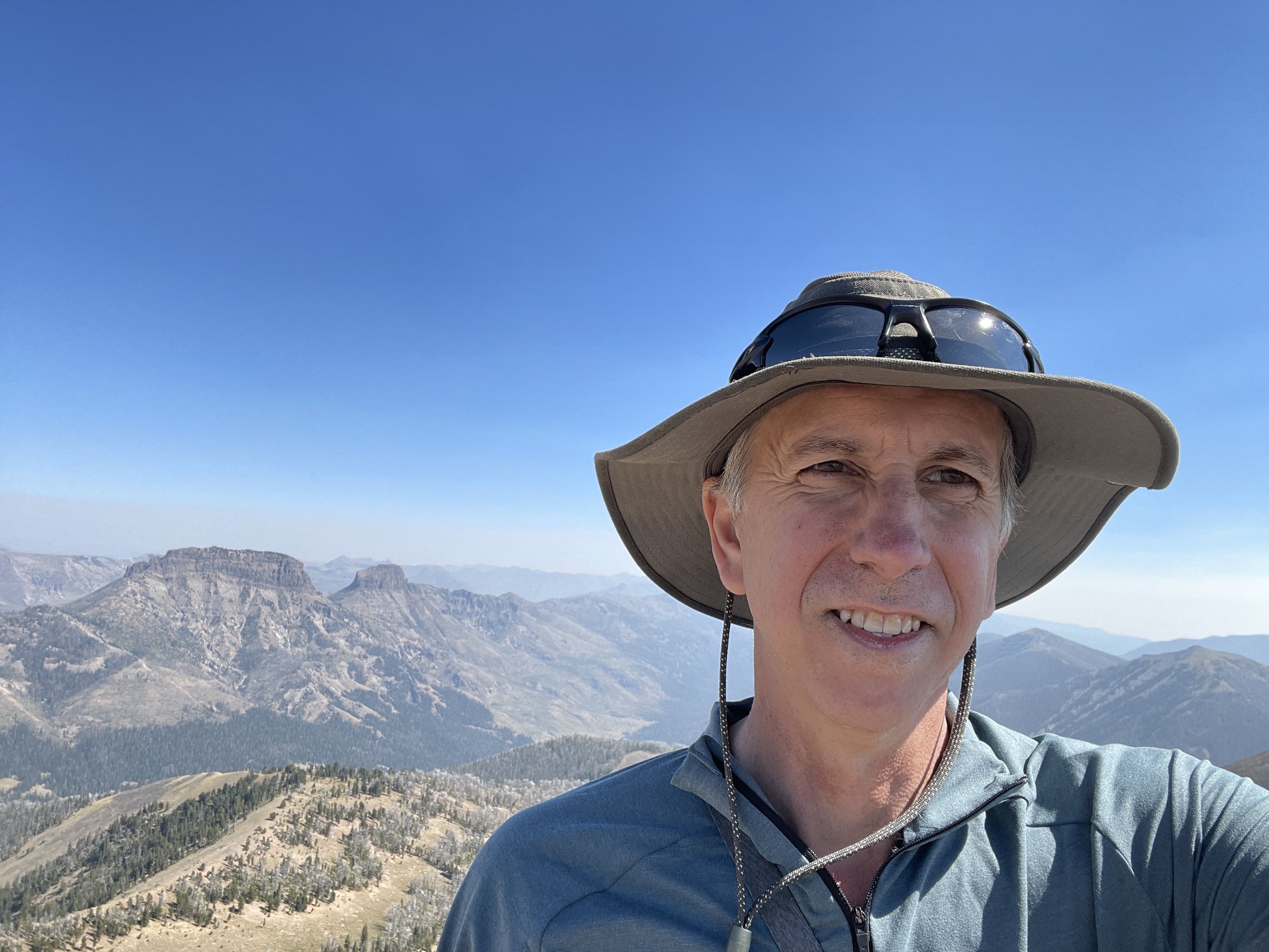
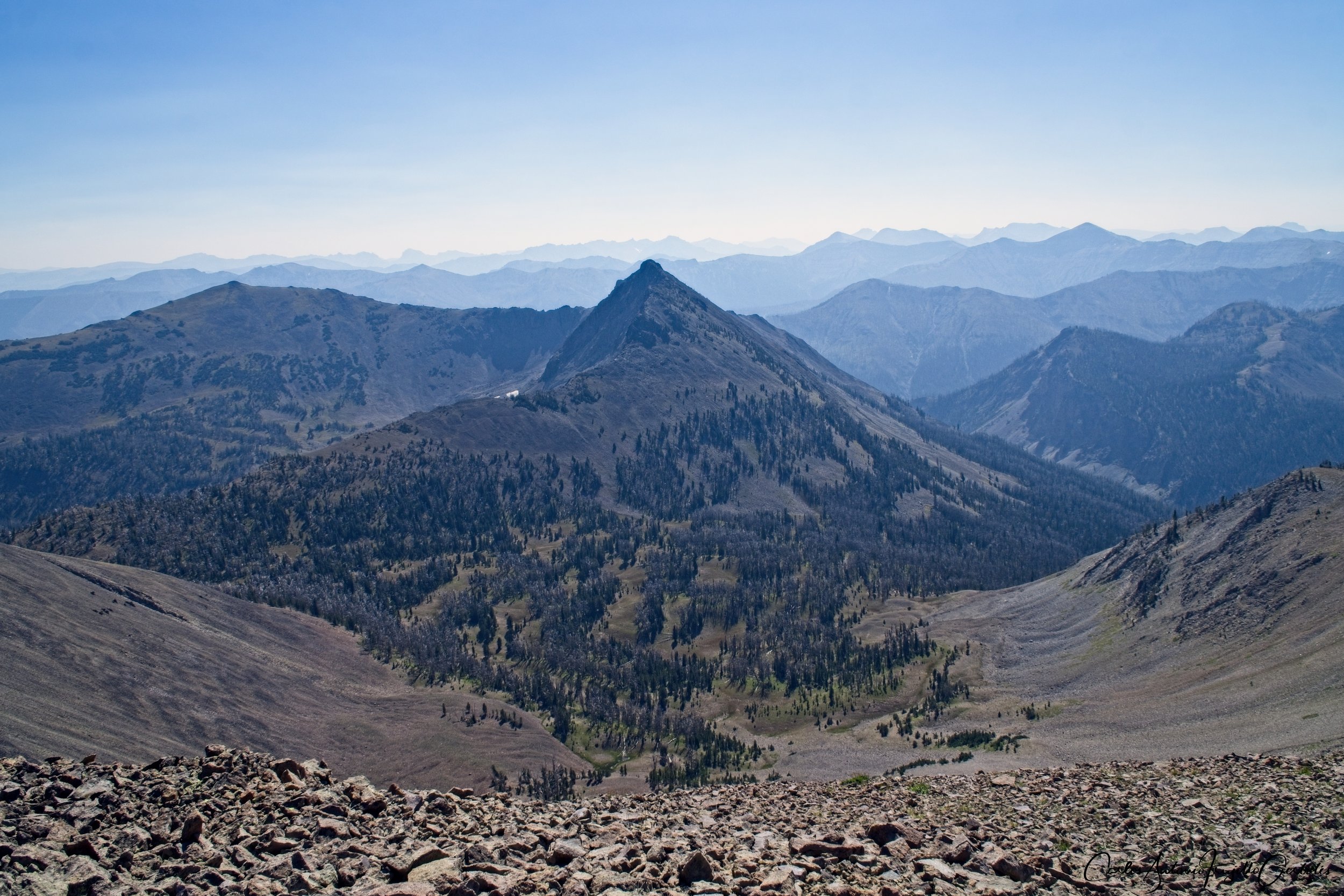
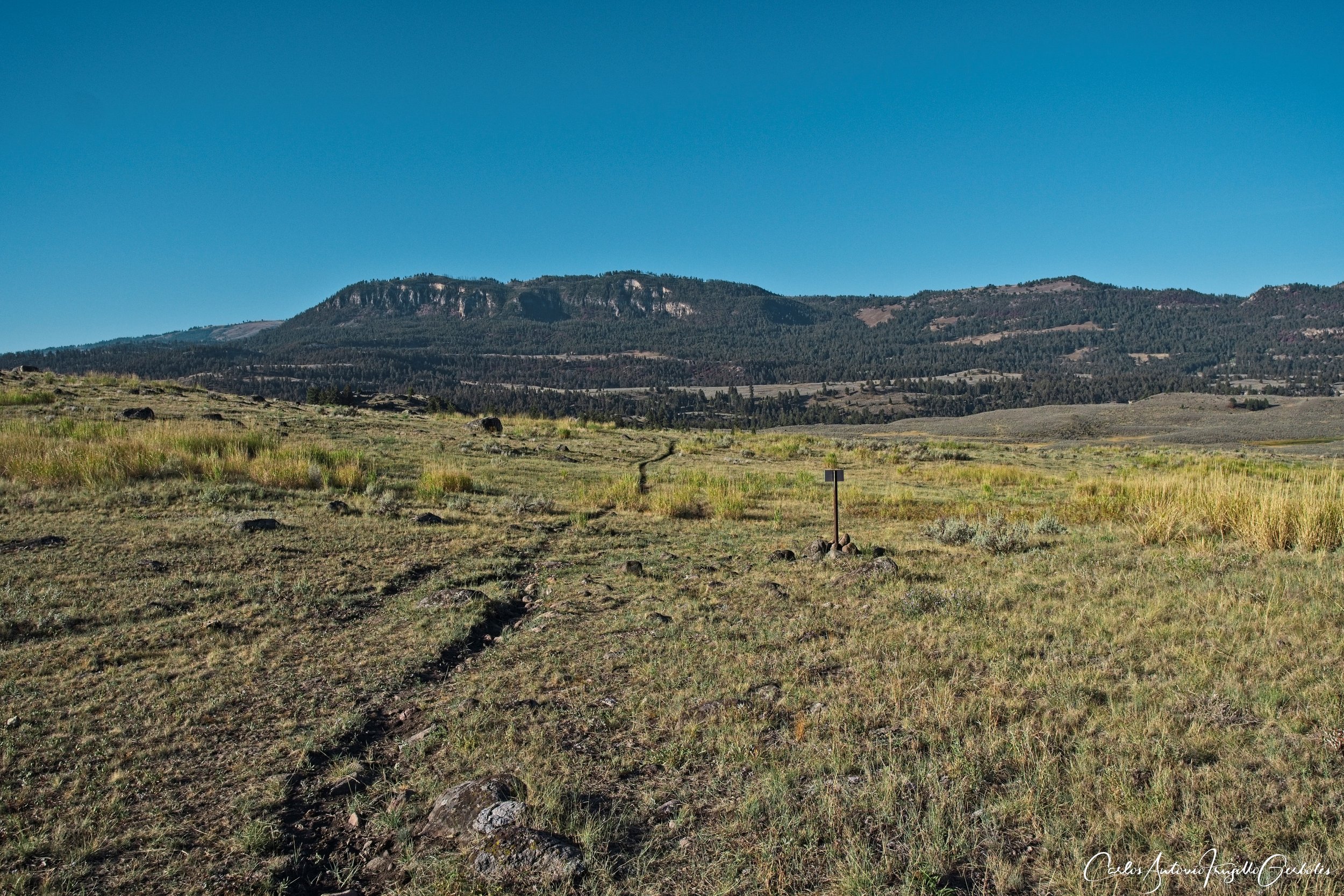
Sepulcher Mountain (in green): the start of this hike is at the Mammoth Hot Springs (the same trailhead that take you to Beaver Ponds, but at some point you take a left for this trail). Once you leave the Beaver Ponds trail you hike uphill in a wooded area (look out for bears, I followed fresh grizzly tracks for half a mile) and reach a the tree line. You then reach the top, a spur to the right, with views of Gardiner. The best views are when you continue the hike, going across the other side of the mountain, which will give you nice views of Electric Peak. Once there, there will be a few hikers on the trail, but not enough to make noise and annoy the bears in the area. Eventually the trail goes down to Glen Creek (a right takes you to Cache Lake, along a creek) and from there you take Snow Pass and a spur trail that takes you back to the original place you left the Beaver Ponds trail. This is a nice to do hike and gives you a bit more views than Bunsen, but there is less human traffic and it is a longer trail.
The Good: If you continue hiking around the mountain, the views are amazing.
The Bad: If you just to go the top of Sepulcher and turn around, the views are not that great.
Once you leave the Mammoth area and go up the road, you will reach a small parking area for the next two hikes.
Bunsen Peak (in red): This is an anyone-can-do hike with a small parking area (but there are pullouts down the road you can park on). It is a very fair set of switchbacks to take you to the top, with great open views on the way up of Electric Peak, Swan Lake and Gardners Hole valley. Atop is a park structure and then you just hike across the other side of the peak to go down the back side to the spectacular Osprey Falls trail. Note: that area was closed in 2023 due to the floods and I think they are still closed, so check the park webpage for details. You then can come back the way you came or walk on a service road that takes you also to the parking area. This is a must do hike, the only effort is getting down to the falls since the trail is a bit steep for casual hikers.
The Good: Everything is good, great views, nice elevation gain, can be done by anyone.
The Bad: The closure of Osprey Falls is sad, these are great accessible falls from Gardiner.
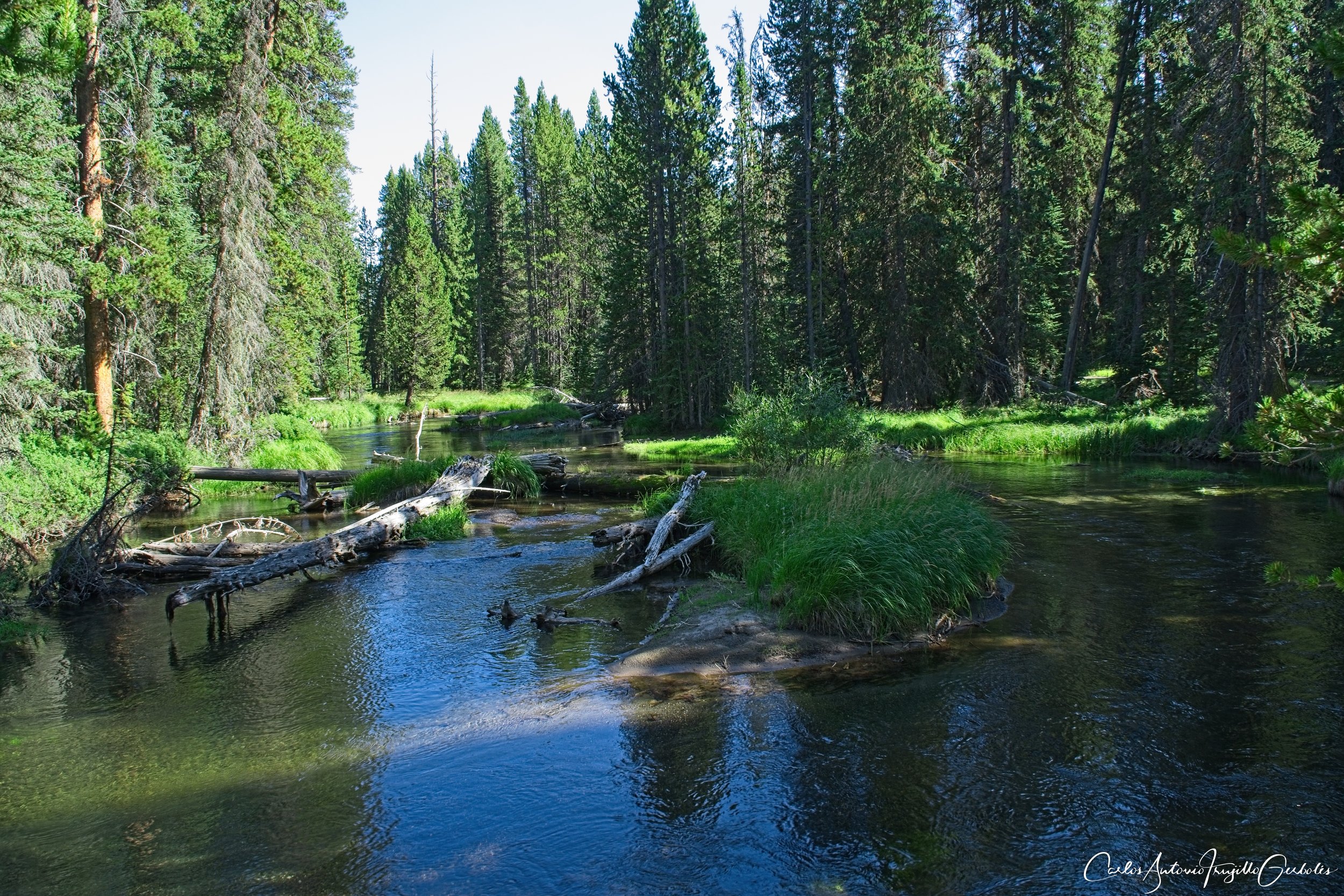
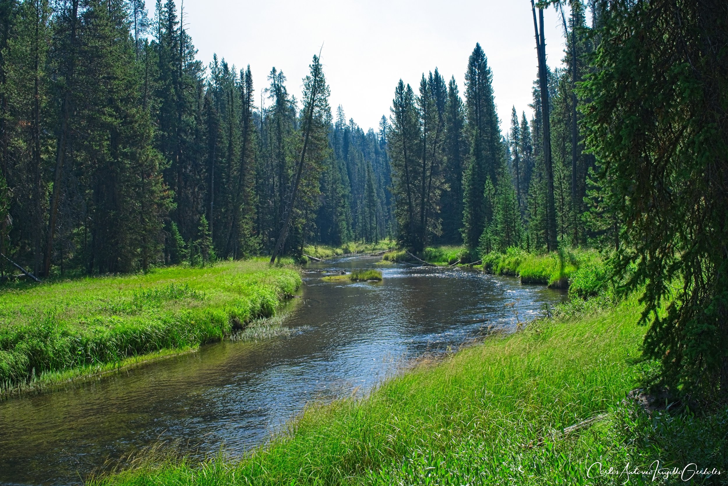
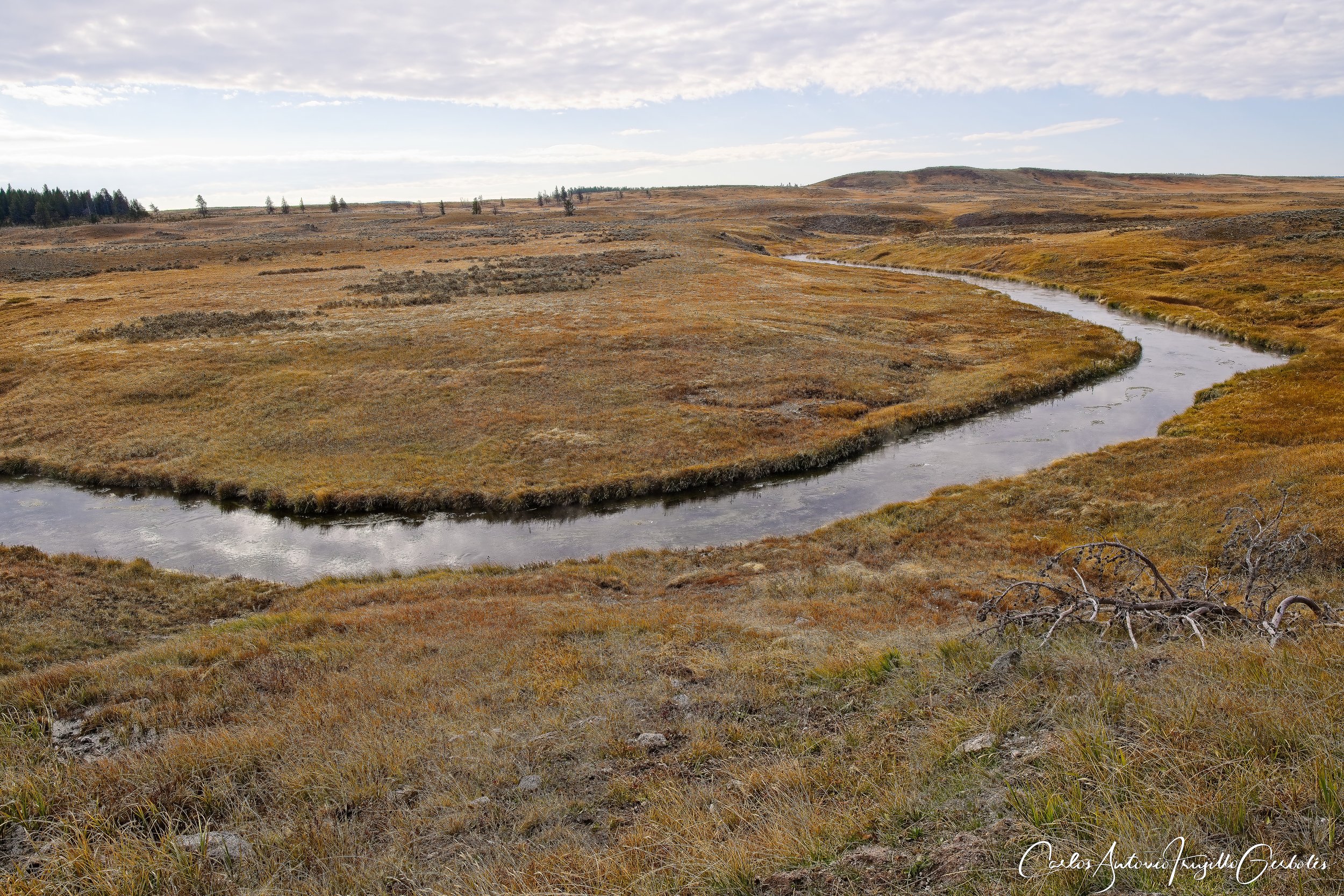
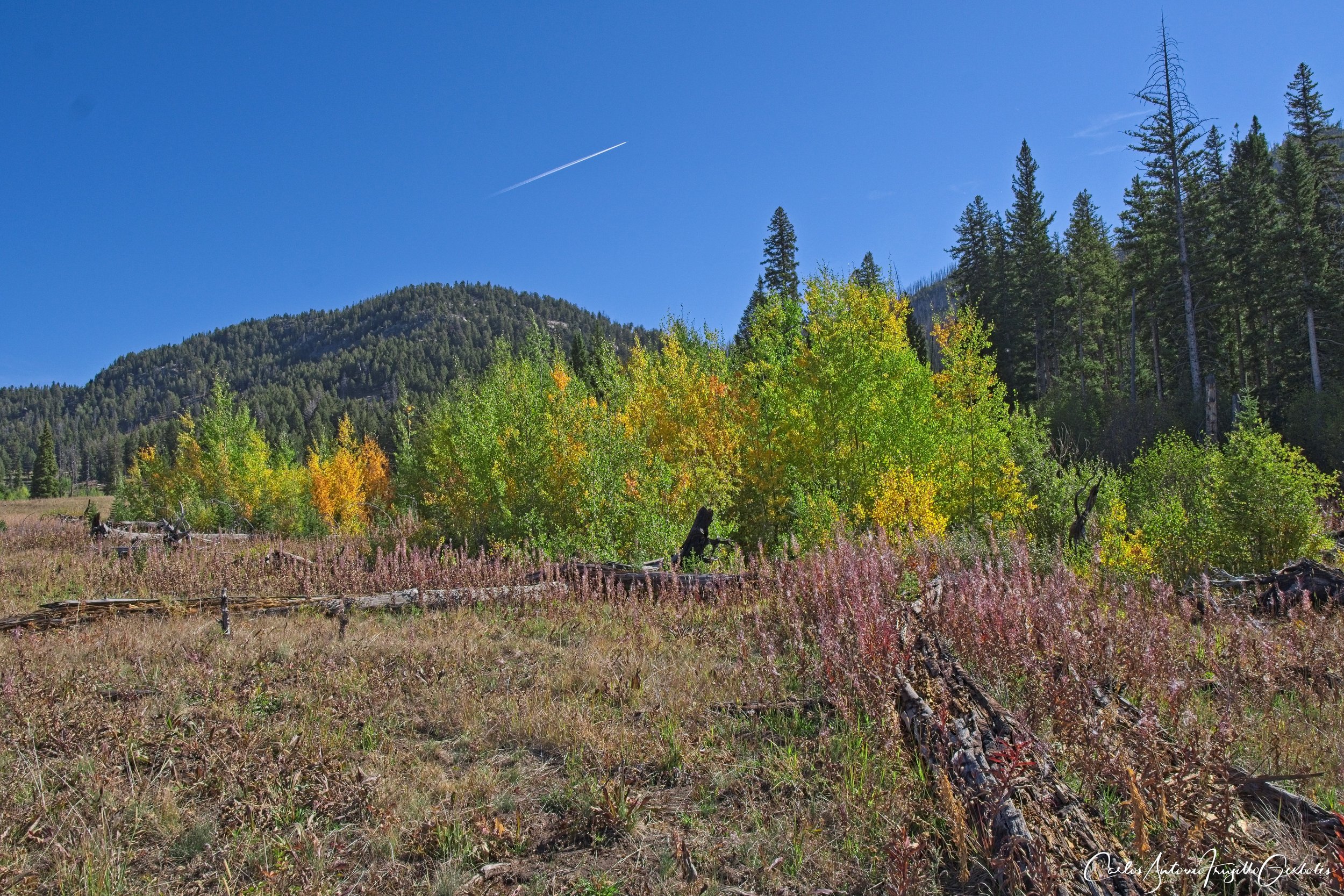
Fawn Pass (in blue): this is a serious trail and not recommended for casual hikers at all. This is basically a backpackers trail that takes you to the Gallatin Bear Management area, where you are NOT allowed to leave the trail. I hiked it 7 miles in, it got spooky and then I turned around. You use the parking lot of Bunsen Peak. Lots of creek crossings and high vegetation hide noises and bears. If you want solitude and are an experienced hikers, the views are great. Side trip to Fawn Lake and then back to the trail; it is at that point that you will enter the bear management area and things get spooky since you are back in the forest and paranoid about your surrounding. Hiking along a creek is pretty but it masks your sounds and that is a recipe for neither a bear or you being aware of the other. There are no campsites past the lake, until the trail takes you all the way to US 191. Always look back since the views are amazing in front and behind you. After the first mile you gain a bit of elevation and get nice views of a valley to your left before you cross the first creek and the views are not that expansive, but I need to repeat that the vegetation is tall. I only ran into some backpackers returning, who told me that they heard wolves at night at camp. This was always a must do hike for me.
The Good: Amazing colors in falls, extreme solitude, lots of creeks.
The Bad: Prime grizzly country.
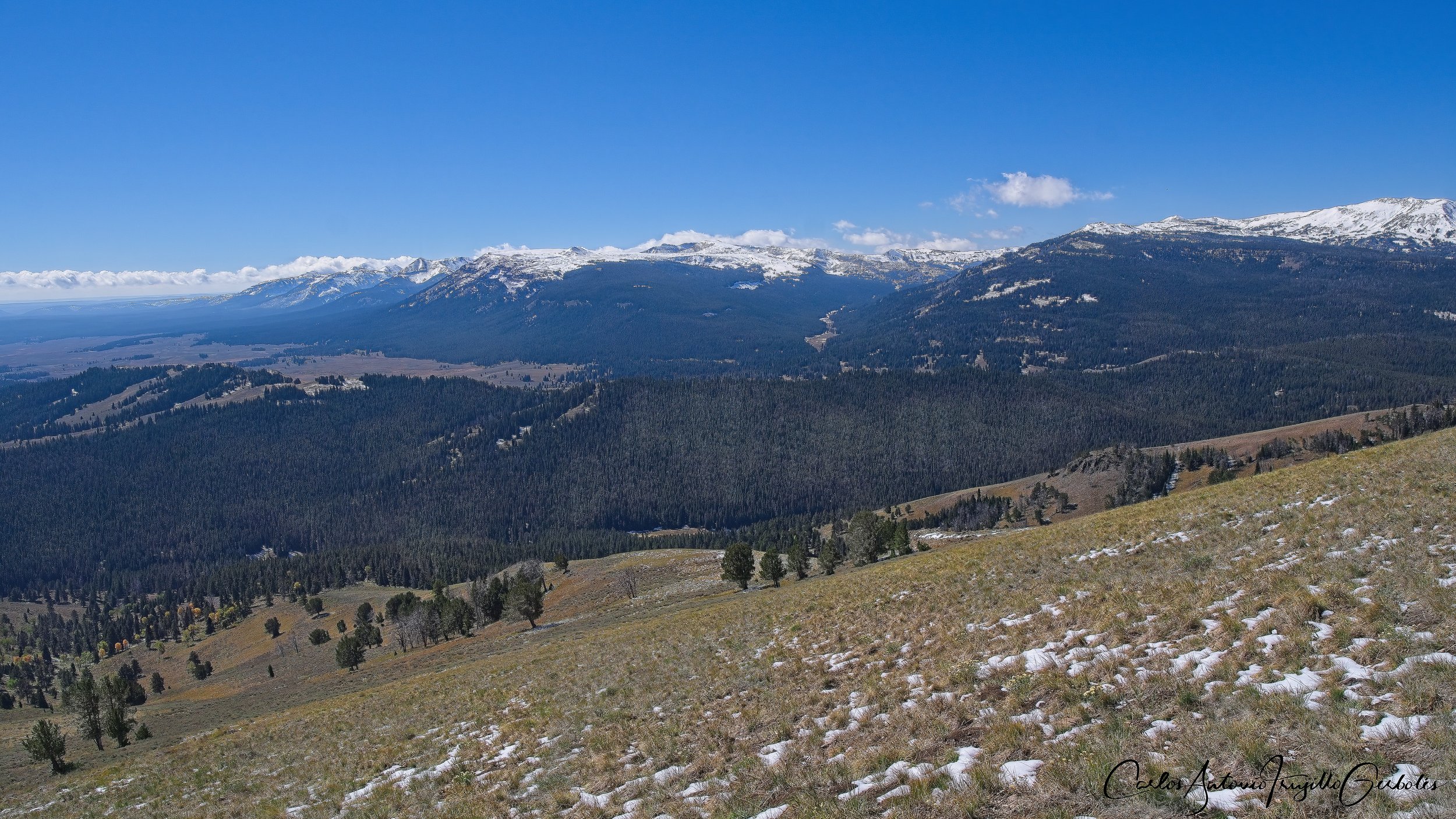
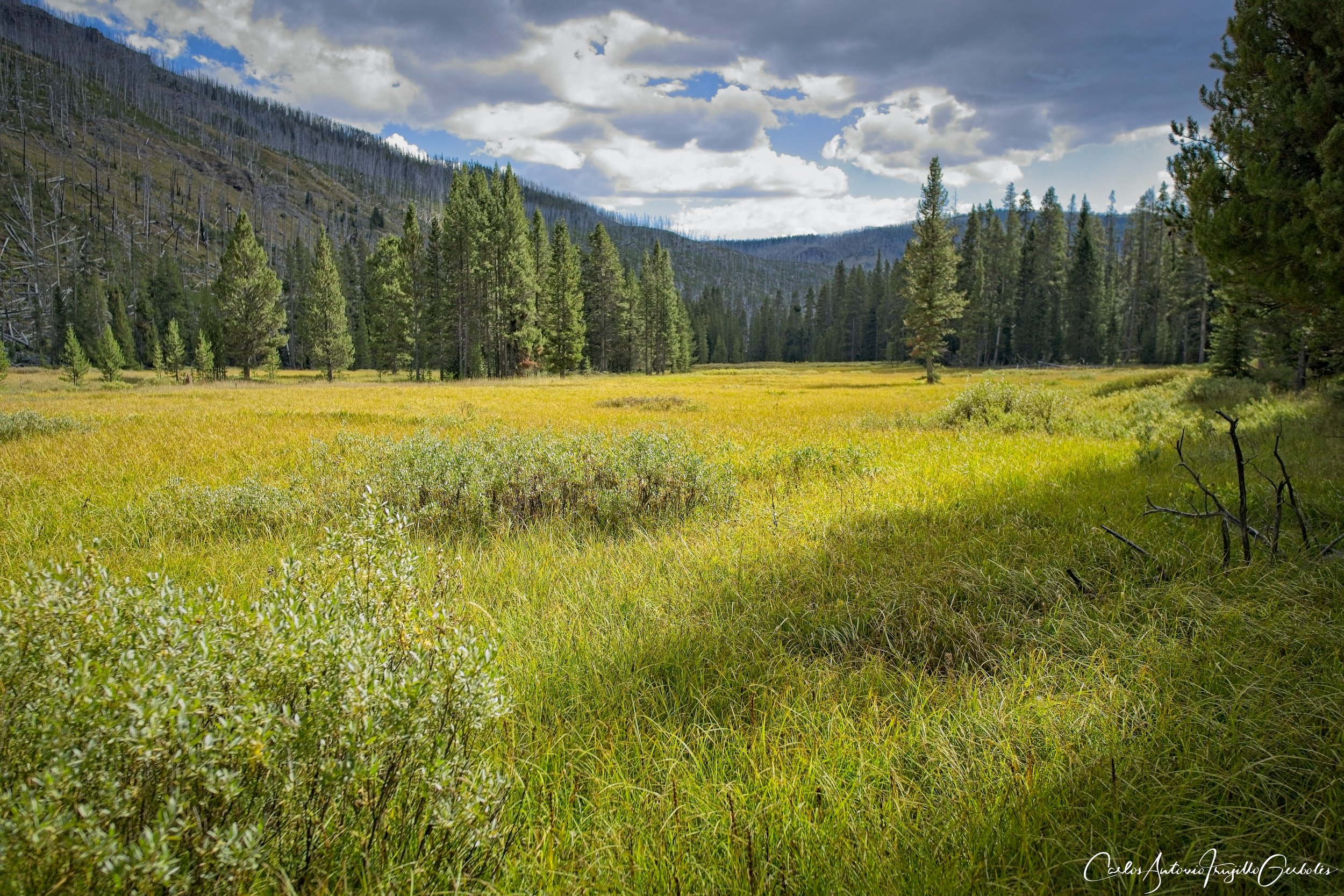
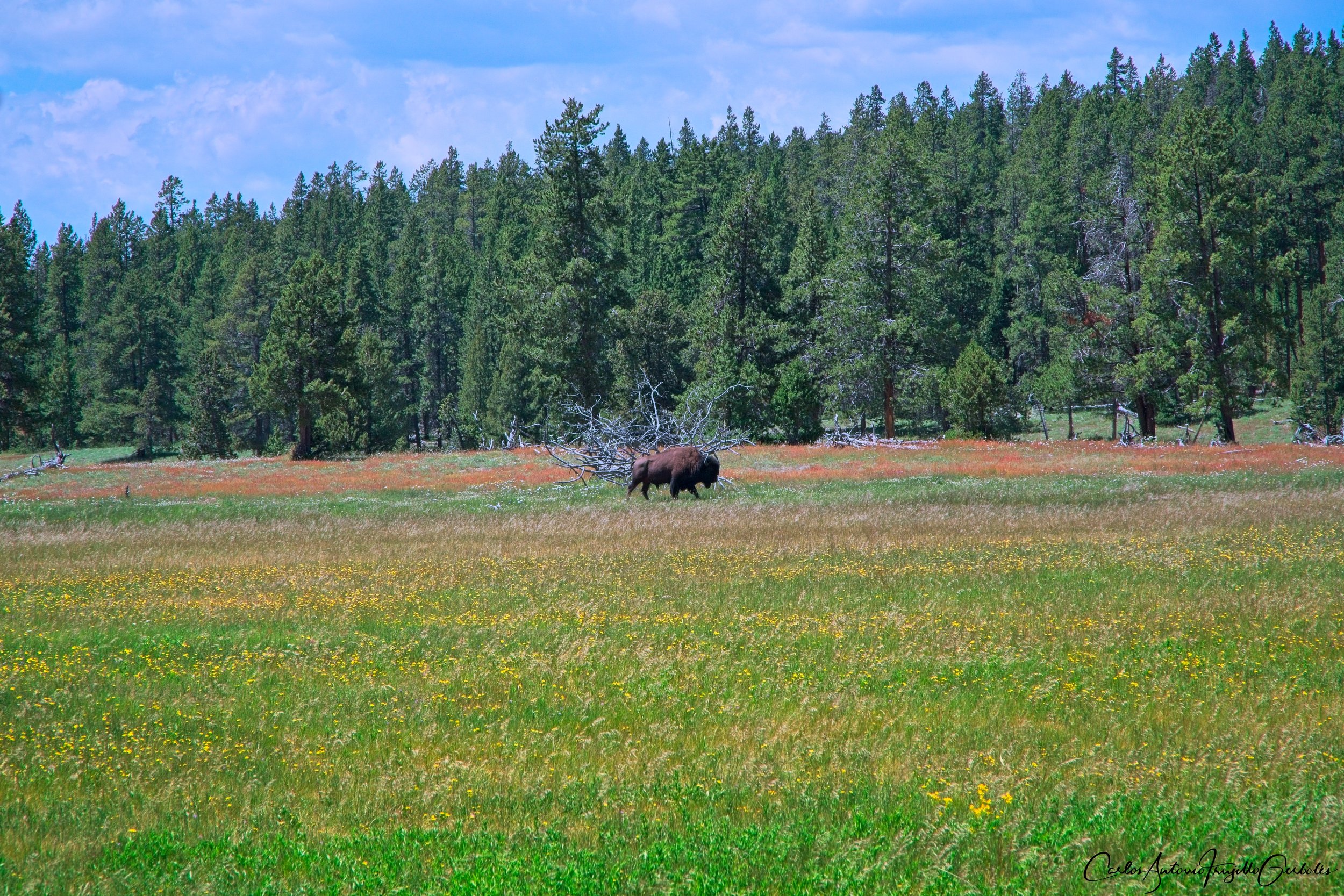
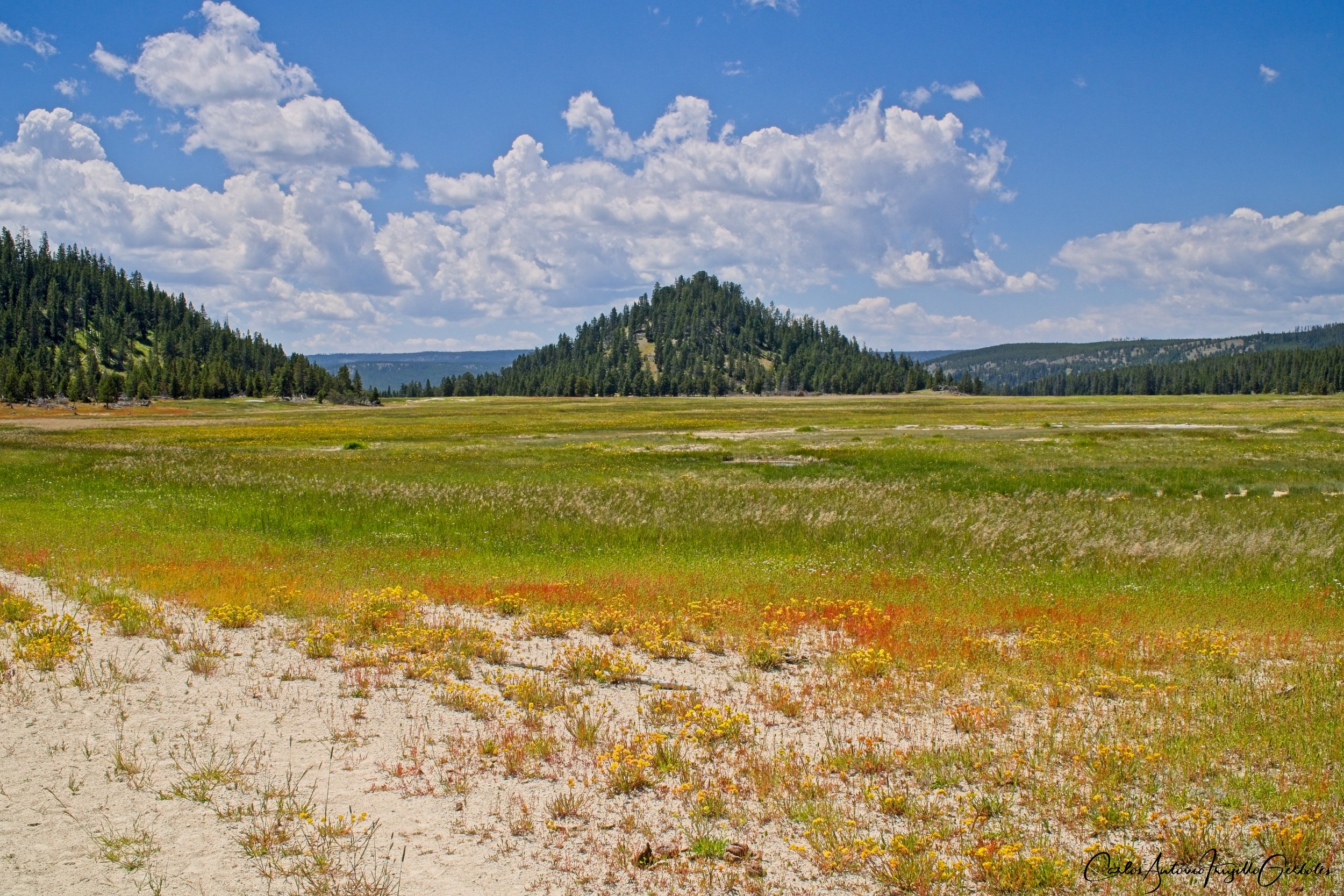
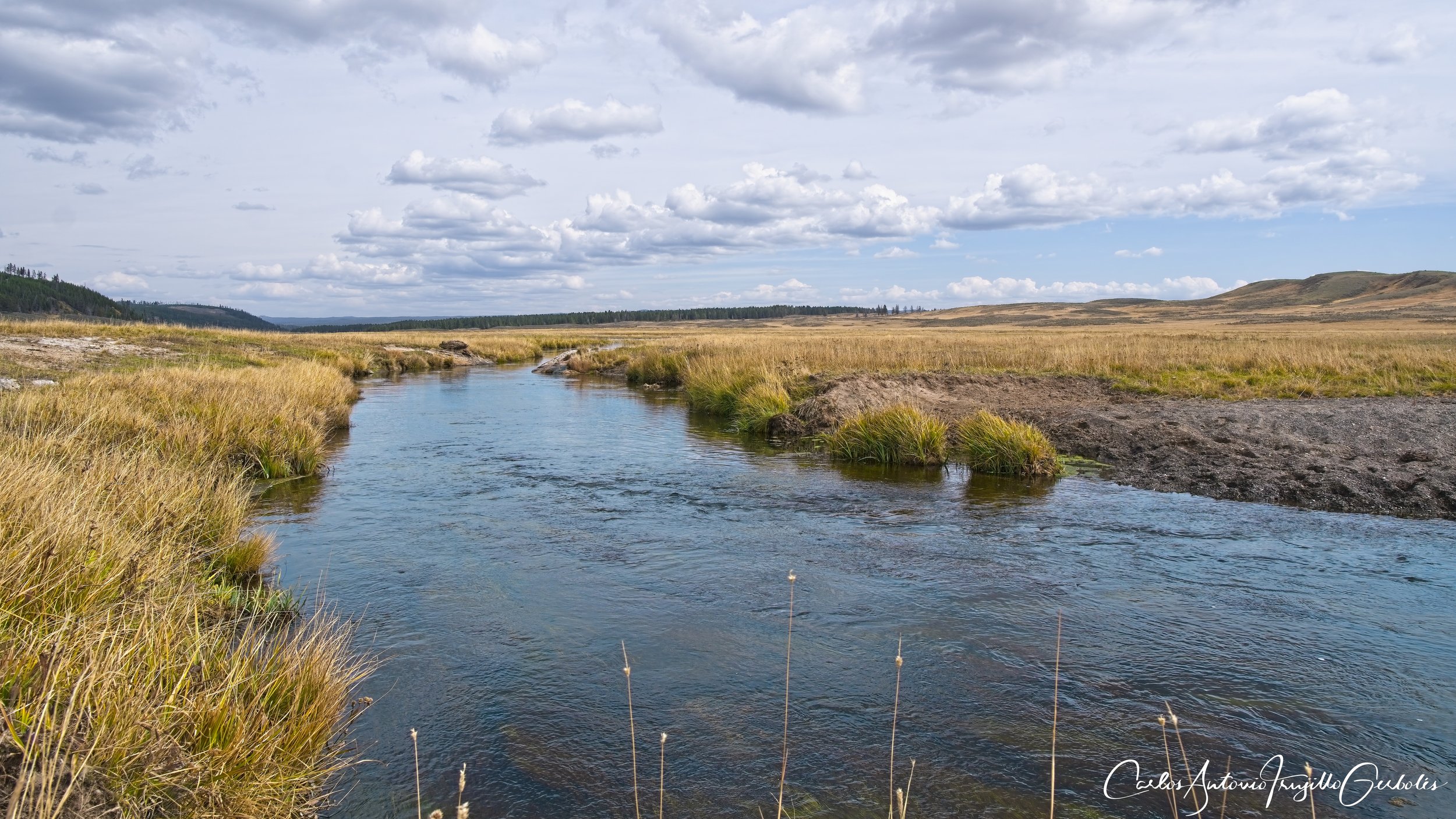
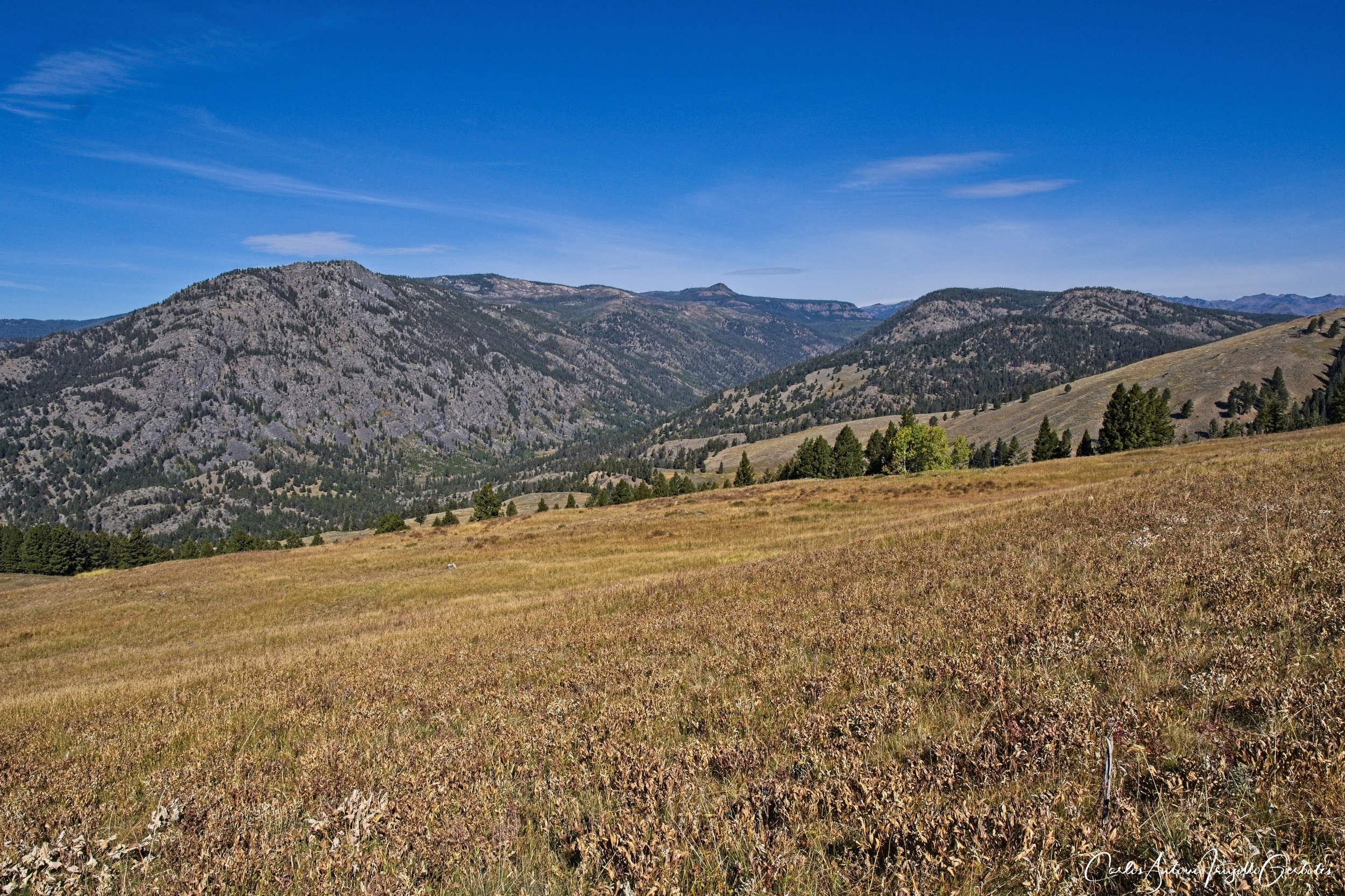
Bighorn Pass (in purple): This another trail for experienced hikers and best done in groups, just like Fawn Pass. You park in the Indian Creek campground; the campground is sometimes closed so you park at the entrance road, as long as you don’t block the main road. For the first 4-5 miles it is wide open with great views of Quadrant, Bannock and Antler Peaks. You will find no one on this trail, just backpackers coming from the west side of the trail. At some point you will enter a forested area and the Bear Management area (again, no hiking off trail). For the wide open views this trail is work hiking until you reach the forested area. I want to do this again and reach Bighorn pass itself. Many backpackers will create a semi loop hike with this and Fawn Pass trail. There are about 2-3 creek crossing, no big deal, but the creeks and the background are so pretty. There are bears here, so keep an eye on the horizon, but the good things is that it is wide open so you will see them coming. For the open views and the nice creeks, this is a must do hike for me.
The Good: Wide open spaces, beautiful creek crossing, great mountain backgrounds.
The Bad: Prime grizzly territory, very few hikers.
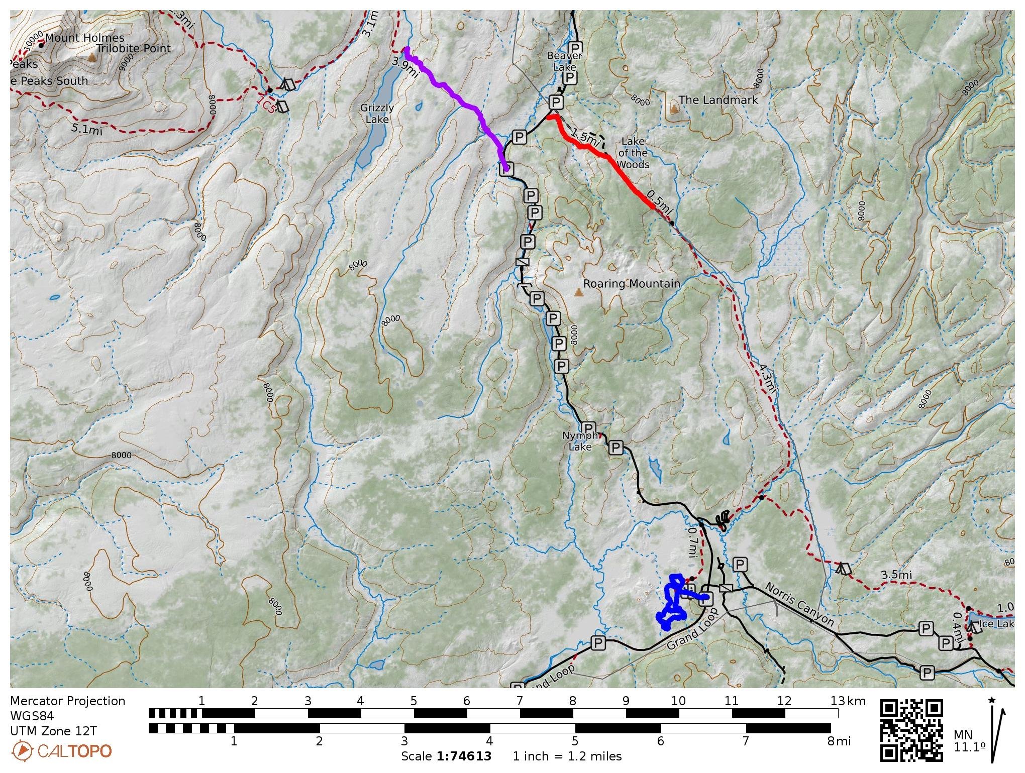
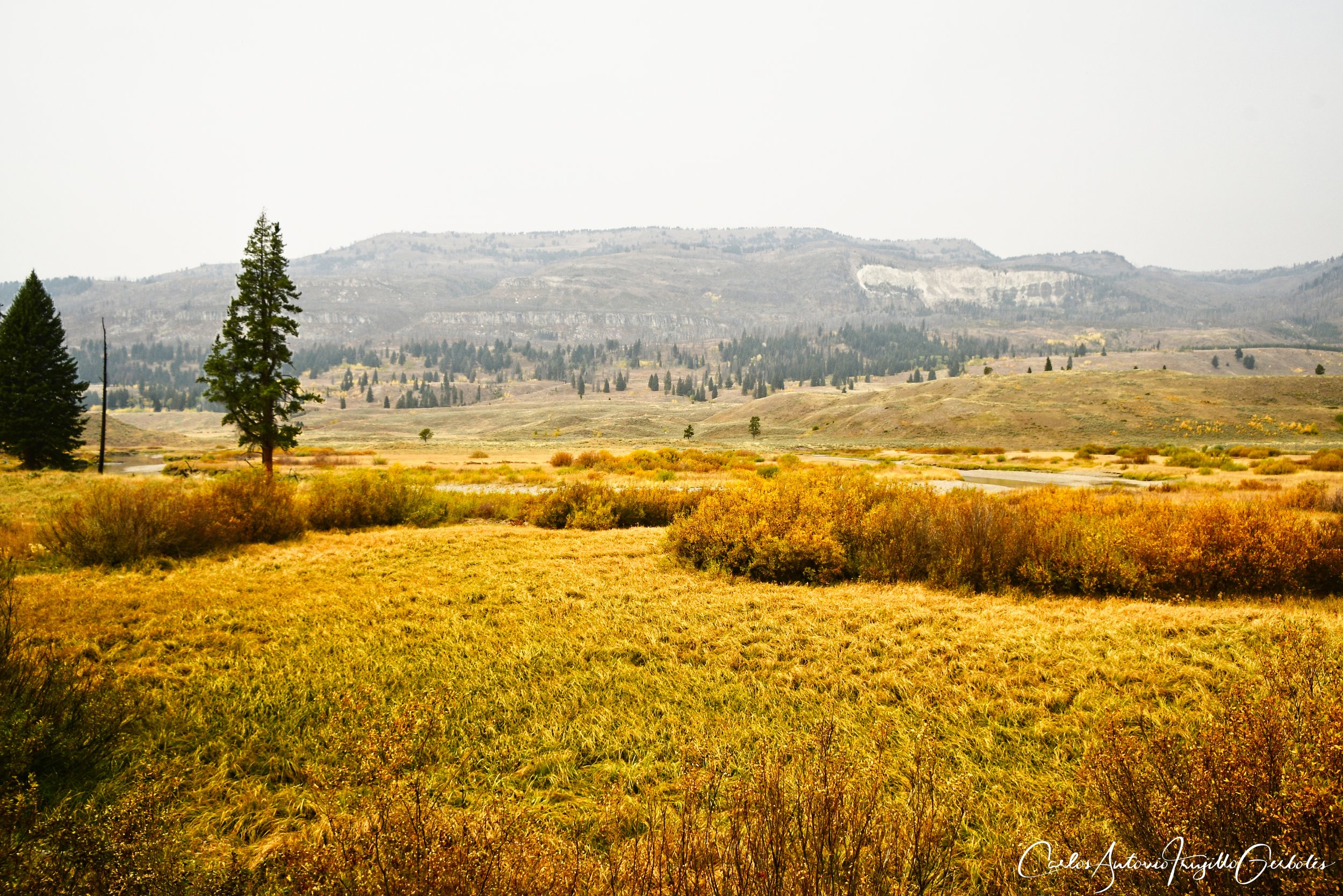
Grizzly Lake, Salfarata, Norris Geyser Basin
The next set of hikes are also doable from either Gardiner or West Yellowstone.
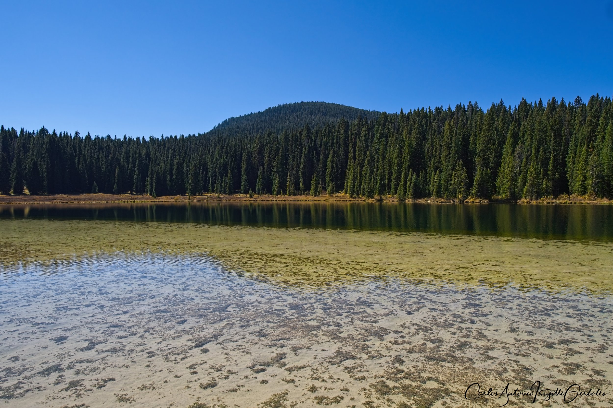
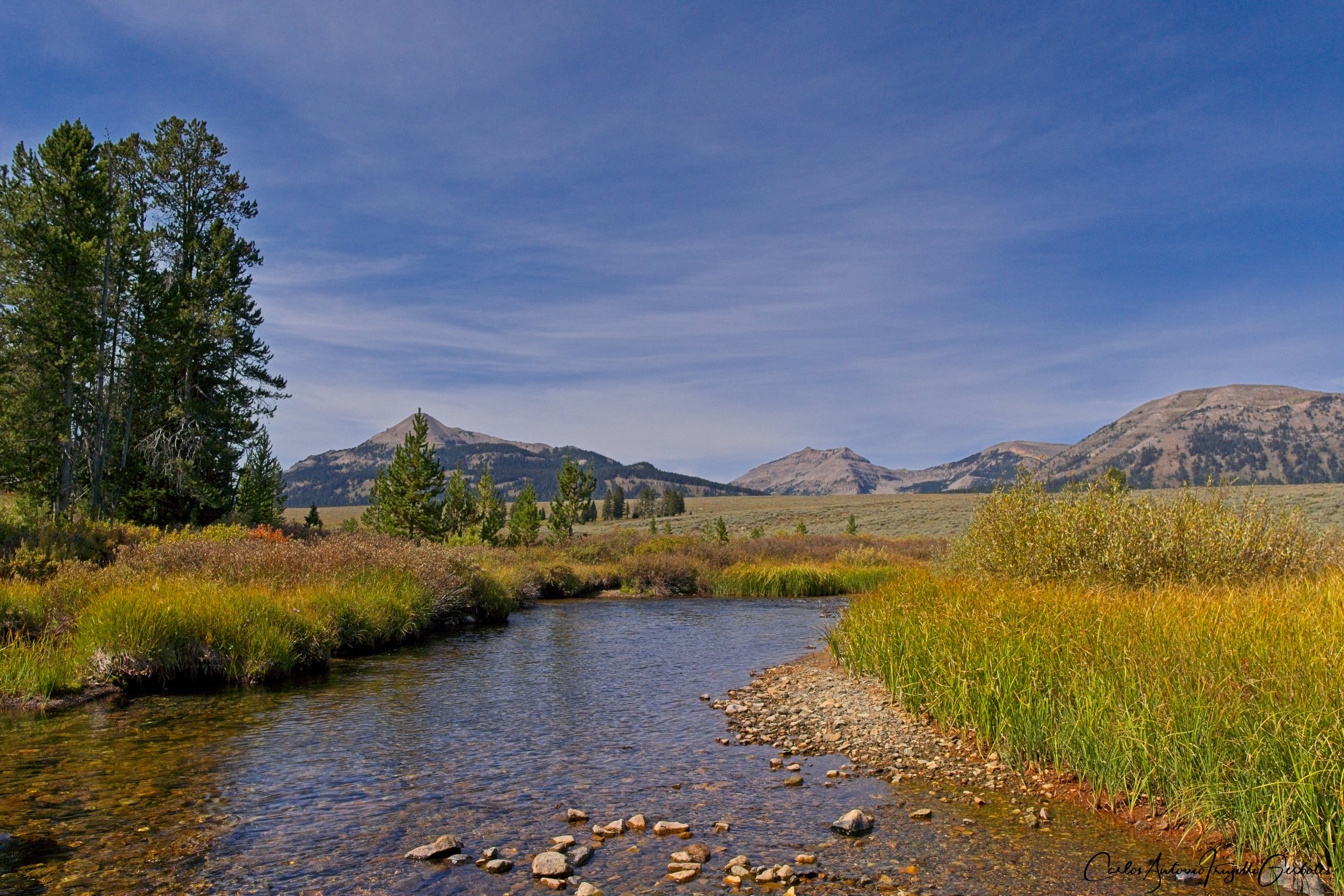
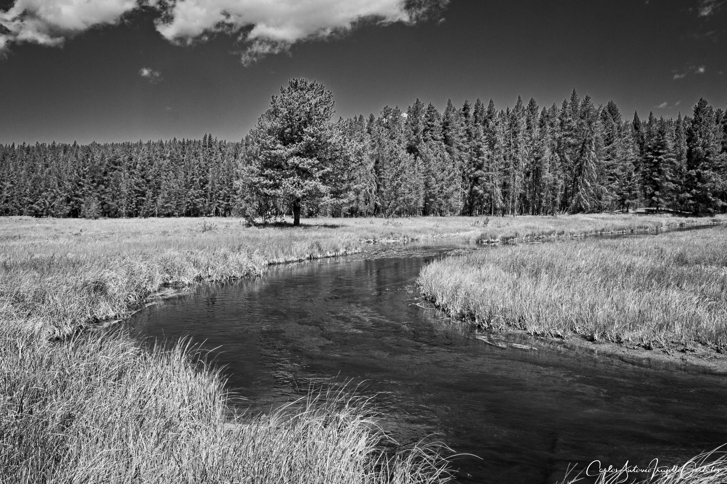
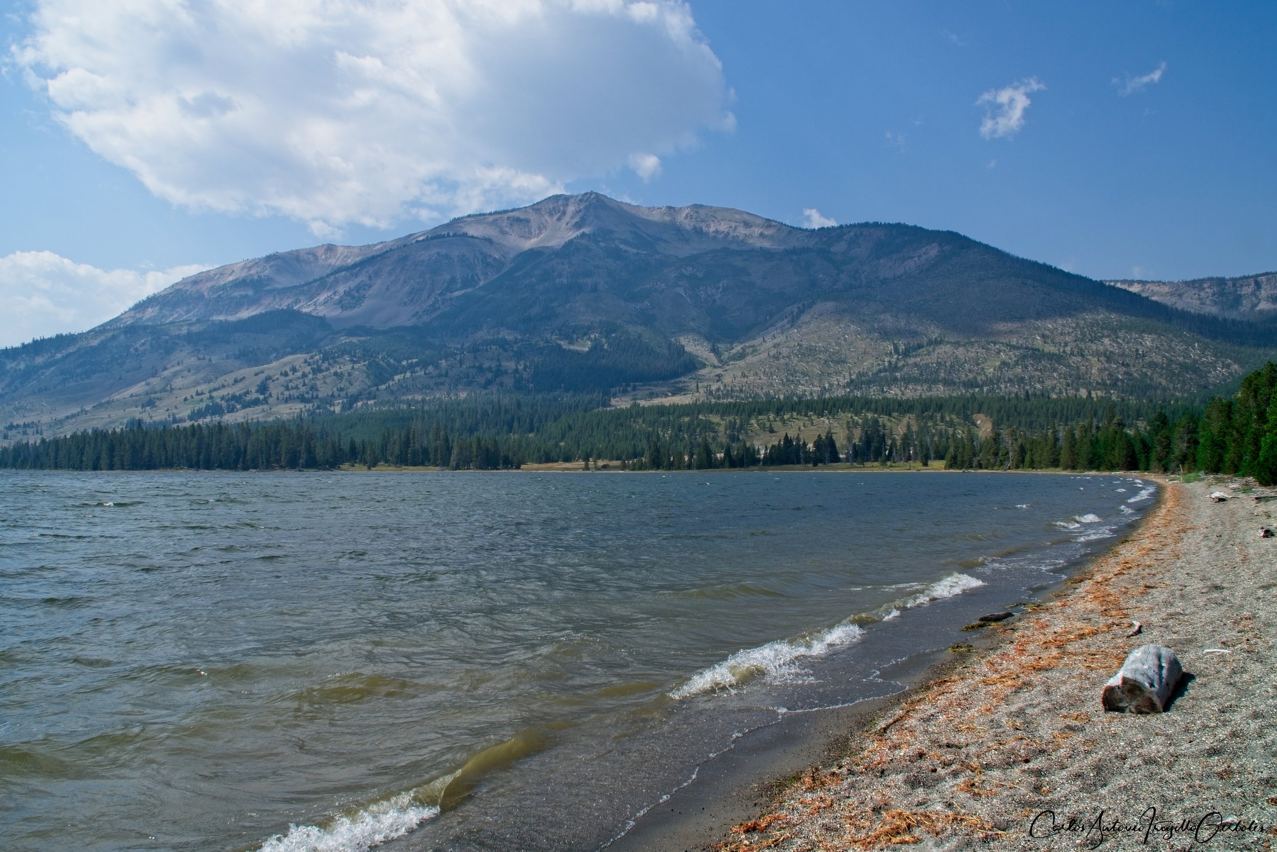
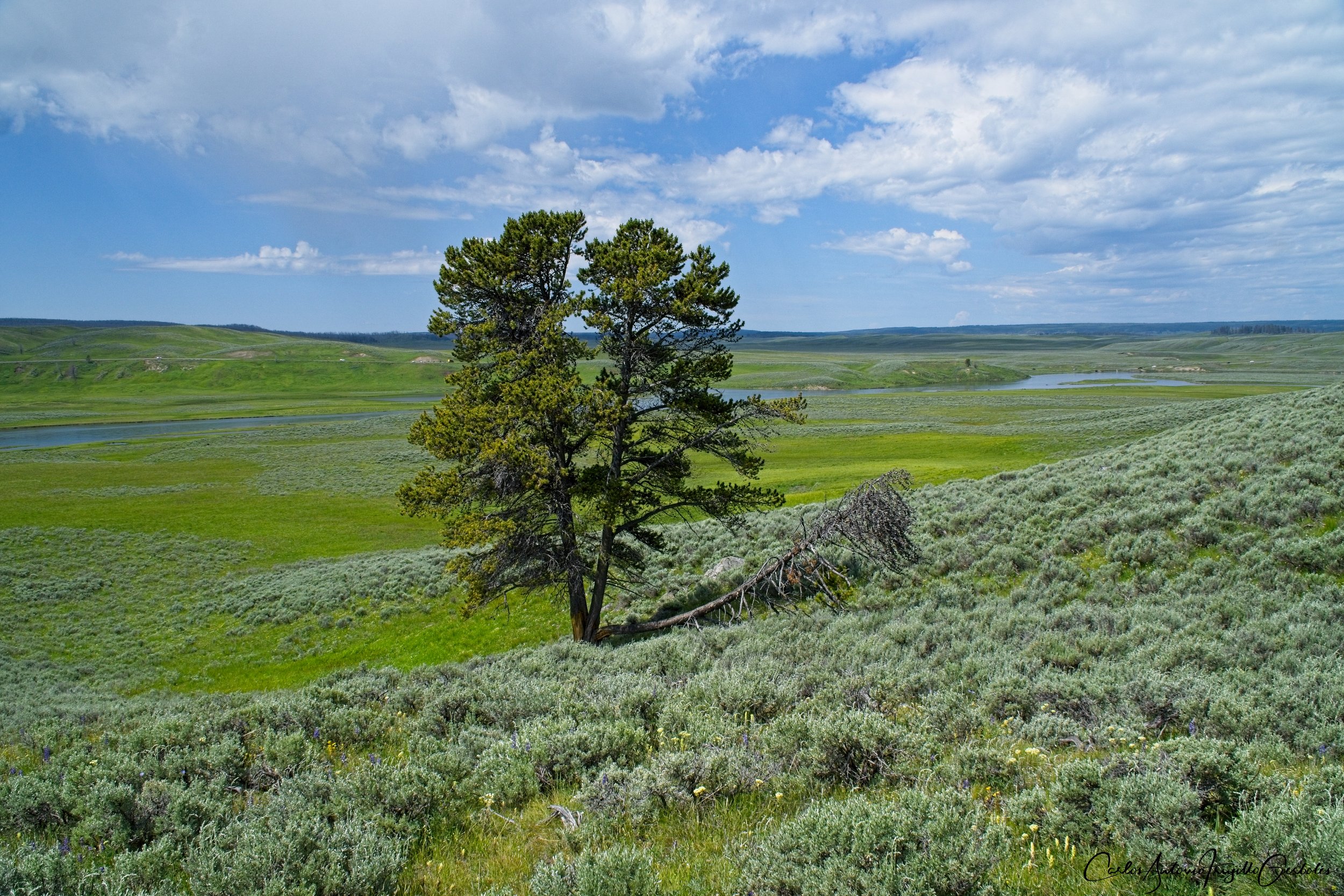
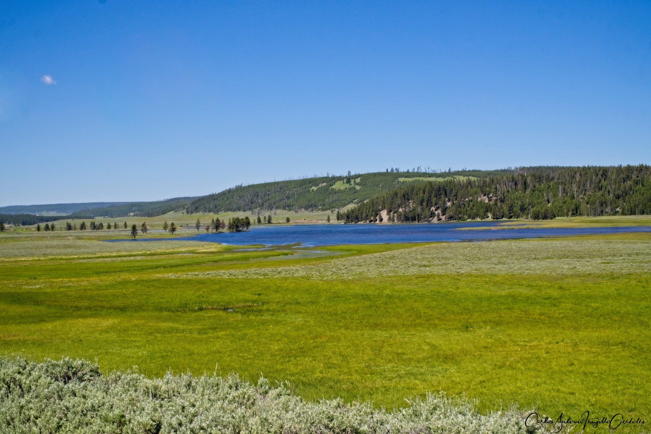
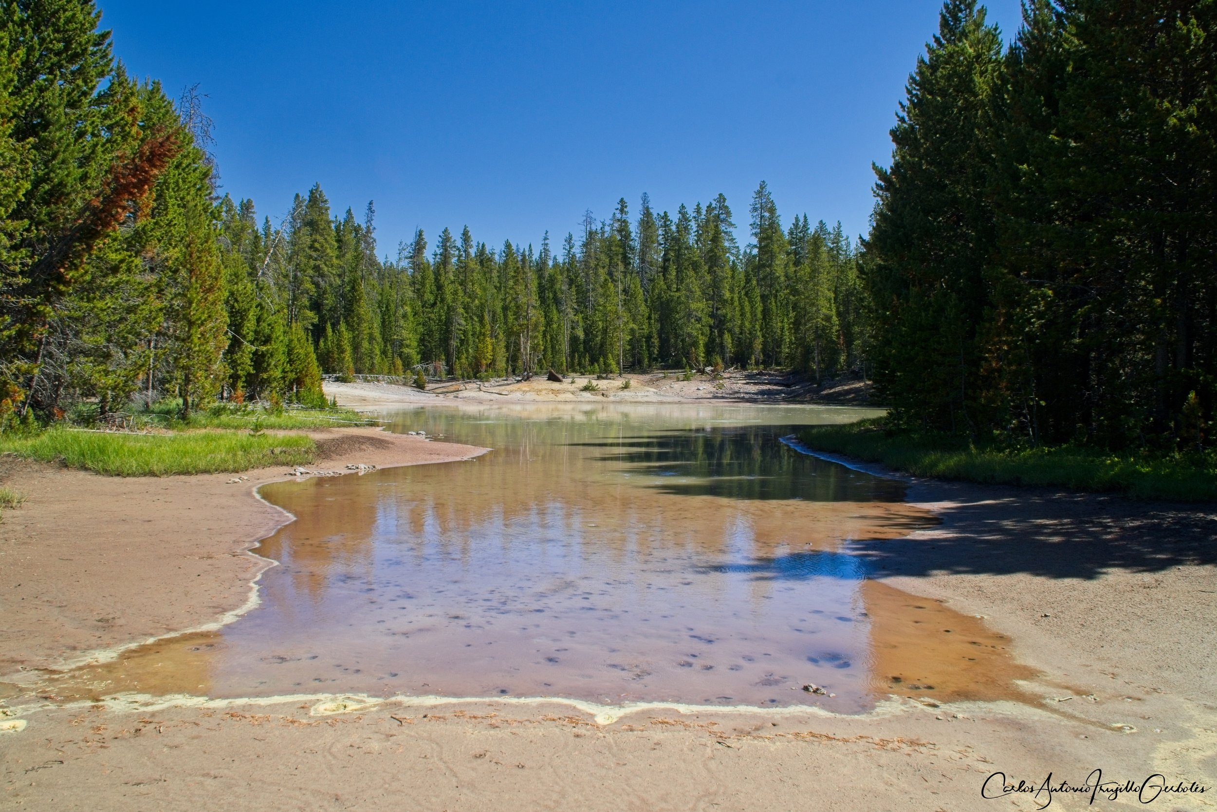
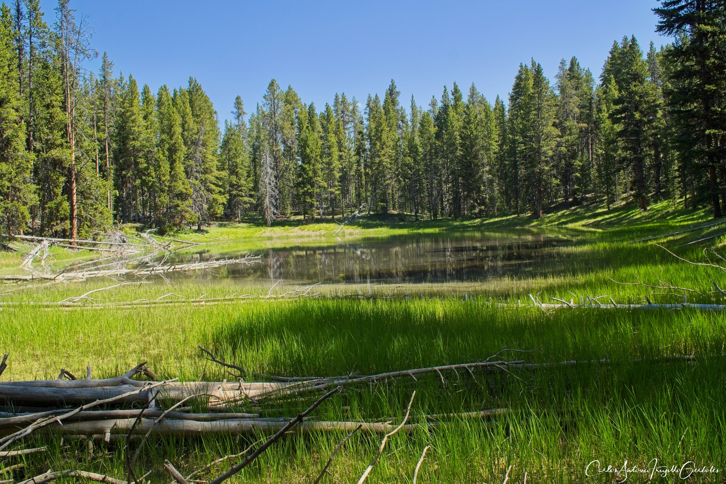
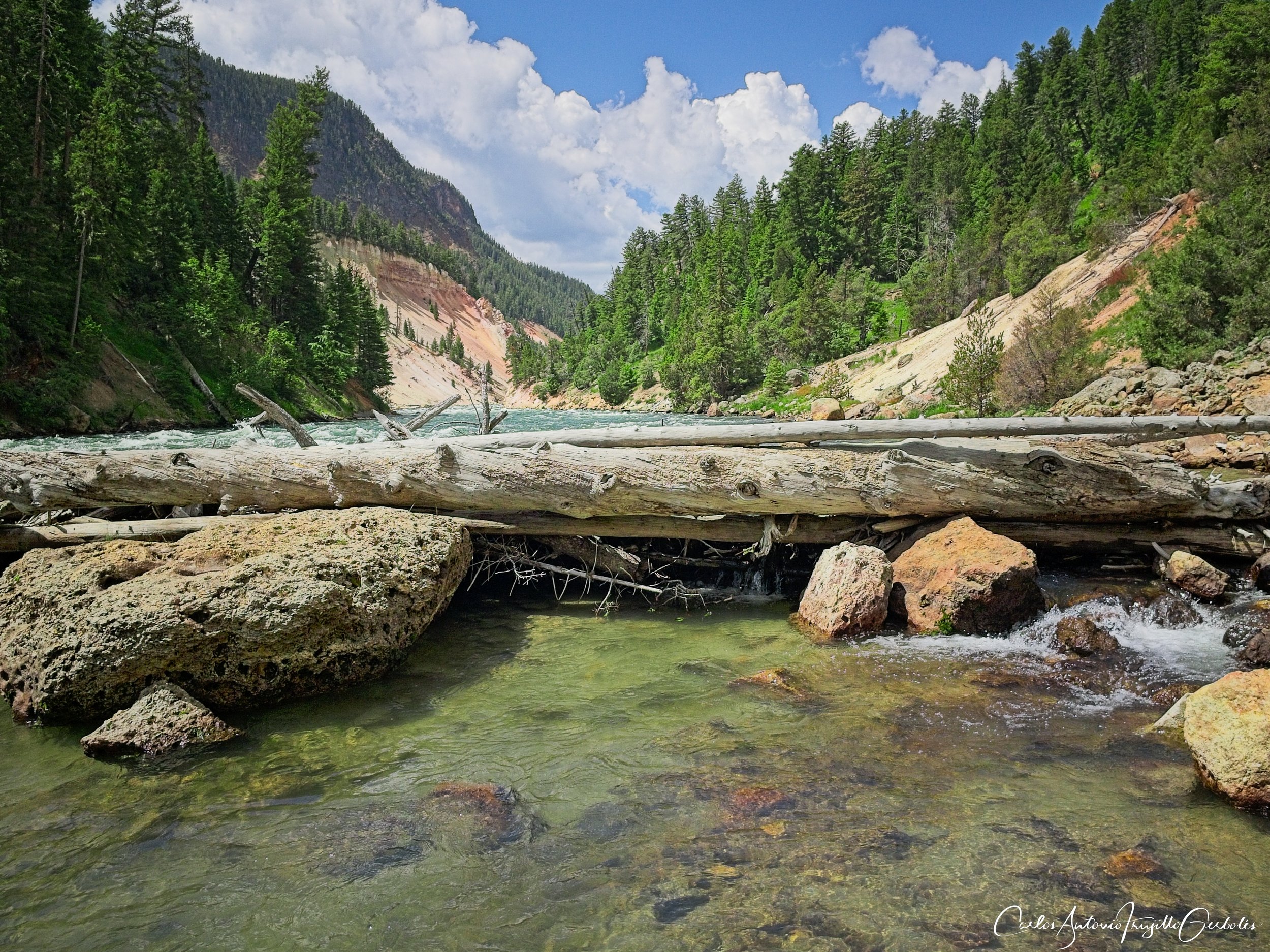
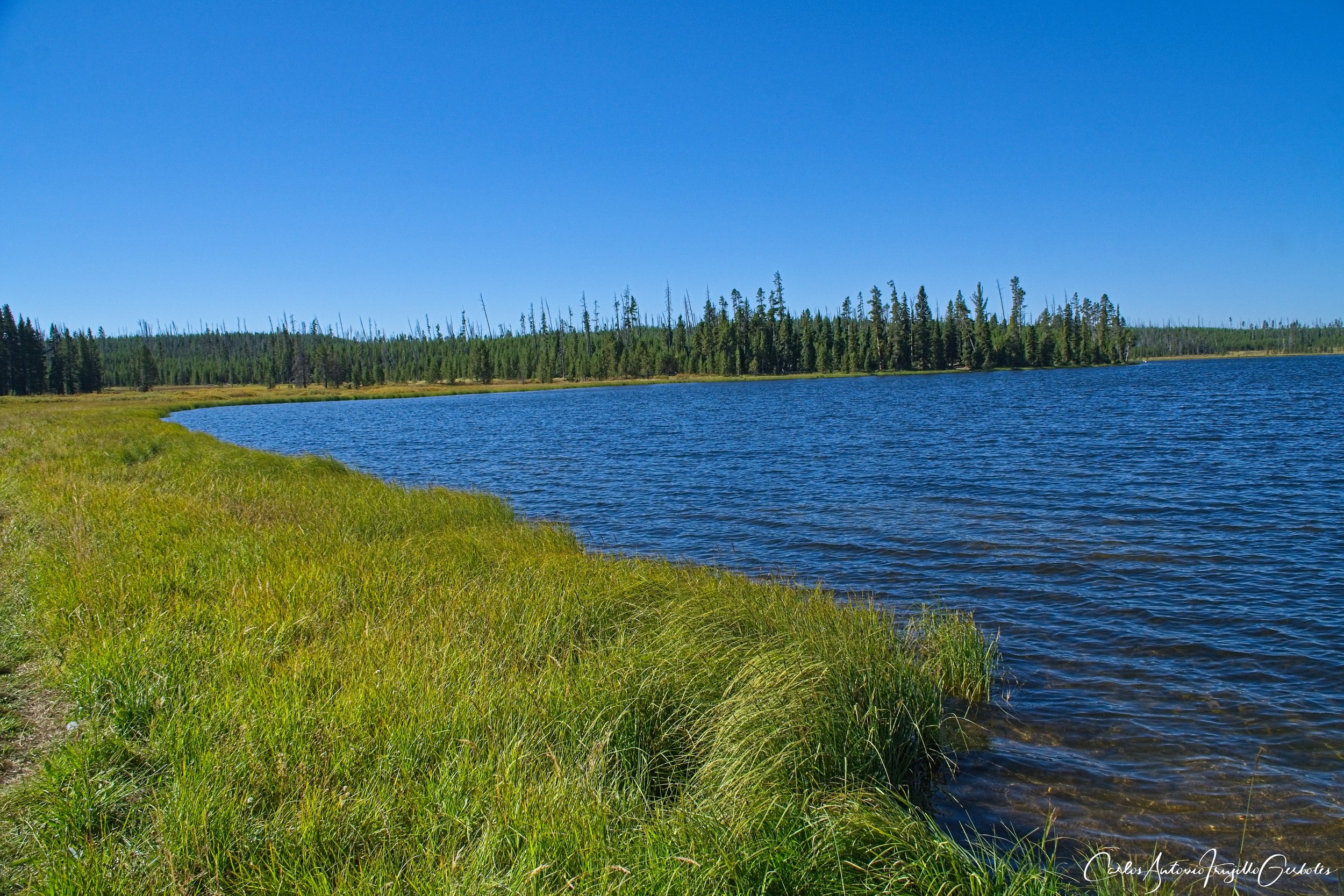
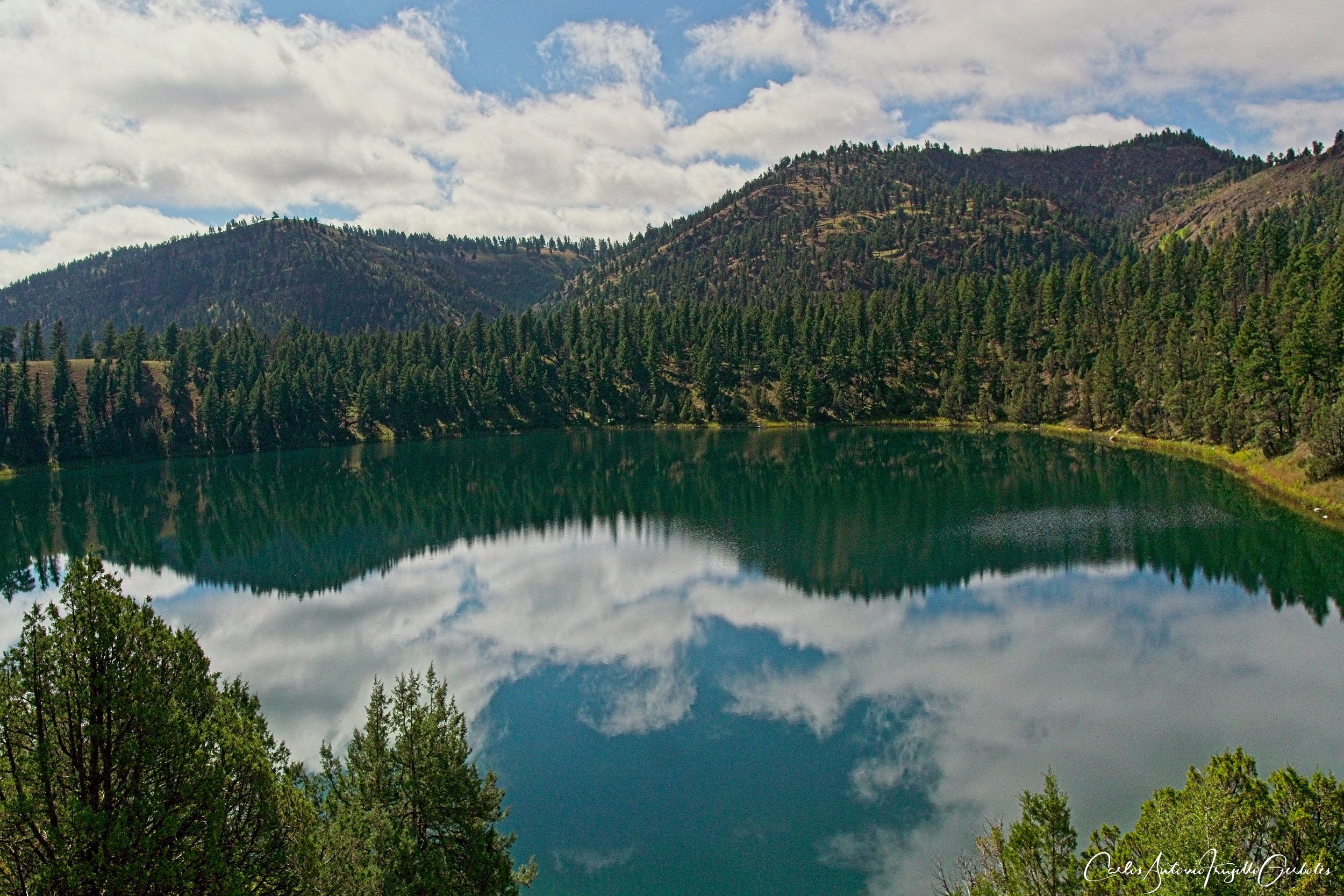
Grizzly Lake (in purple): This is the perfect 2 hour hike for those that just want to drive around the park road and do short hikes. The parking area, which is a long pullout if I remember correctly, is pointed to by signs on the road. You cross a small meadow (careful, bison) and then enter a forest that takes you down to the long and pretty Grizzly lake. Most of the way down the view of the lake is obscured but there are clearings that allow you to enjoy the lake and the background of mountains. If you noticed in the topo map, you can use the Mount Holmes trailhead to get to this lake too; I have not done that but it looks nice, but a longer hike. On a side note, hiking to Mount Holmes I don’t recommend it as a day hike: the trail is not well established and when you start gaining elevation the trail disappears past the first campsite (maybe it was me since this was my second hike ever in Yellowstone and I was not accustomed to the trail markers). It is too much for a day hike to spend energy hiking and then finding a route. There are campsites at the base of the mountain and I think that is the best way to hike to the top. There are no bad lakes in Yellowstone, so I loved this hike. You can see the background of mountains that always makes a great background for the lake.
The Good: A short hike that takes you to a pretty lake.
The Bad: Nothing, really.

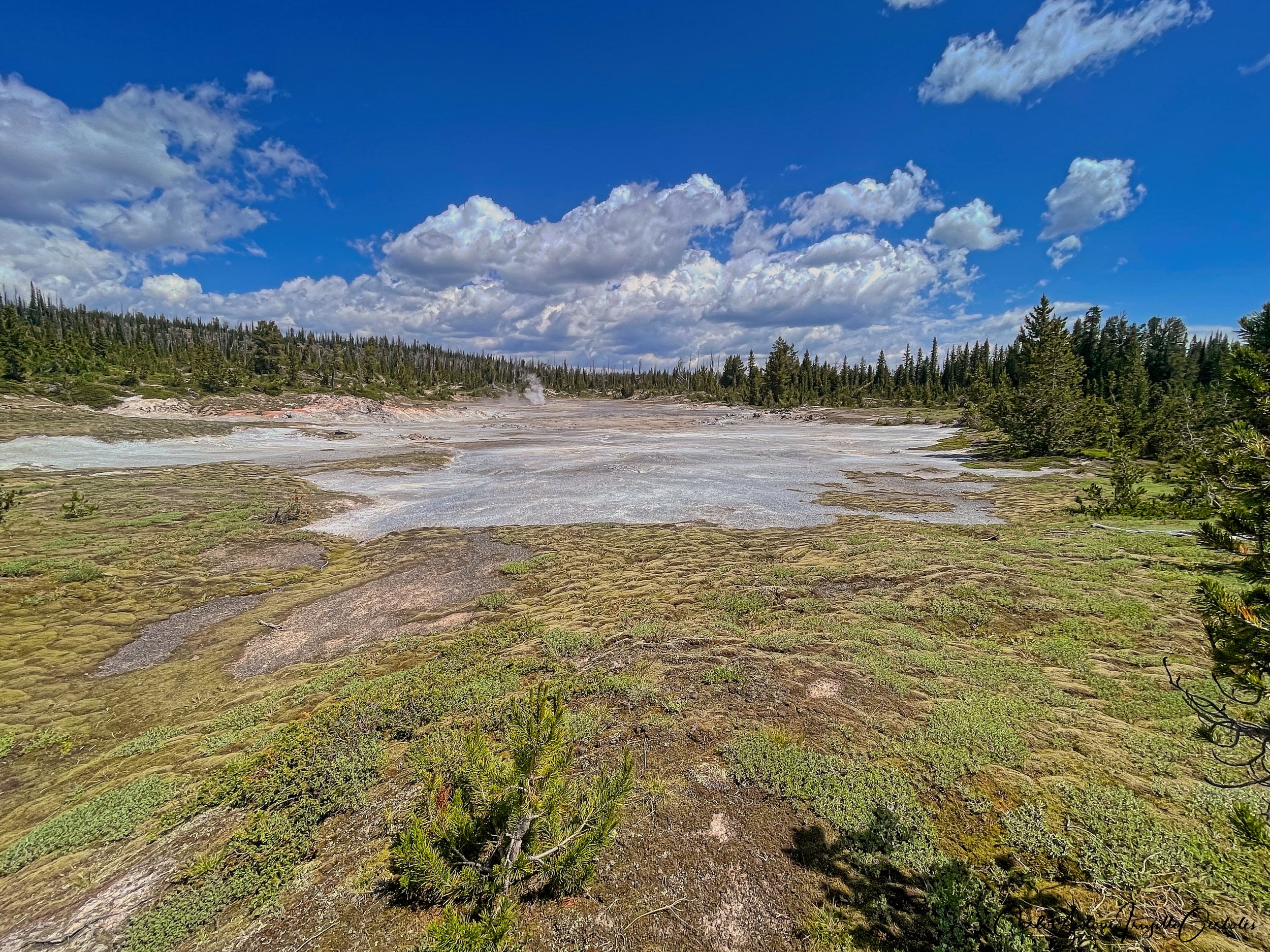
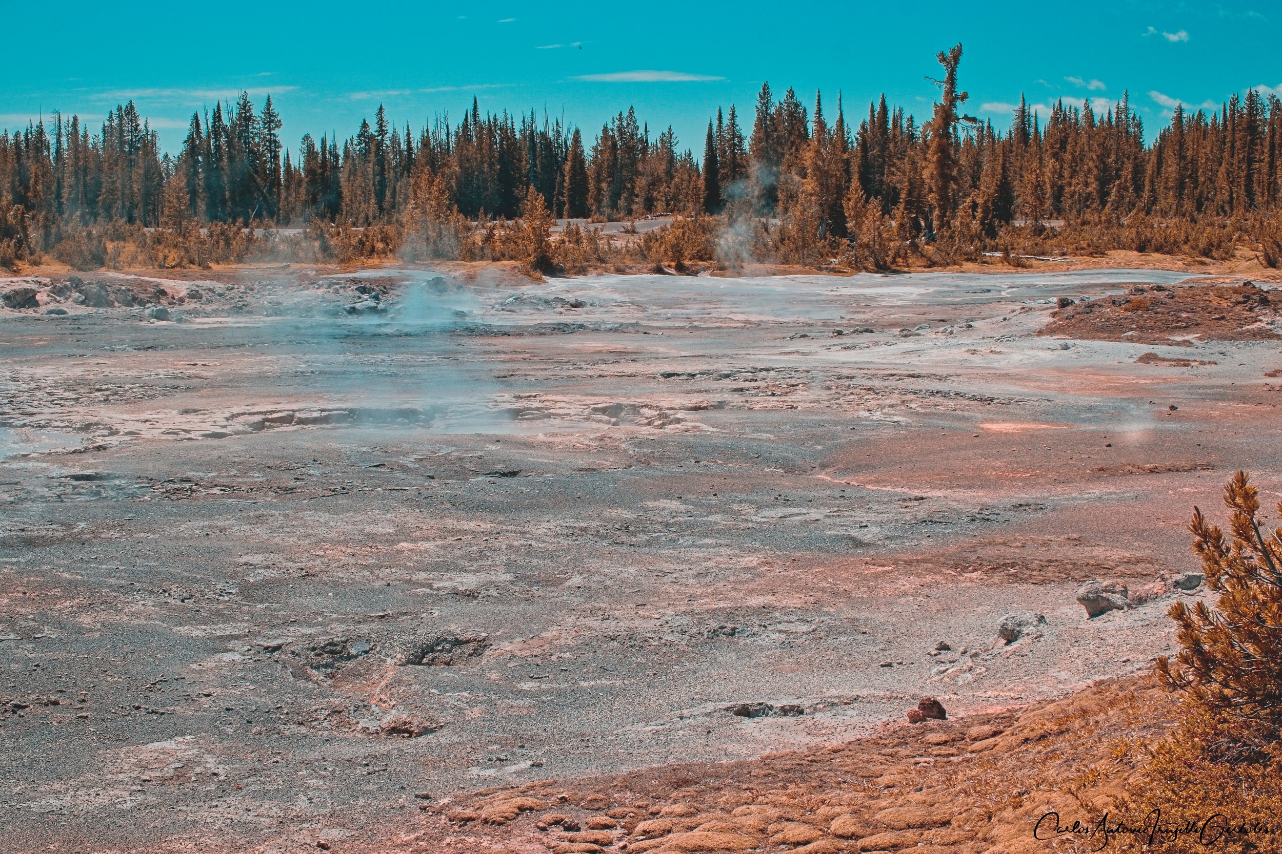
Salfarata (in blue): I didn’t like this trail and I think it is because I hiked it from the wrong side. I think you need to hike it from the south so you can hike along a creek and reach some thermal areas. From the north you immediately gain elevation (to your right you can see thermal areas, but they are too far to appreciate) and then the trail is basically the park clearing an area in the forest for the transmission lines. I was very curious about reaching the Lake of the Woods, but that area is permanently closed. You can’t even see the lake from the trail. This is a no for me until I hike this from the south and see if it is better that way.
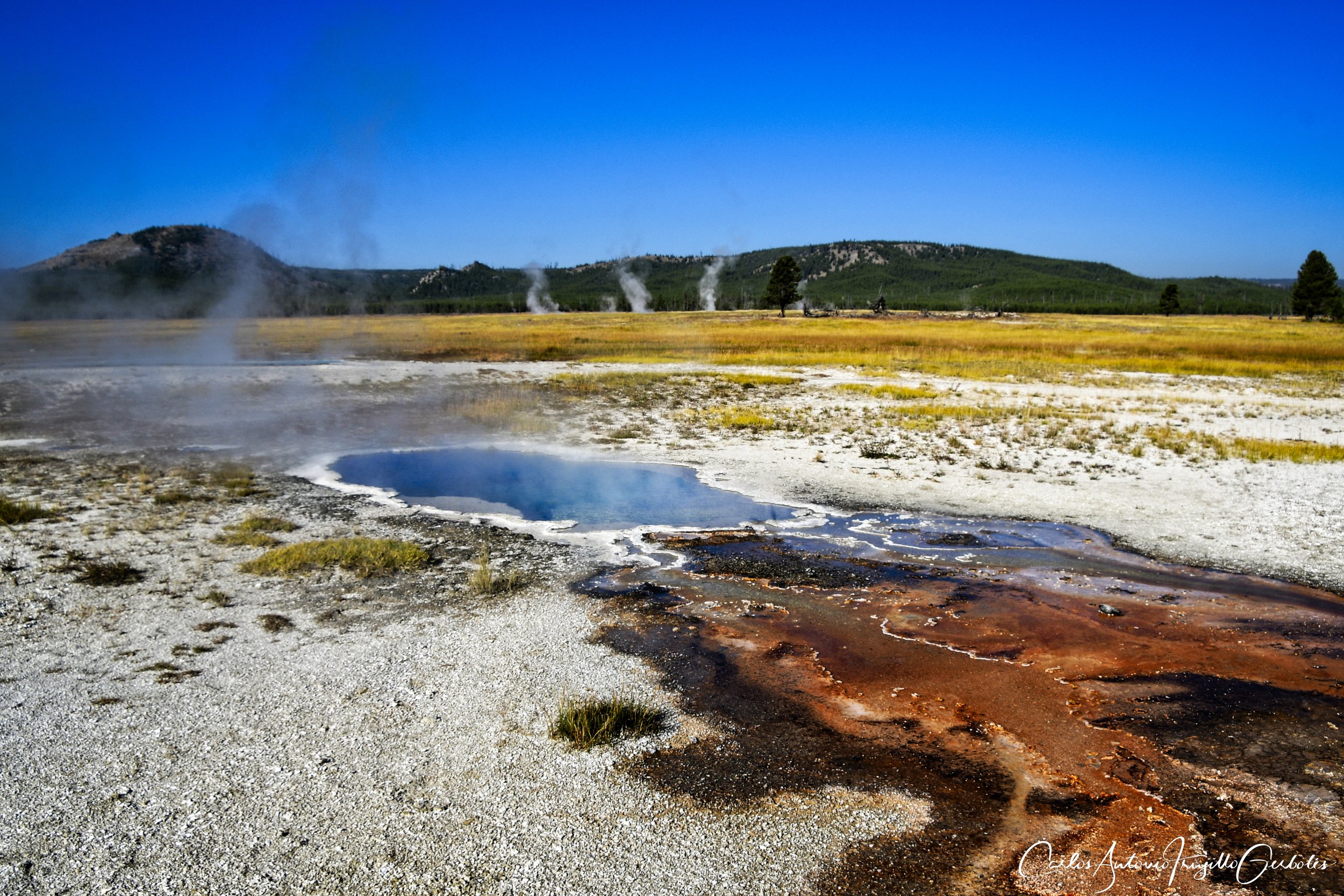
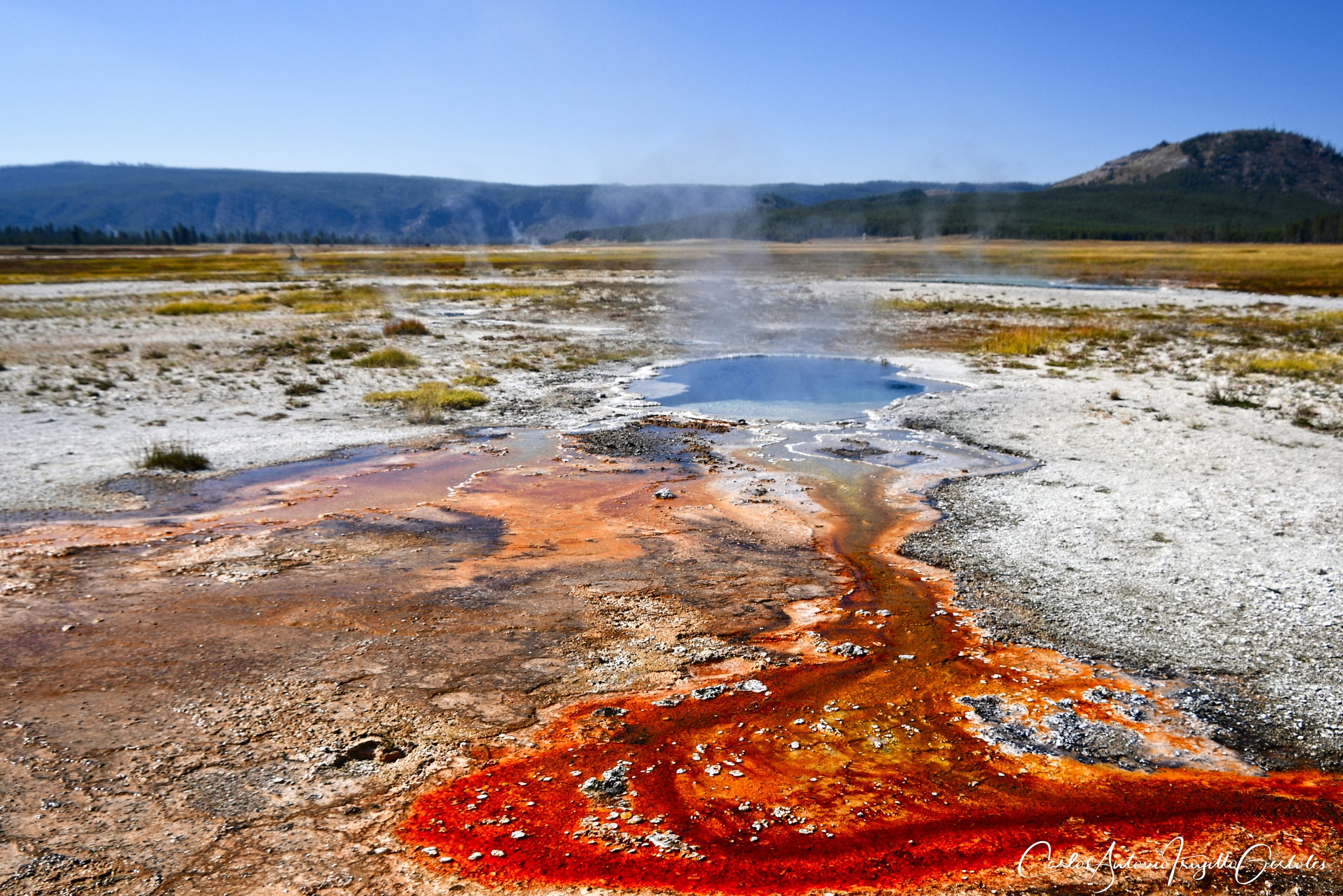
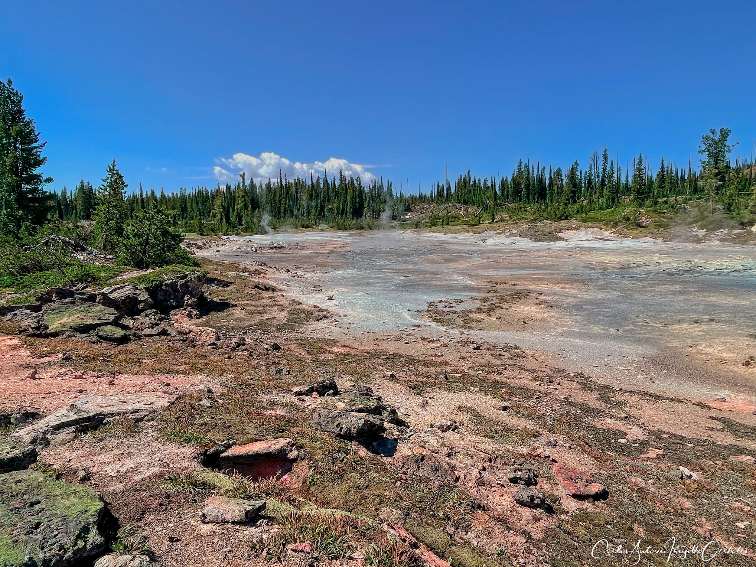
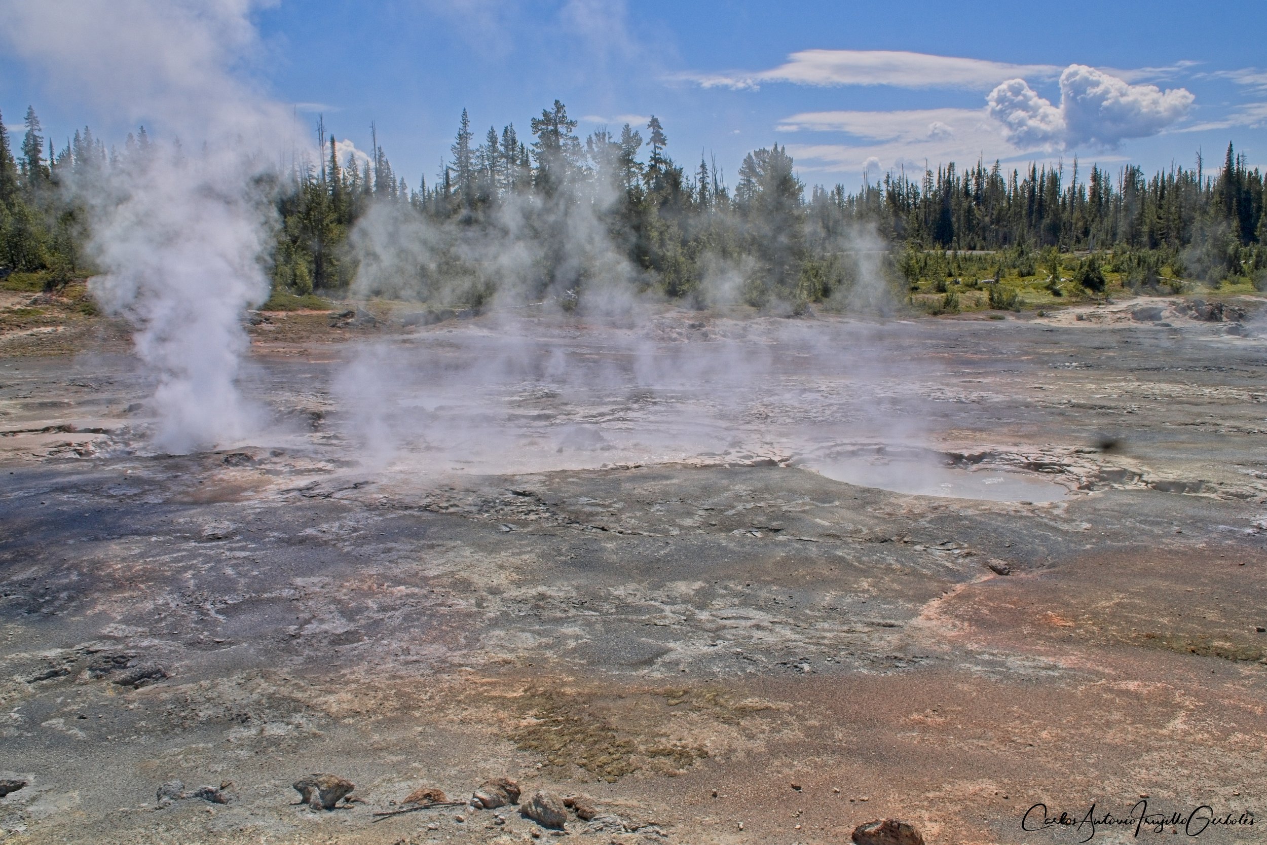
Norris Geyser Basin (blue): this is not really a long day hike, but just like Grizzly Lake this is a must do if you are into thermal features. The area is heavily visited by tourists, so much that there is overflow parking on the main park road. There is a large variety of pools, small geysers and vents; all of them well marked and documented. One that is legendary is Steamboat Geyser, but it erupts rarely and when it does your car better not be parked in the main parking area since the material being expelled will ruin your car’s paint. This is a must hike just for the variety of features and the leisure walks around them.
The Good: Great variety of thermal features to explore.
The Bad: parking, everyone goes there.
Monument Geyser Basin, Purple Mountain, Gneiss Creek

We keep driving south and pretty soon we reach the next two hikes, Monument Geyser Basin and Purple Mountain. The third hike starts on the road back to West Yellowstone.
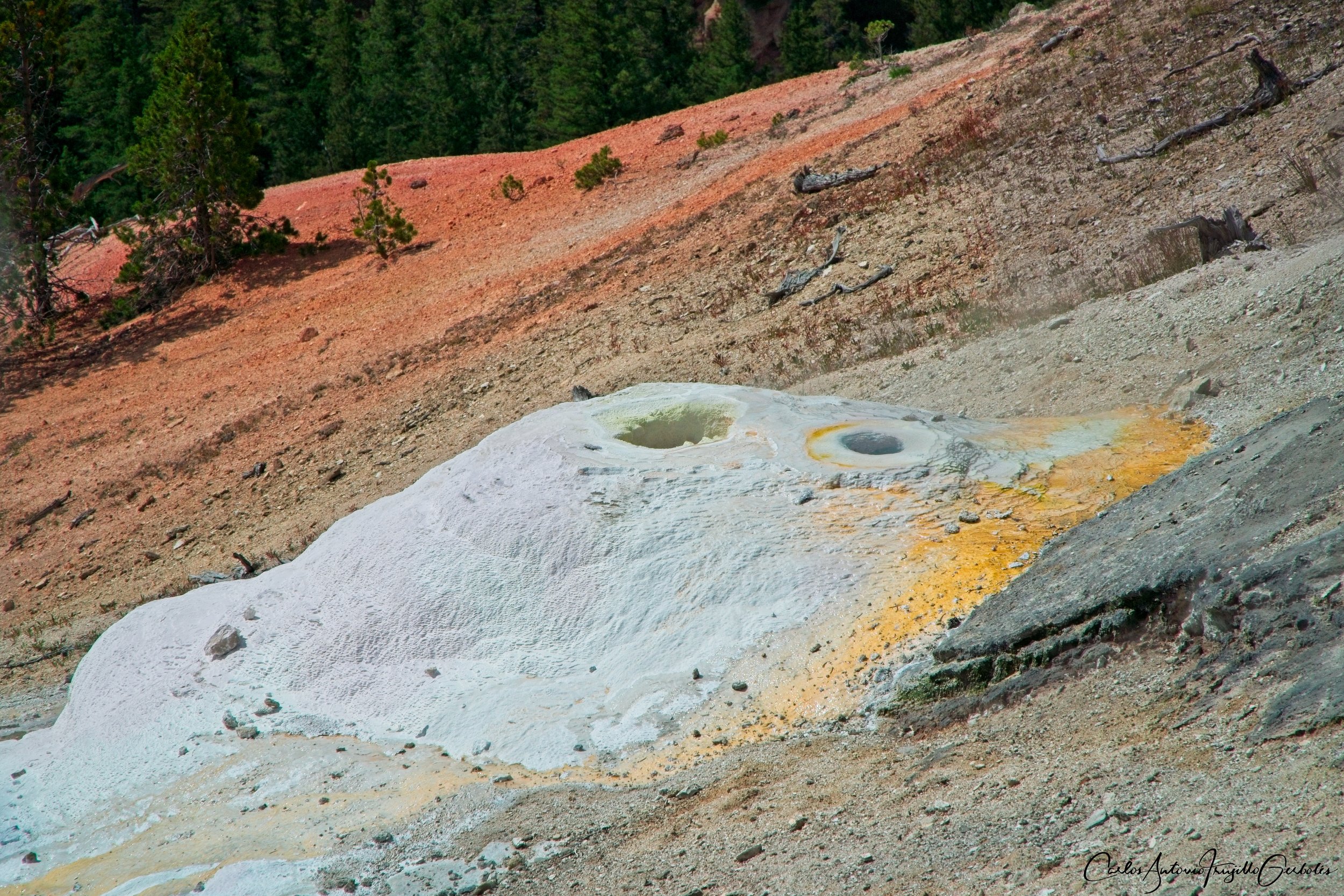
Monument Geyser Basin (in blue): Just another quick hike on a day reserved for quick hikes. This is quite a steep hike, you can see from the topo map that you are hiking up to a bench. The parking area is a long pullout along the road. There are very few features to see at the top, mostly geyser cones, and no color at all. There are thermal features that you can’t see so the area is small to explore in comparison with the most popular ones (for example, Norris). If you want to exercise your legs for about a one mile step hike, then go for it, but the few thermal features at the top are not worth the steep hike.
The Good: nice cardio going uphill.
The Bad: the thermals at the top are not worth the hike.
Purple Mountain (in red): I am just highlighting this hike but I have not done it. From what I see on the road you will hike uphill in a forested area until you reach a bench area (just like Monument Basin) and I am thinking the views must be pretty nice if there are no obstructions.
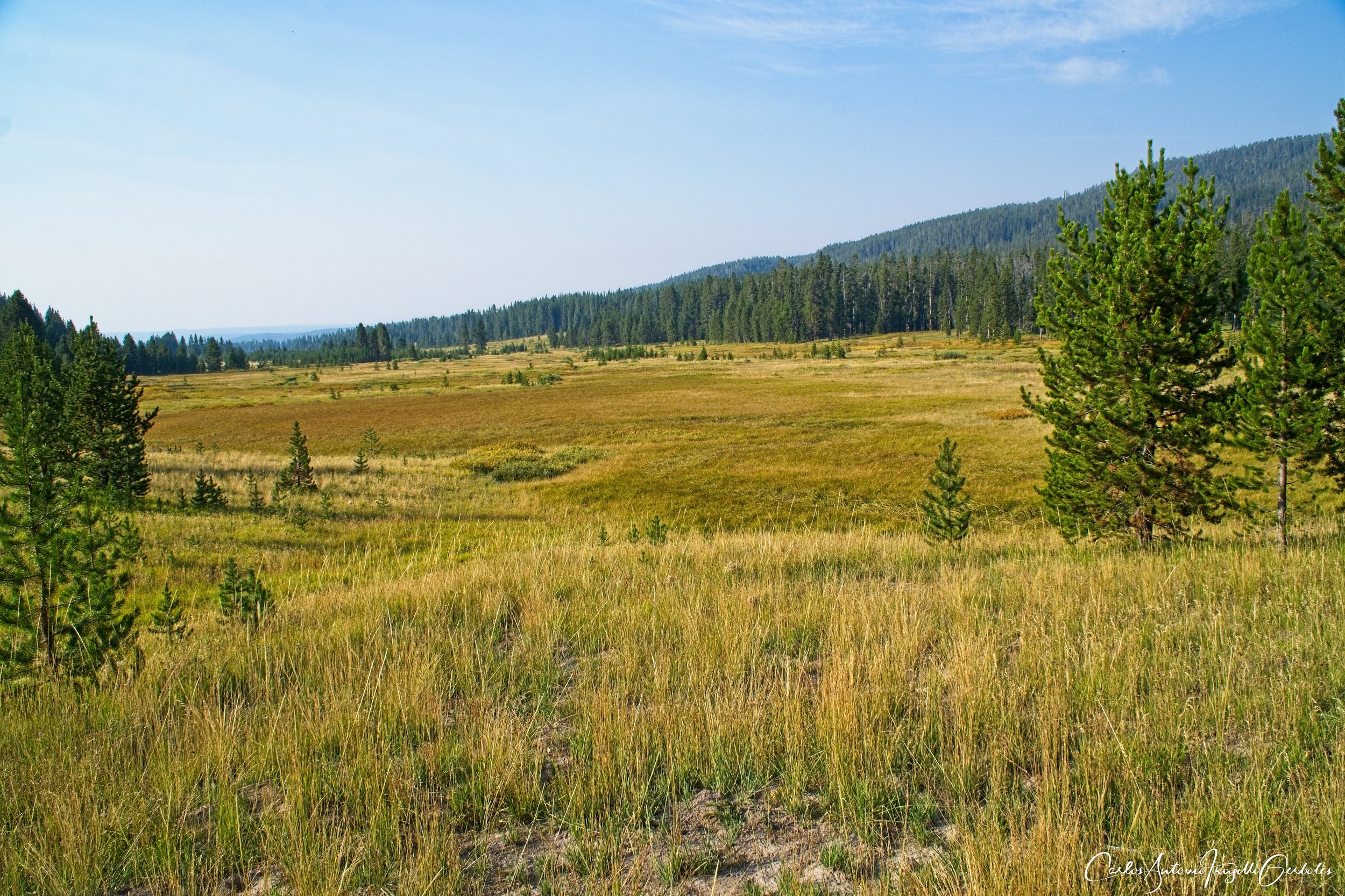
Gneiss Creek (in green): Once you take the road back to West Yellowstone you will see signs for a trail and a small parking lot before the road crosses the Madison River. This is a rarely hiked area; you start hiking along the river while gaining elevation (no big deal) and then make a sharp right turn to enter Madison Valley. There are two choices to make: a short hike to Cougar Cabin or take the actual long trail west. Expect to run into bison (I was pushed off trail by them). Also expect creek crossings and a trail that disappears at times in those areas. I couldn’t find the trail at the Maple Creek area and just went off trail but turned around when dark clouds started to show up. The remoteness of this trail will potentially reward you with lots of wolf tracks. This is a weird trail since there are not views of valleys, it is something to explore in complete solitude. In 2023 a beaver dammed one of the creeks and made it mess trying to cross it. The trail was worth because of the large amount of wolf tracks that I saw, but the views were not special.
The Good: Solitude, great chance to see animal tracks (wolves).
The Bad: the views are not good.
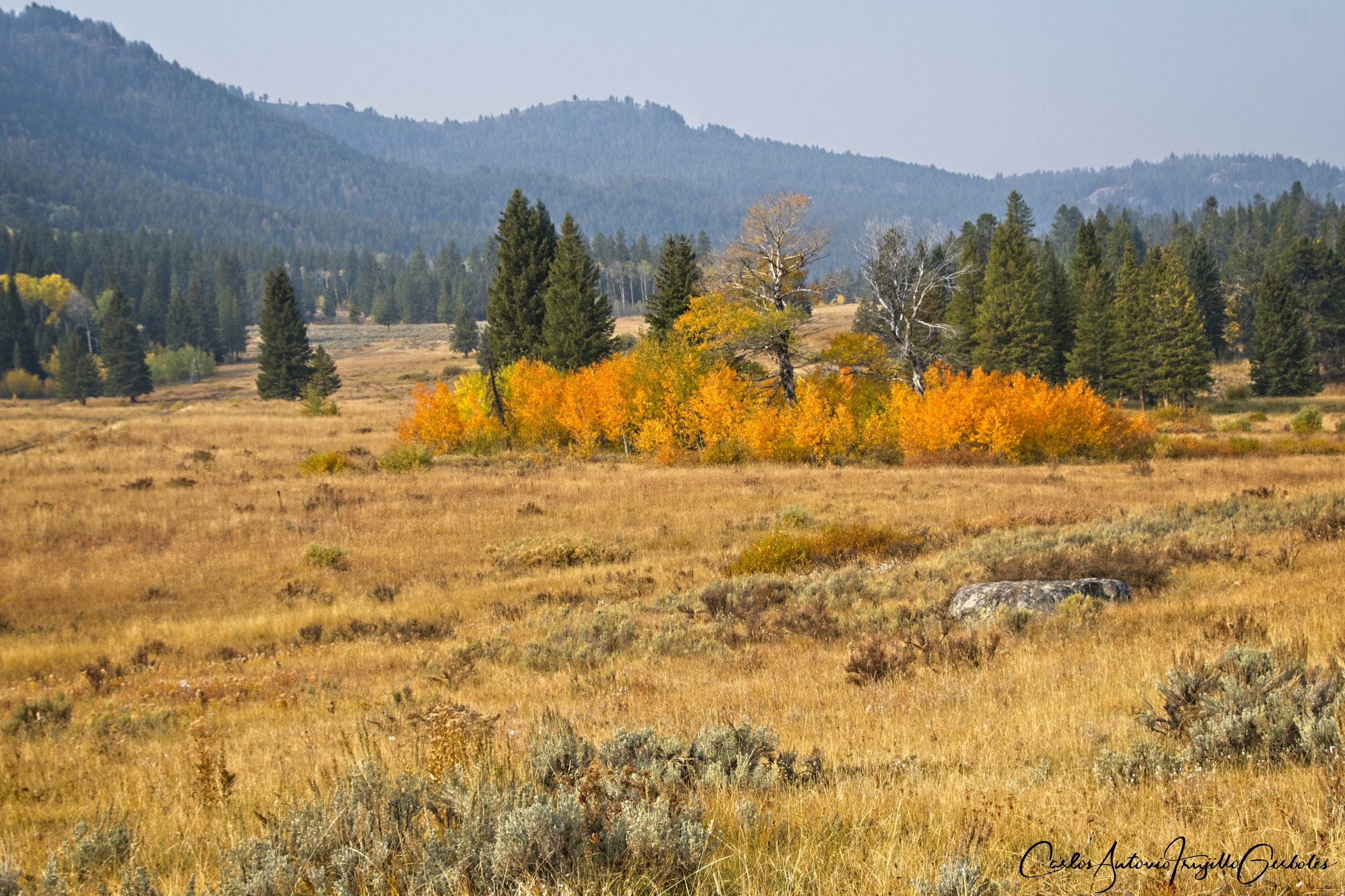
Mary Mountain West, Fairy Falls/Queens Laundry, Shoshone Lake

So instead of driving towards West Yellowstone, you keep driving south ………. and I guess these hikes are better reached if you stay in West Yellowstone. Again, I love to just drive in the park since you never know what will you run into, but for distances these hikes are West Yellowstone hikes.
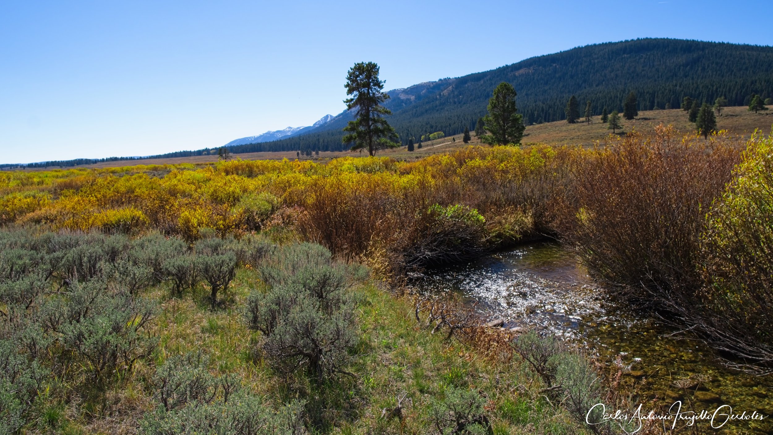
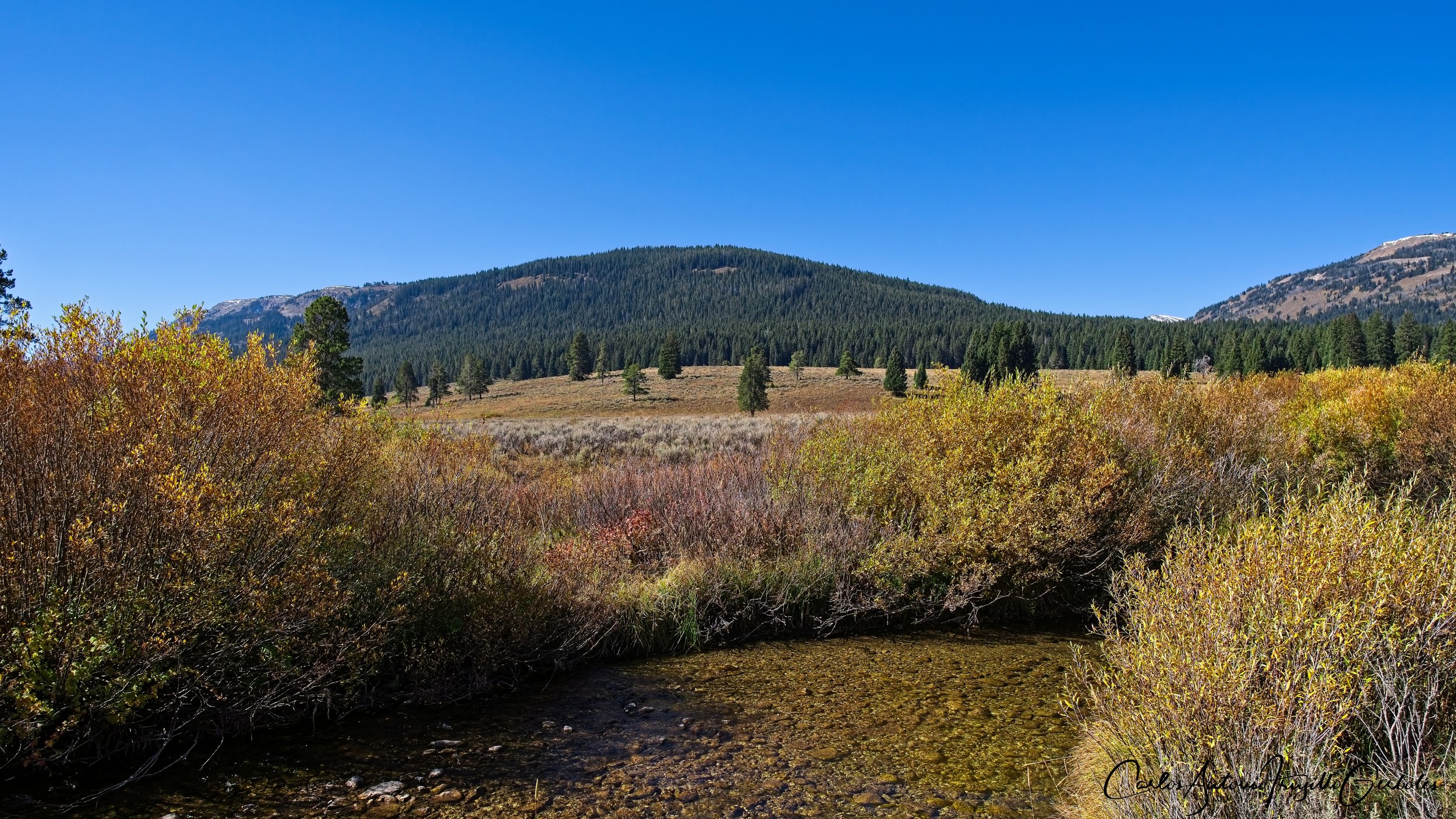
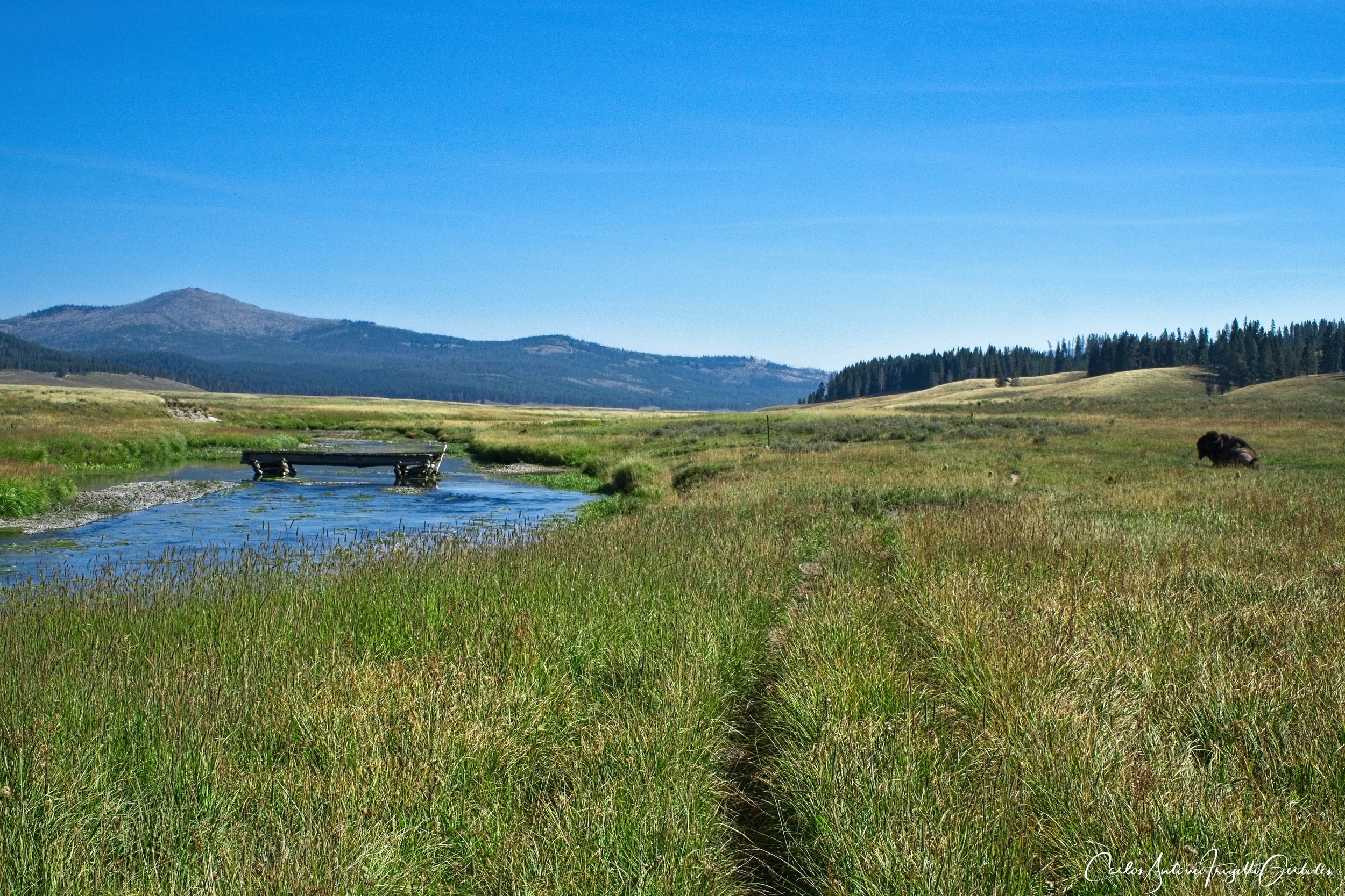
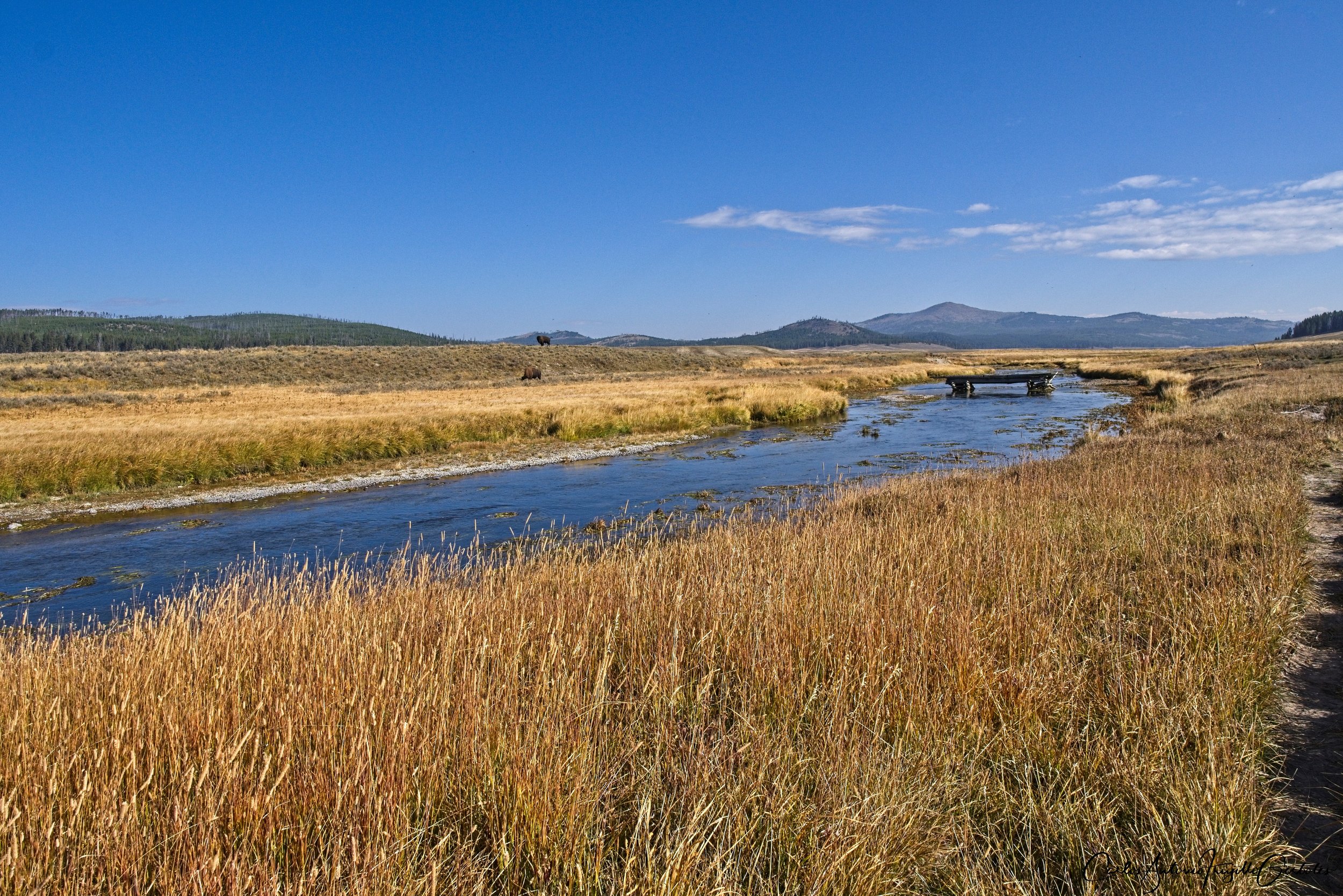
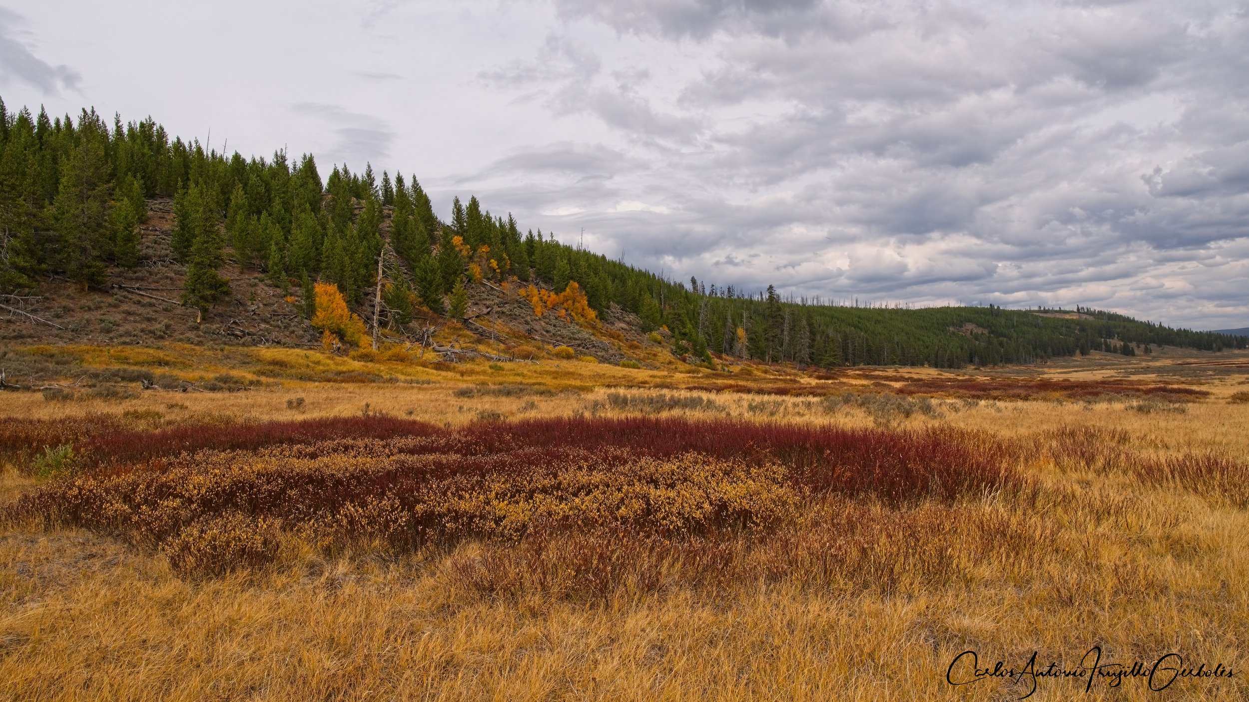
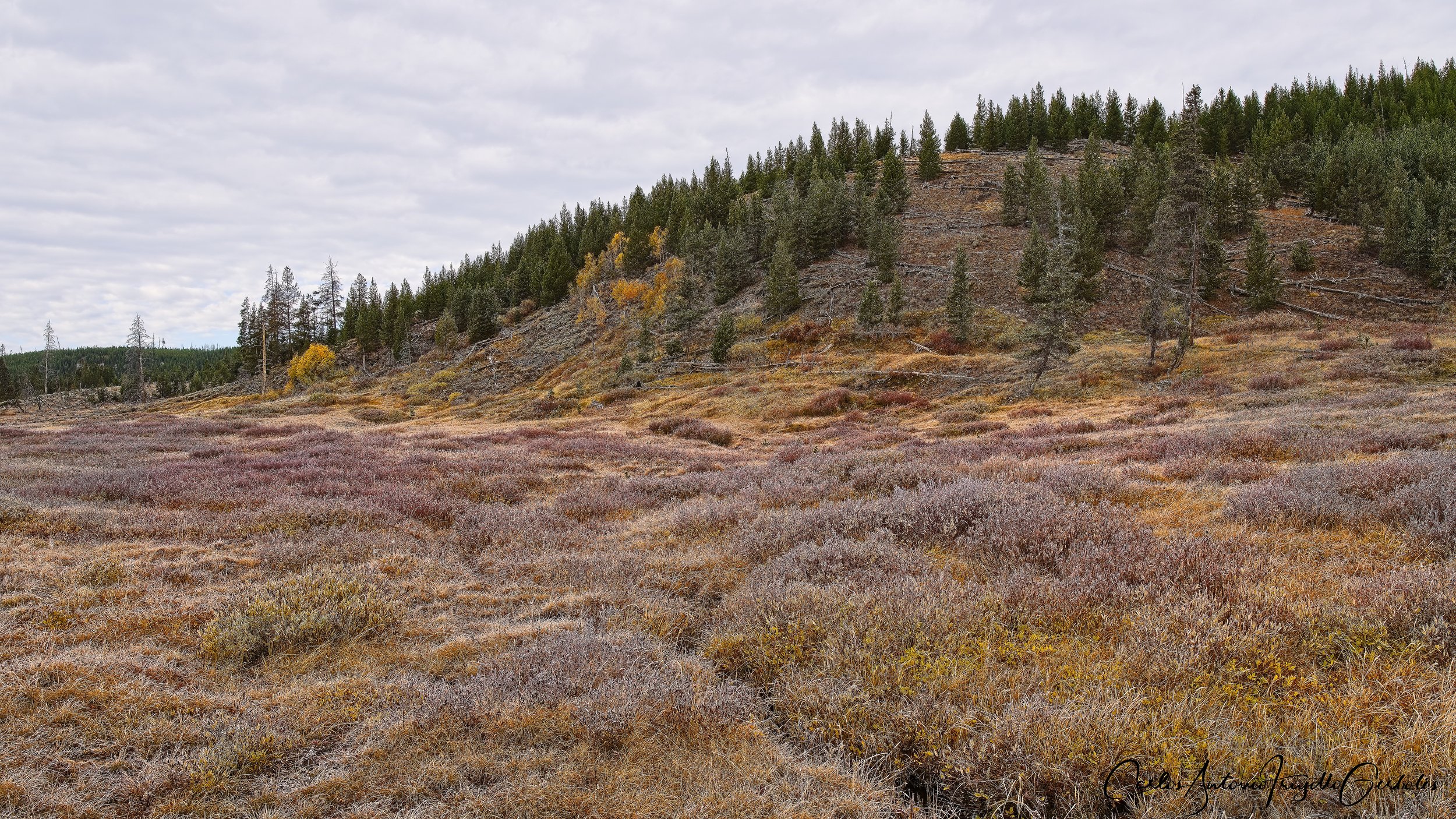
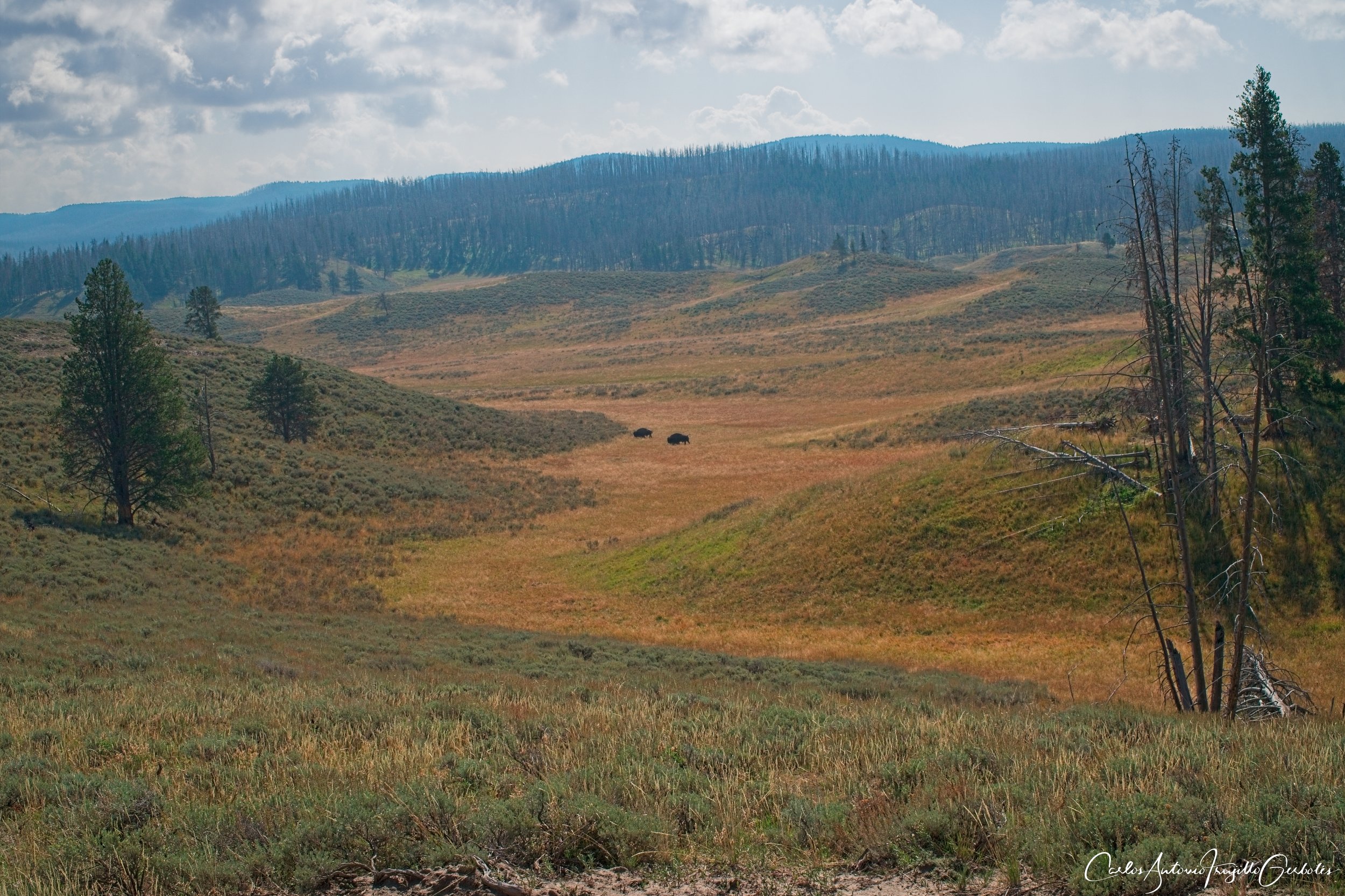
Mary Mountain West (in green): This is a 20 mile point to point hike that takes you across Hayden Valley all the way East. This is a serious trail and I strongly recommend to hike it groups. I will describe the East side later. This is another seldom hiked trail and when I hiked it there were sow warnings. This trail is dangerous, in my opinion. Once you hike on a meadow and cross a partially destroyed bridge over a creek, you hike mostly along the Nez Perce Creek, some times next to it, some times on meadows close to it. The colors of the wildflowers are amazing. Keep an eye on the grounds for wolf tracks (specially in areas where there is mud next to the creek), also you will probably see bear scat (hopefully not fresh). I hiked about 6 miles in when the trail opened to a large meadow and turned around. There is NO backcountry campsites on this trail. To me, this is a must do hike, but it has to hiked in groups.
The Good: Great creeks, wide open meadows, great fall colors, ample opportunities to find animal tracks.
The Bad: barely anyone hikes it, this is famous for being a bison highway so that could be scary.
Fairy Falls/Queens Laundry (in red): Part of this hike is super popular since it gets you to (1) the Grand Prismatic viewpoint (do it) and (2) Fairy Falls. I guess the allure of Fairy Falls is the height, but the thing that is better is continuing to Imperial Geyser. That geyser surges every 5 minutes and it goes high (there is a short and super steep trail that takes you to two nice lakes). If you want to do that loop that I put on the topo map, you will walk by beautiful thermal pools and get to see large thermal mounds in the Queens Laundry area, including thermals next to the Firehole River. Many of these thermals are next to the trail, so please take extreme caution.
The Good: Grand Prismatic overlook is amazing, Imperial Geyser is great, the thermals along the trail to Queens Laundry are great but you need to be careful around them.
The Bad: The area around Fairy Falls and the Grand Prismatic overlook is super crowded, same for the parking lot.
I am going to skip the mayhem around Old Faithful area, but definitely it is worth walking on the boardwalks and see all the thermal features, including keep going all the way to Riverside Geyser. Lot of cool features in that area.
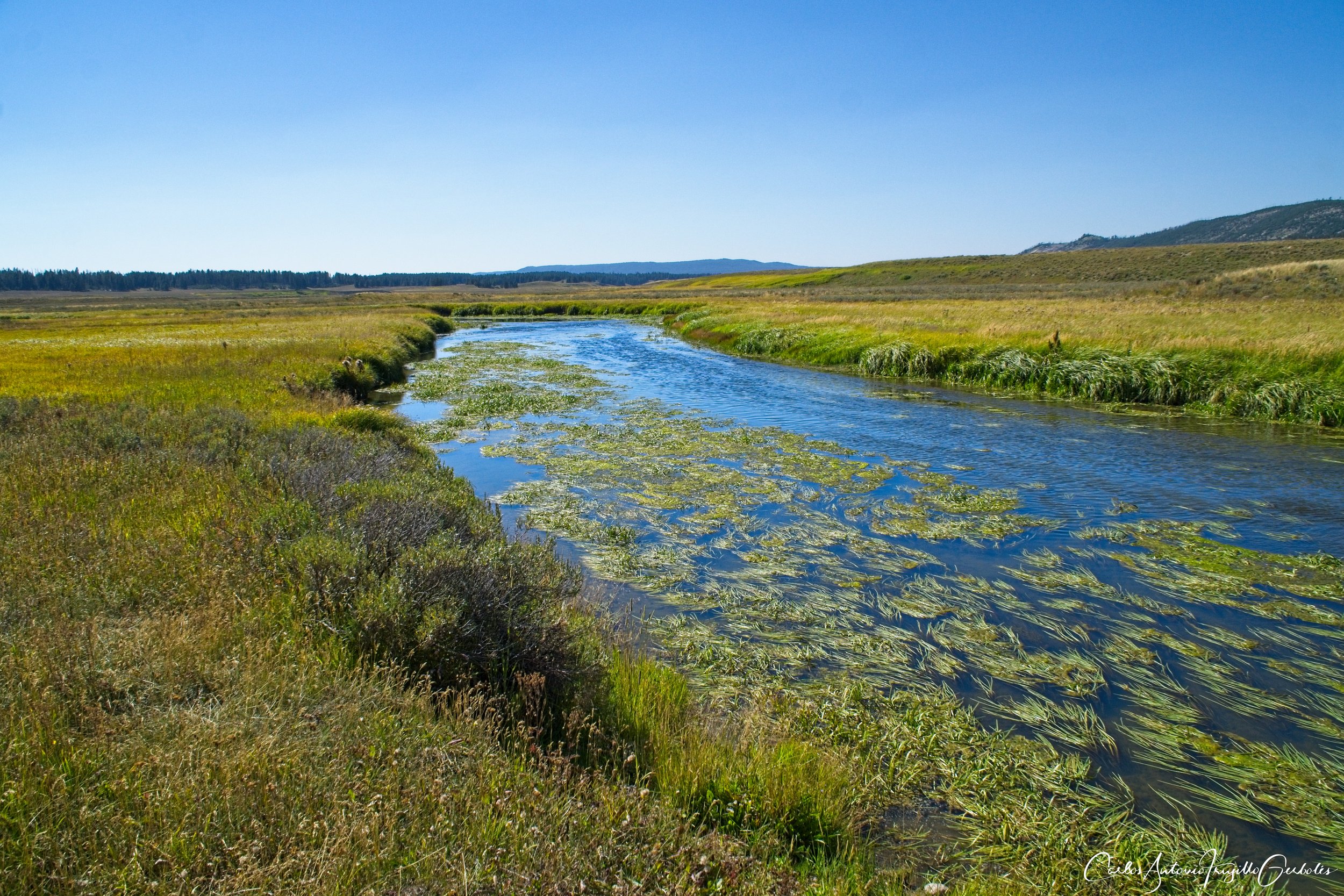
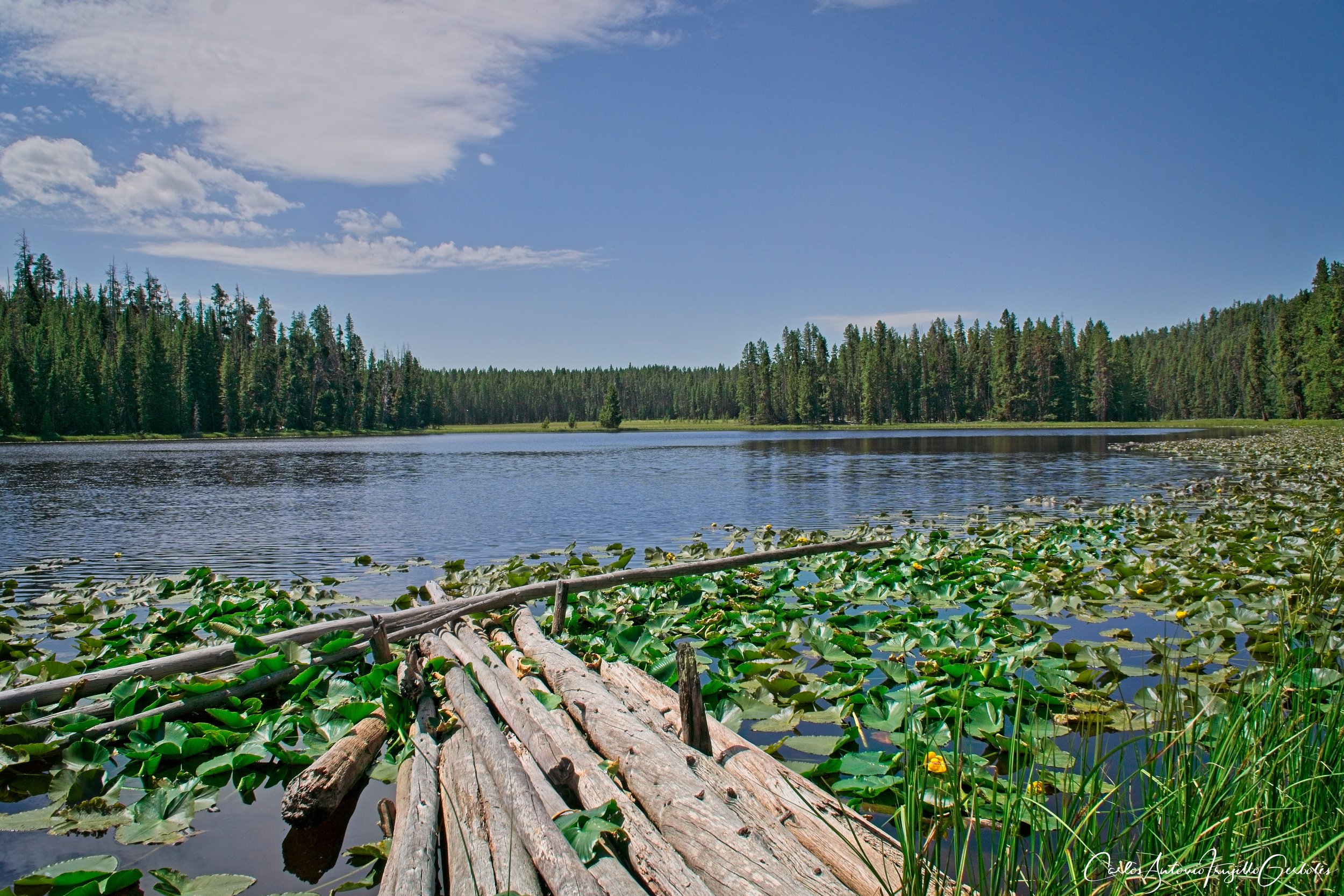
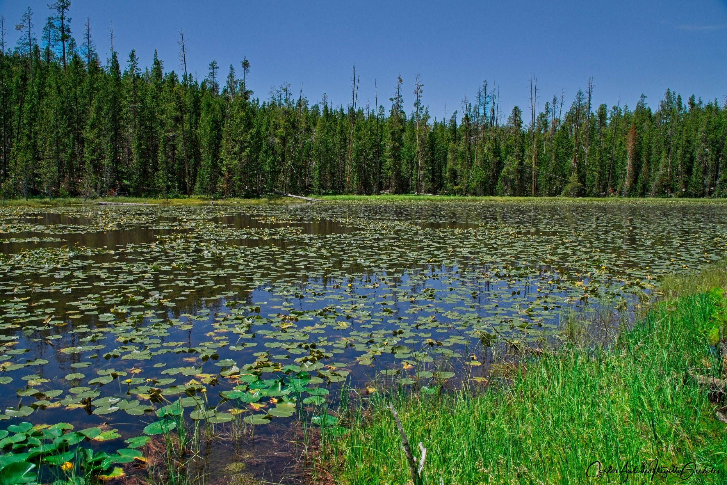
Shoshone Lake (in blue): there are two ways to reach the lake: if you just want to see the lake, take the trail that takes you along Delacy Creek. There are some nice openings into large meadows along the way. Now, if you want to see thermals area, take the long route that takes you by Long Star Geyser (I think it goes off every hour) and then gets you to a long day hike (I am doing this in summer 2024) to the Shoshone Geyser Basin. I will have more to say about that area once I hike it this summer. No matter what, the lake is gigantic and it is also a treat to stop and rest on the beach and listen to the lake sounds.
The Good: There is good stuff along the trail that takes you to the lake. I havent seen it, but the geyser area at the lake (from the Lone Star Trailhead) look amazing.
The Bad: It is a very long day hike, mostly used by backpackers. The Lone Star geyser takes 1 hour between eruptions, so patience is required.
Dogshead/Lewis Lake, Heart Lake, Pitchstone, Boundary
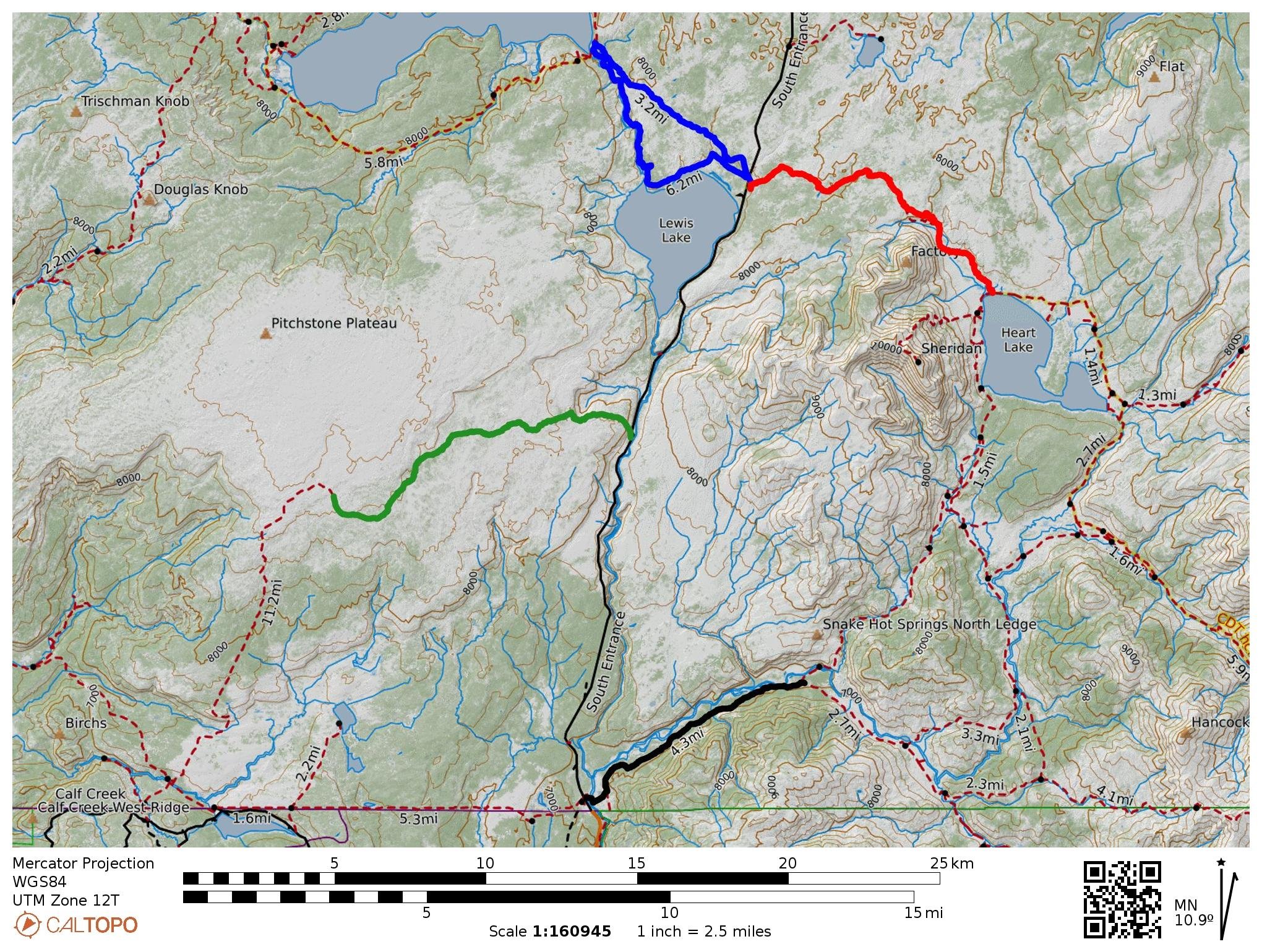
Now we are past the entrance to Old Faithful and keep driving and take a detour towards the South Entrance before we backtrack.
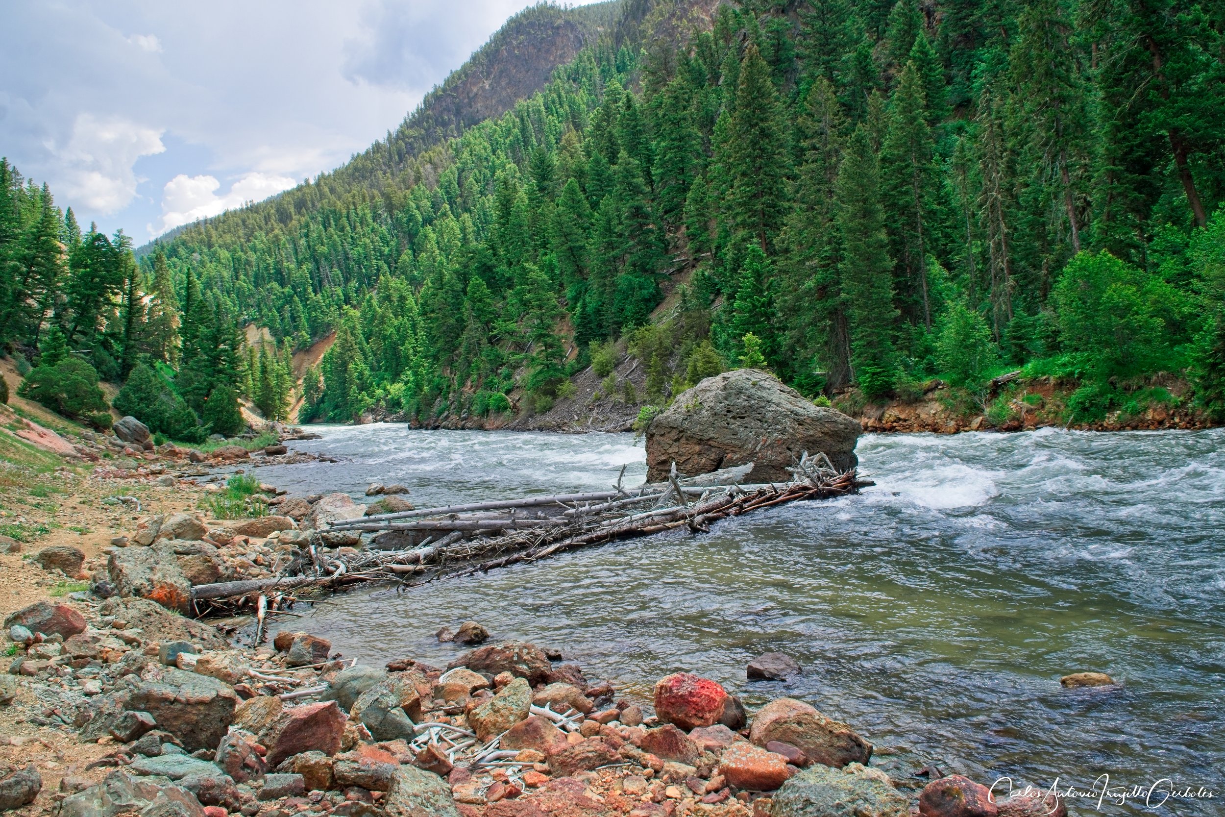
Dogshead trail/Lewis Lake (in blue): I lied, there is a third way to get to Shoshone Lake and that is going on the Dogshead trail and make it a look returning on the Lewis River trail. I do not recommend doing the Dogshead trail, nothing much to see; but Lewis river trail is another story. You are walking along the river all the time, with great views when the river bends. There are a couple of areas that you can climb a large rock and just have lunch overlooking the river. A big bonus is that many people take canoes and go on the river to reach Shoshone Lake; in some areas they are force to get off and walk the canoe since the river is shallow in some areas. I liked a lot the Lewis River trail.
The Good: Lewis River trail has great views.
The Bad: The second part of the loop is in a forest, with zero views.
Heart Lake (in red): I absolutely love this trail, it is a must do. The trail take you thru open meadows, a couple of nice thermal areas and then to Heart Lake. Once you approach the lake, you have large Sheridan Mountain to your right, giving you a nice view of a meadow with the mountain on the background. Lots of backpackers along the lake, who also decide to climb Mt Sheridan as a day hike from their campsites. I liked this lake better than Shoshone (maybe when I hike to the Shoshone Geyser Basin that will change my mind). This trail is varied and there are no boring parts along the way.
The Good: The trail to the lake is scenic, with thermal areas.
The Bad: Nothing, really.
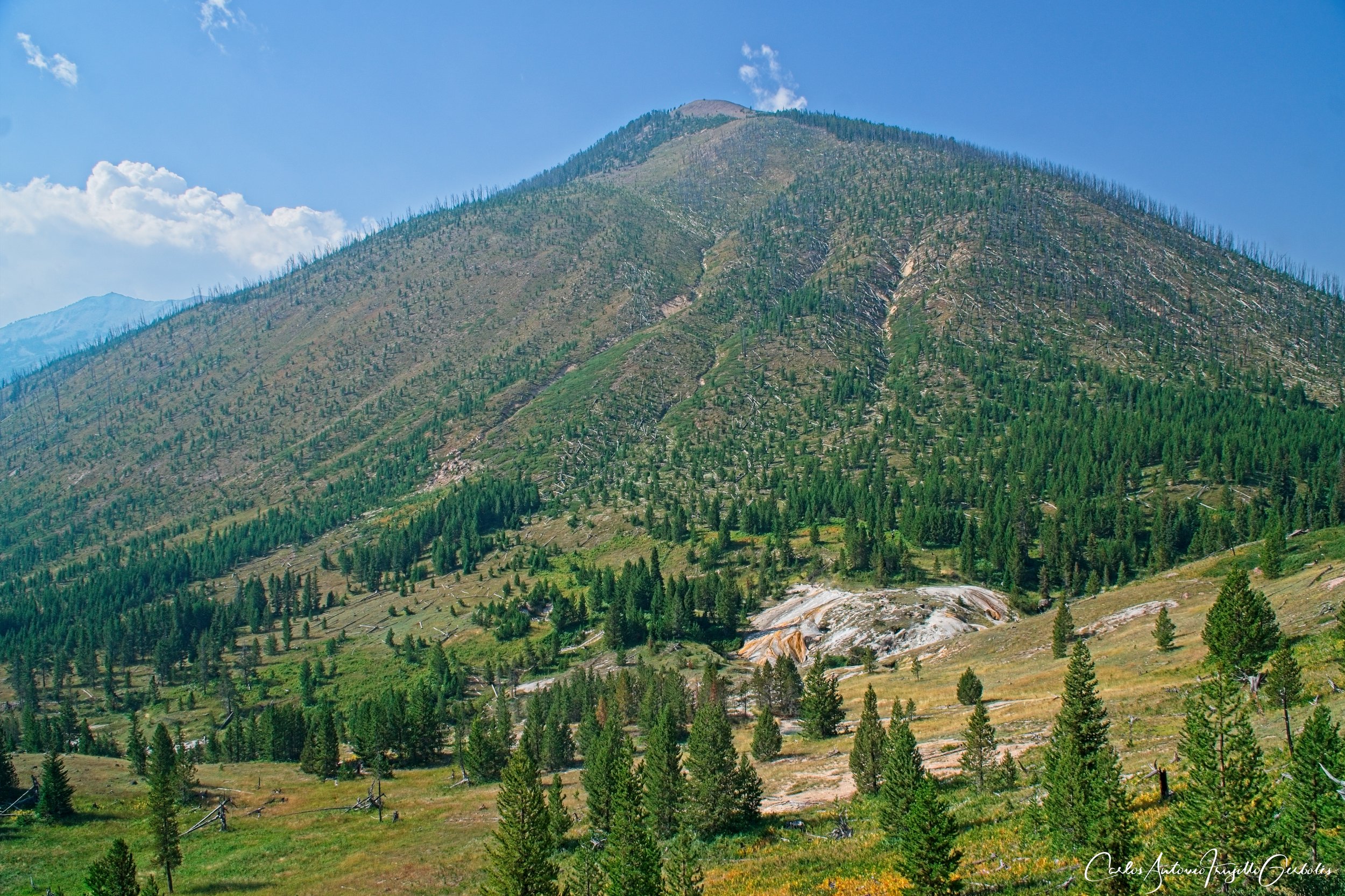
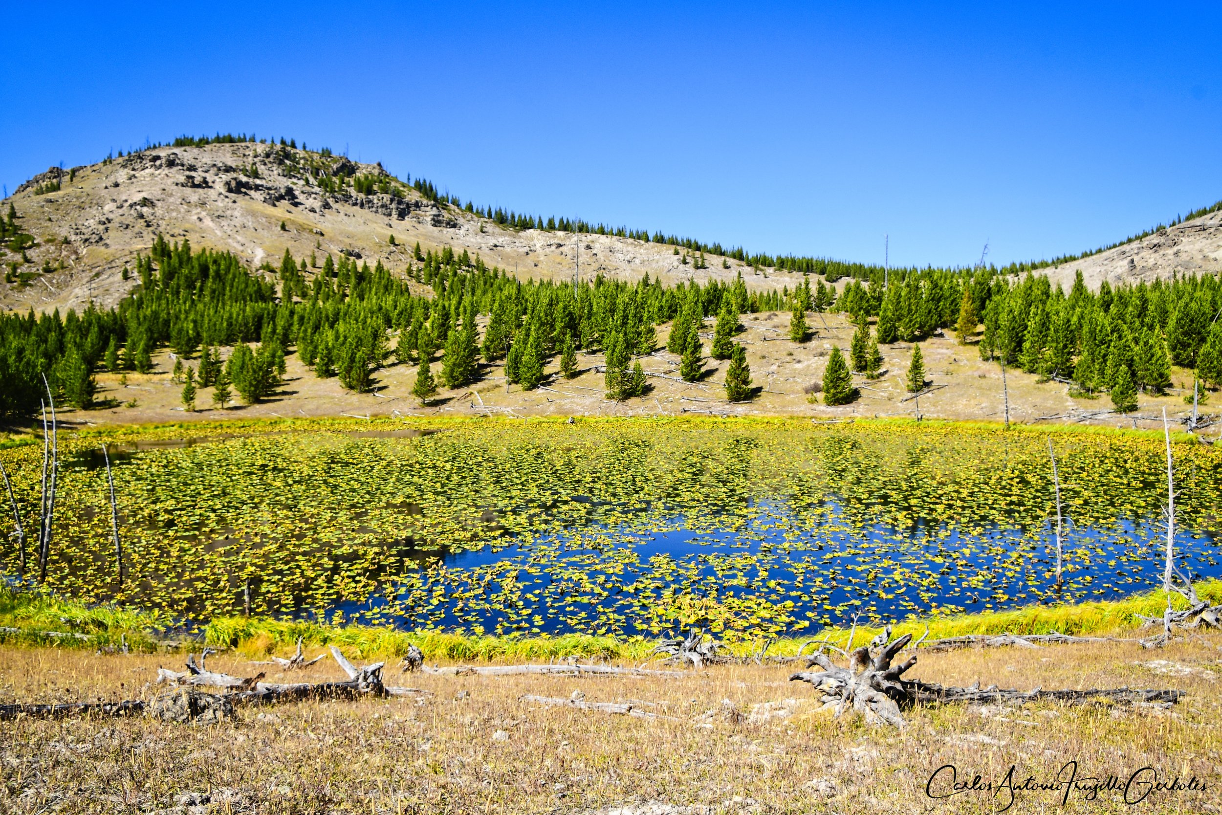
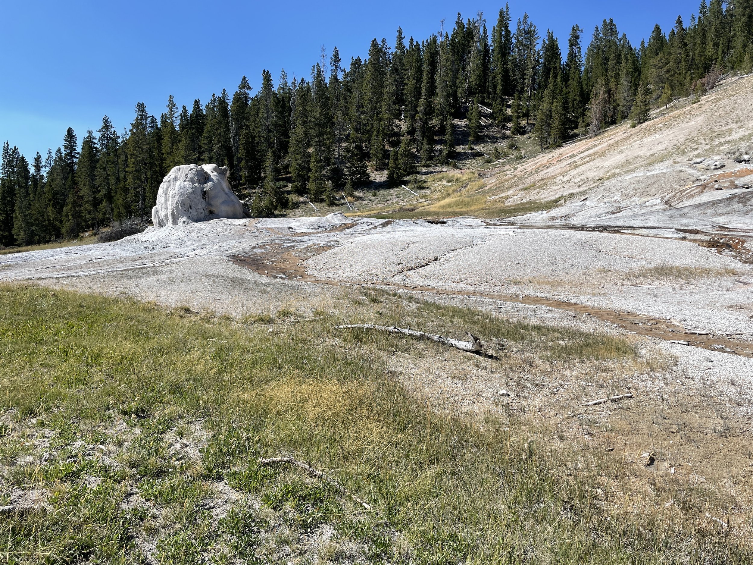
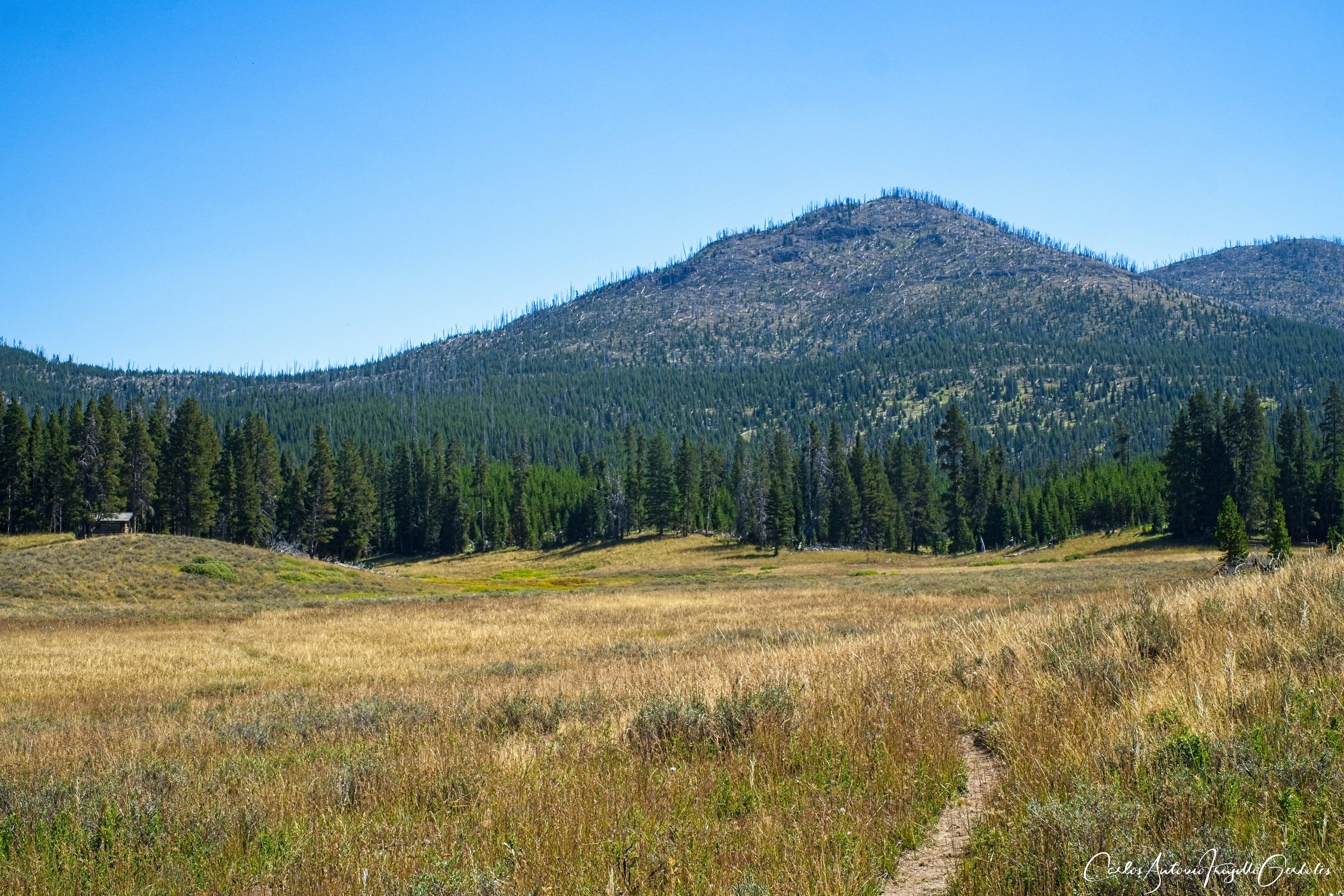
Pitchstone Plateau (in green): This is a hike for those curious about the hottest vent in the park (I think it is): the Phantom Fumarole. The trail itself goes up to a bench (the plateau) and it mostly in a forest. I have seen bear tracks in there; the trail is one of the last that the park service clears of downed trees. The Phantom Fumarole is a treat; if you go early in the season the fumarole will have water boiling from the winter, later in the year it is dry and it must be eerie to look at knowing those gases will melt you in seconds. I went when there was still water in the vents. This is a niche trail, just for those that want to get to the destination, the way in is nothing special. I have been told that compasses will fail in this area.
The Good: TBD.
The Bad: The destination is the point of the hike, nothing special until you reach the thermals.
South Boundary Trail (in black): I just put a placeholder here since I have not hiked it yet, will do it in summer 2024. Stay tuned.
Avalanche Peak, Pelican Valley

Let’s re-orient ourselves. If you are staying in West Yellowstone, you will reach these hikes going East on Norris and then take a right at Canyon. If you are staying in Gardiner, you can do the same or take the Grand Loop road that takes you by Mt Washburn and keep going south past Canyon.
Avalanche Peak (in red): To me, this is the best peak in the park (I haven’t done Electric). From a small parking lot you enter a forested area going uphill (the whole hike is uphill), where you need to be careful since bears love the nut trees there. Once you leave the forest, you are going up and up and up and up. One ridge is a bit sketchy for people afraid of heights. The top is super windy and there are human made rock shelters. The 360 degrees view of beyond amazing. This is a must do hike and even though it is steep, lots of people do it, just hike slowly. I tend not to linger around, but on this peak I spent one hour just at the top.
The Good: TBD.
The Bad: TBD
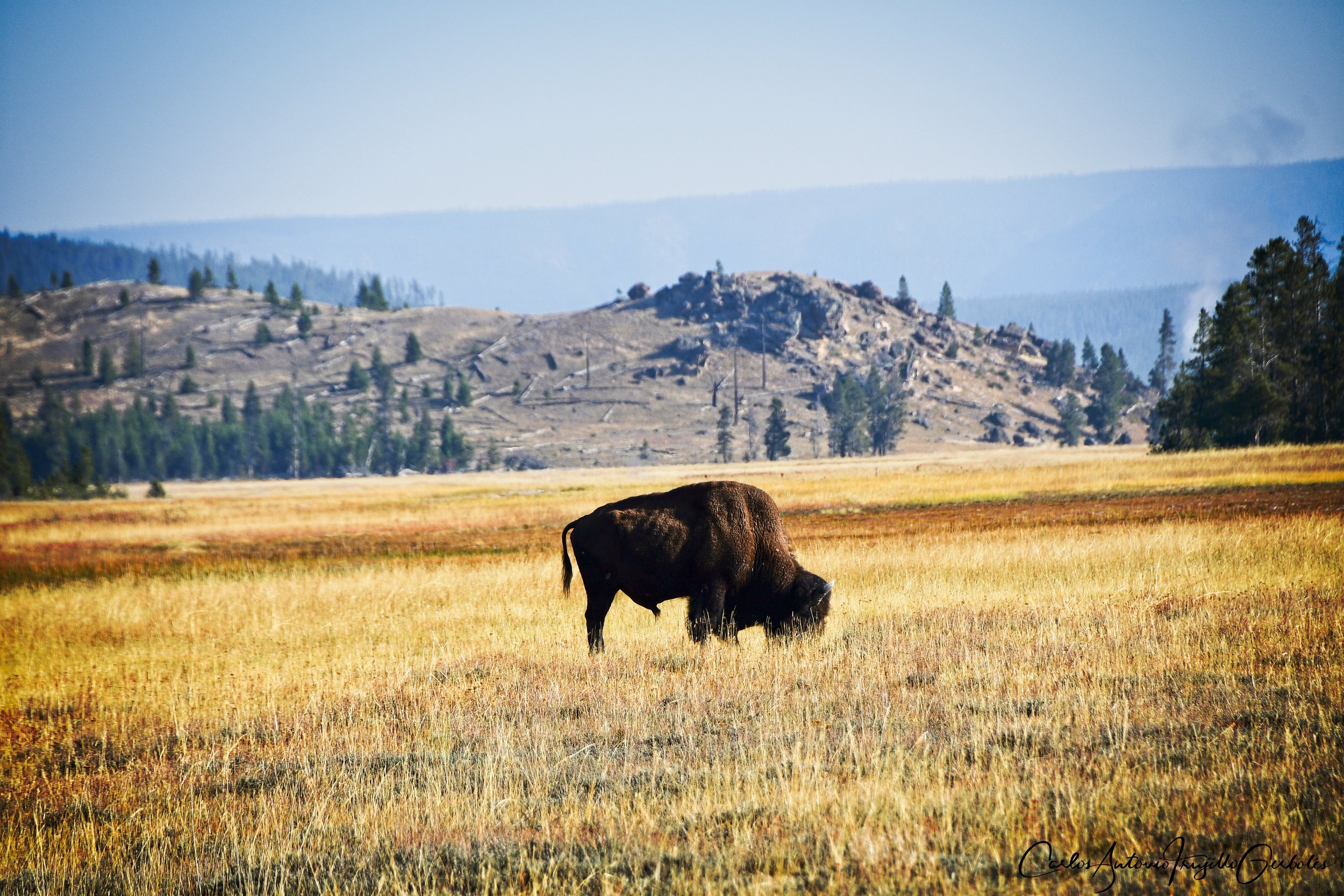
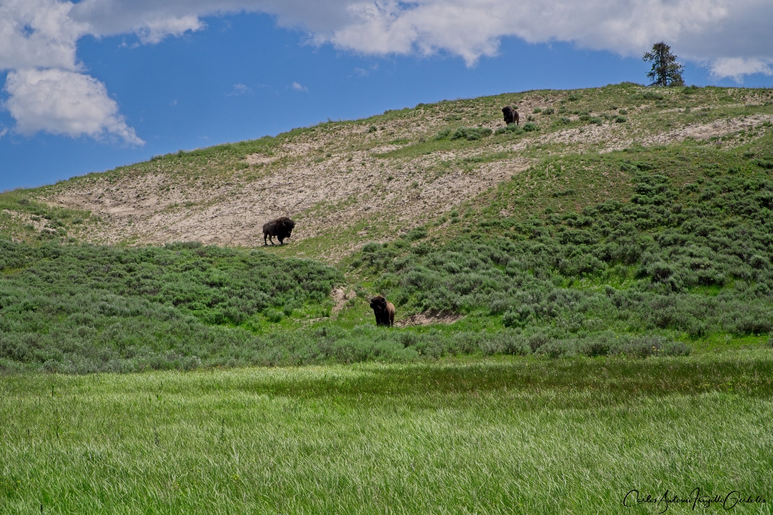
Pelican Valley (in black): This is my favorite hike in the whole park; i have done it 3 times and more to come. This is the “other” valley that doesn’t get the interest as Hayden or Lamar get. But this is a restricted time hike (you can only be there from 9am to 7pm) and the possibility of bears is high. I have run into black bears in the forested area in the first mile and people have run into grizzlies in the valley itself. I prefer to do a lollipop look that takes you to the Pelican Springs cabin, cross the valley (the trail is not that clear at that point) and then come back from the other side of the valley (careful, look at the forest for bears and smell for carcasses) and then cross the valley again and cross the creek at the bridge that everyone one turns around. I barely have seen another hiking past the bridge. Lots of bison, lots !!!!! You are hiking close to the forest and you need to look for anything coming out of the forest; when you are crossing the valley it is amazing but remember that there are bison all over the place and they rule the place. Couple of creeks to cross at the top of the hike, cross them where the trail is.
The Good: TBD.
The Bad: TBD
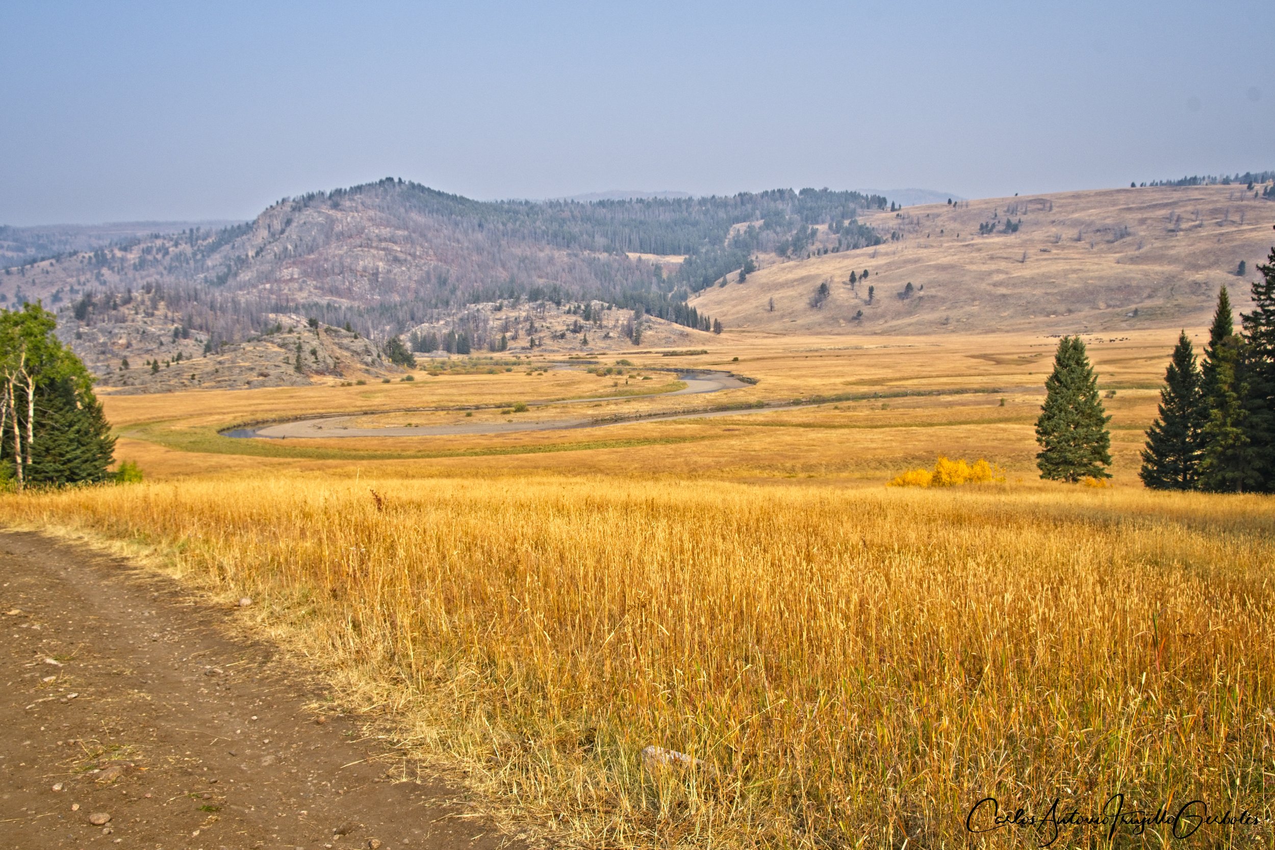
Howard Eaton, Mary Mountain East, Hayden Valley (off trail)

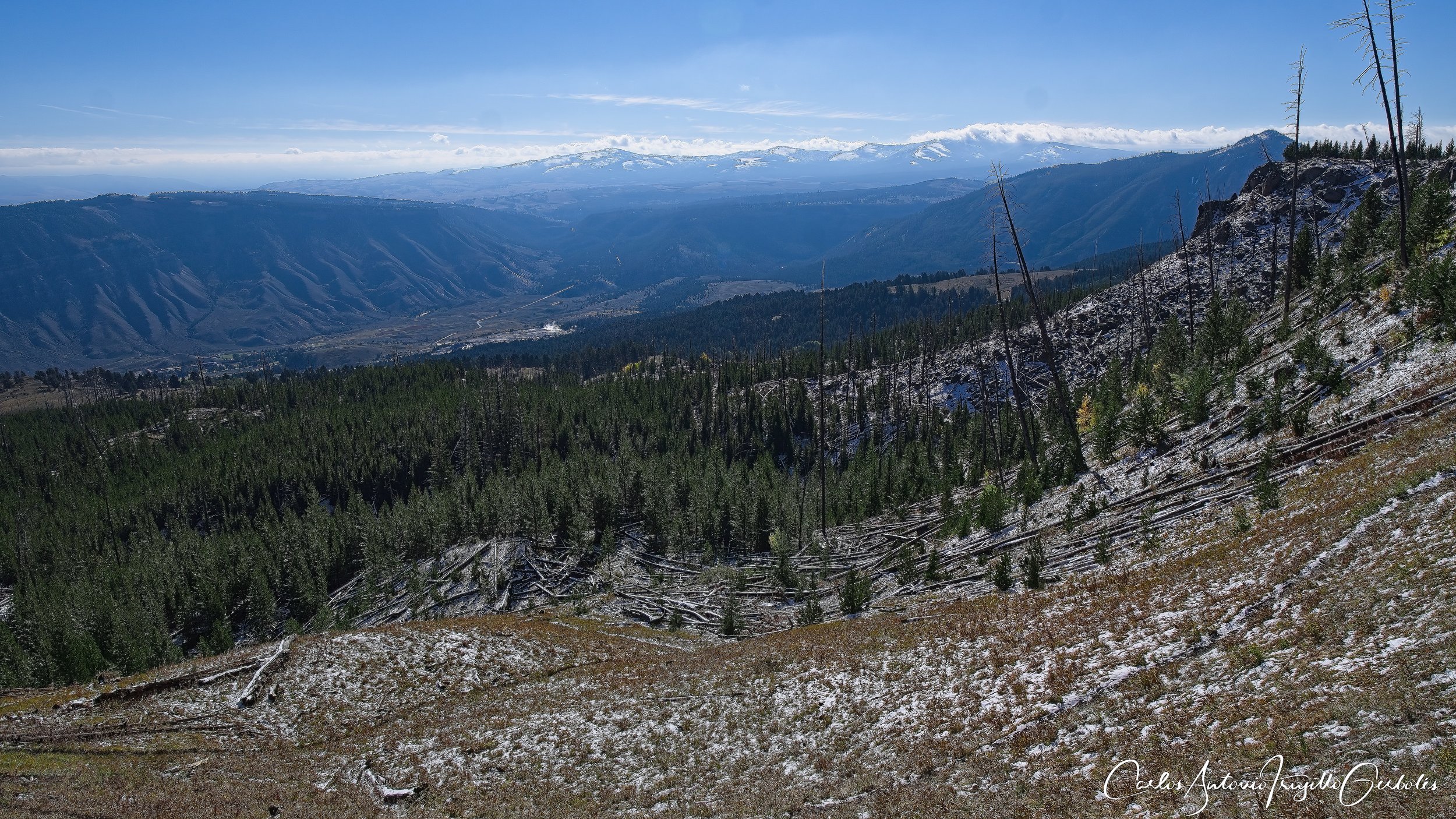
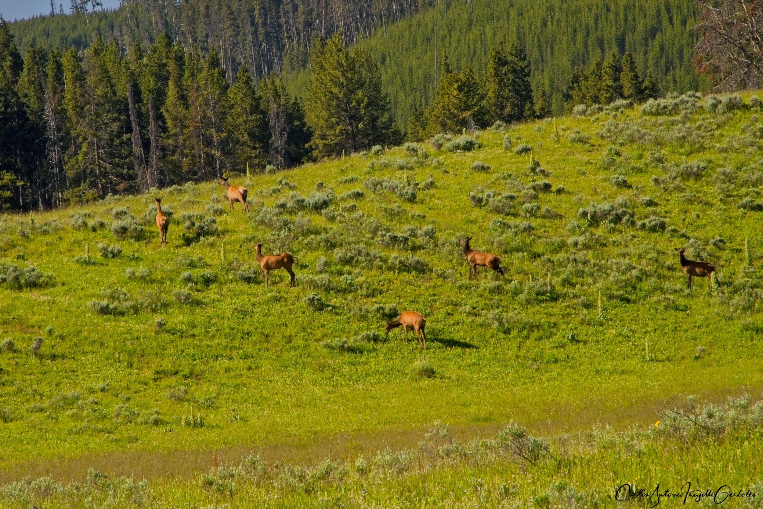
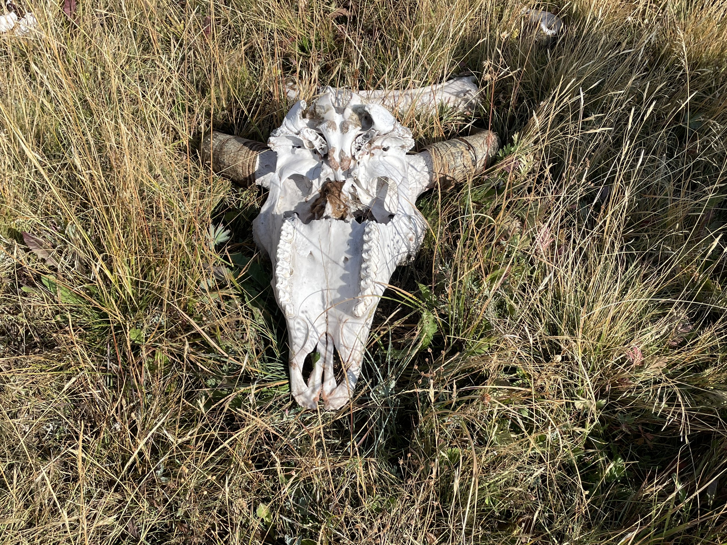
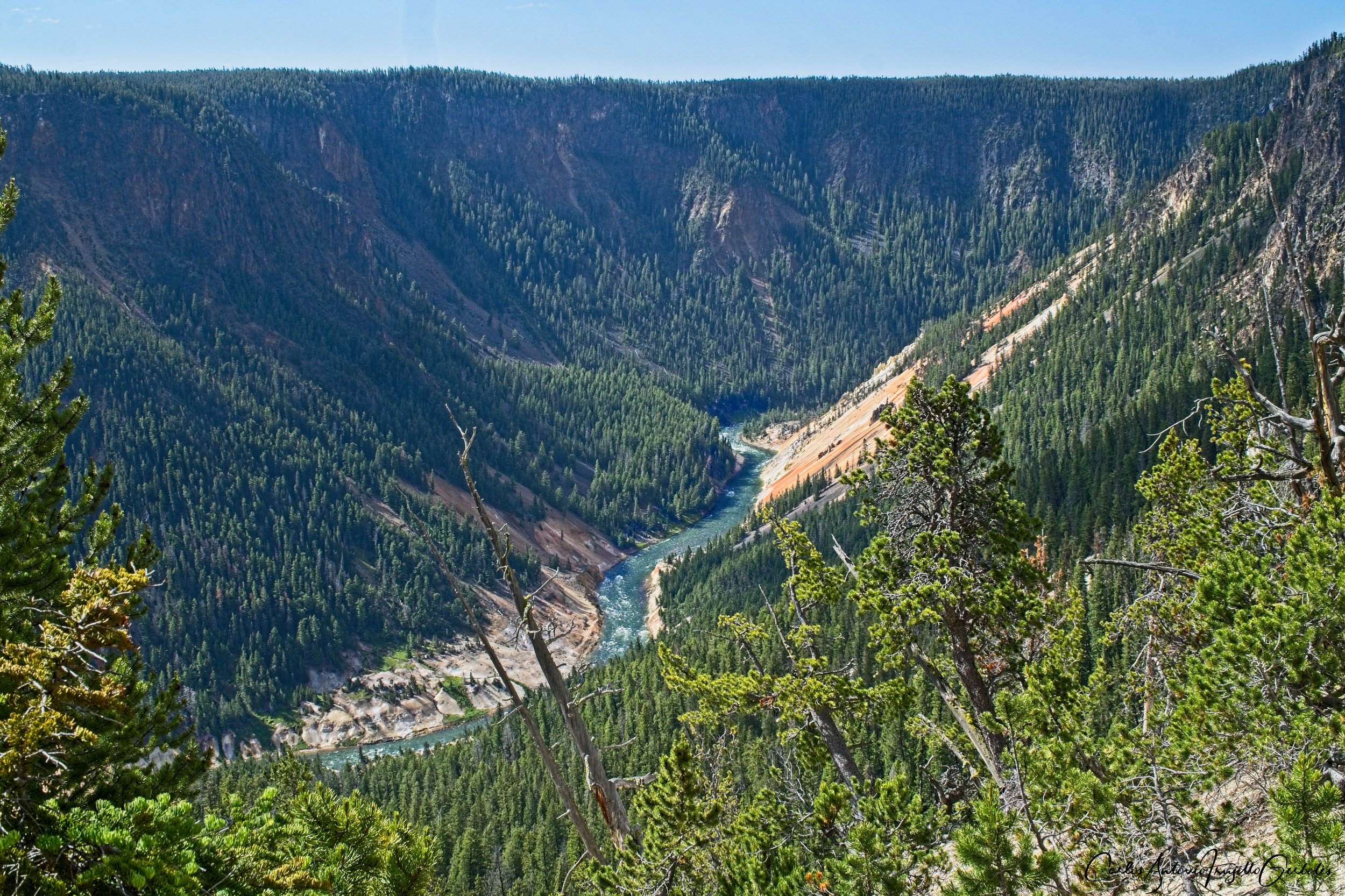
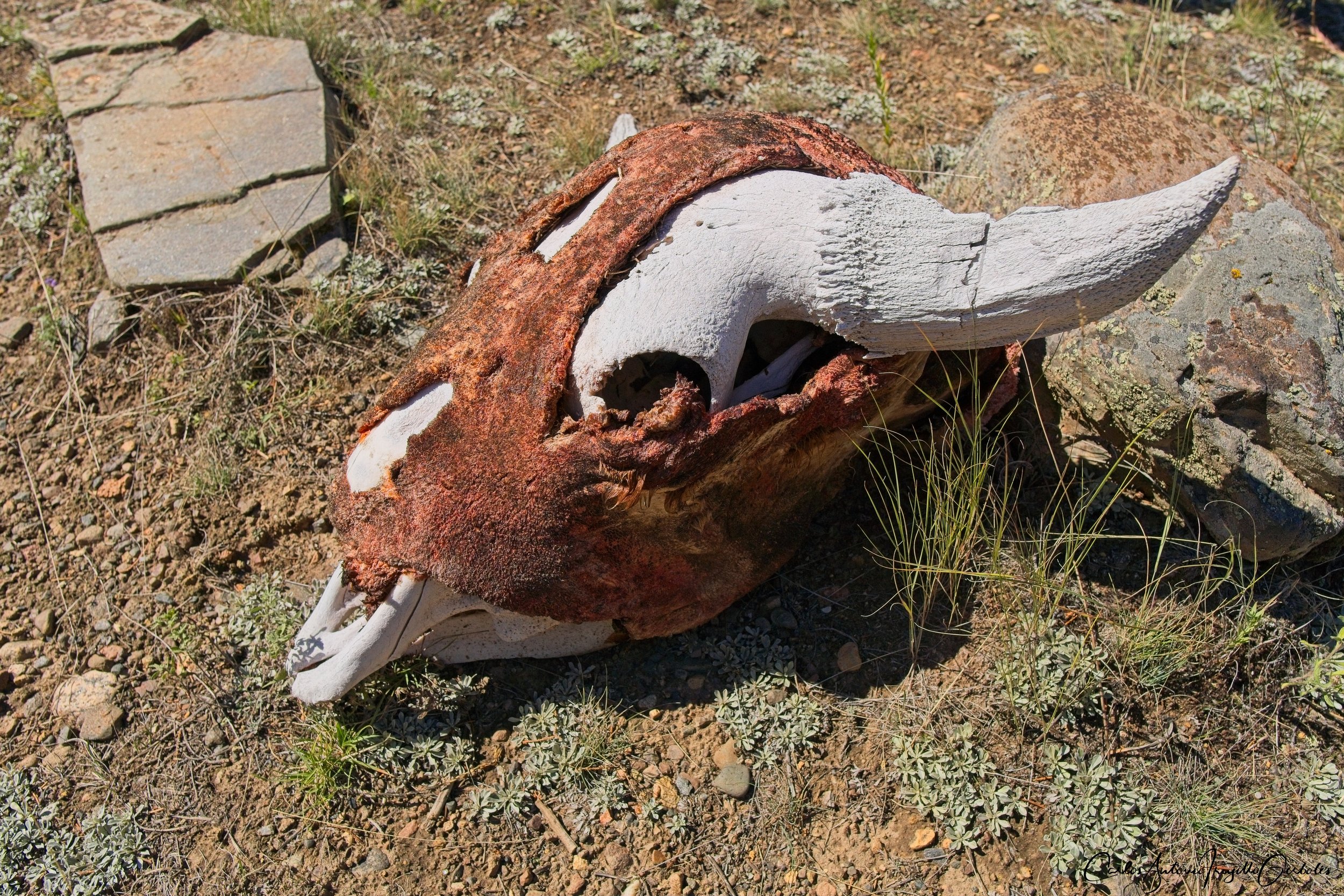
Howard Eaton (in blue): I will say it, I prefer to hike it from Canyon, get to the overviews of Hayden Valley and turn around instead of hiking from Fishing Bridge and then turn around. I don’t have a shuttle so I need to pick a side and the Canyon side is superior. Large meadows just starting the hike and I have run into herds of elk there. You cross a creek in a small forest and from then on it is expansive views of the Yellowstone River and the road behind it. You will definitely run into bison and please keep an eye for carcasses, I have seen quite a few year old skeletons. At around mile 8 I just found high ground and admired the expansive views of Hayden Valley from an elevated location. This is a magnificent hike, specially when you have a scope and notice the people at the pullouts on the road wandering how this guy made it there.
The Good: TBD.
The Bad: TBD
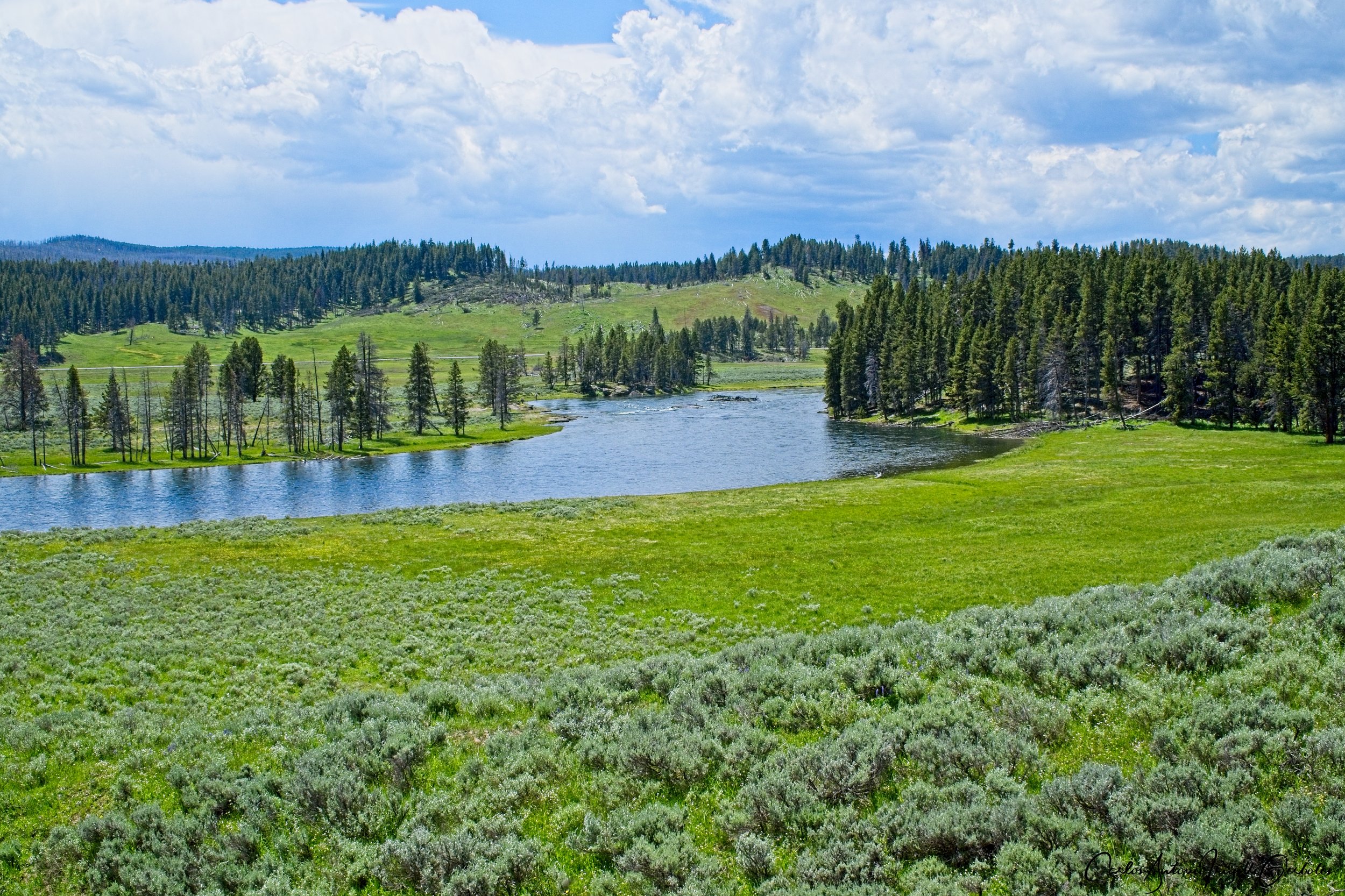
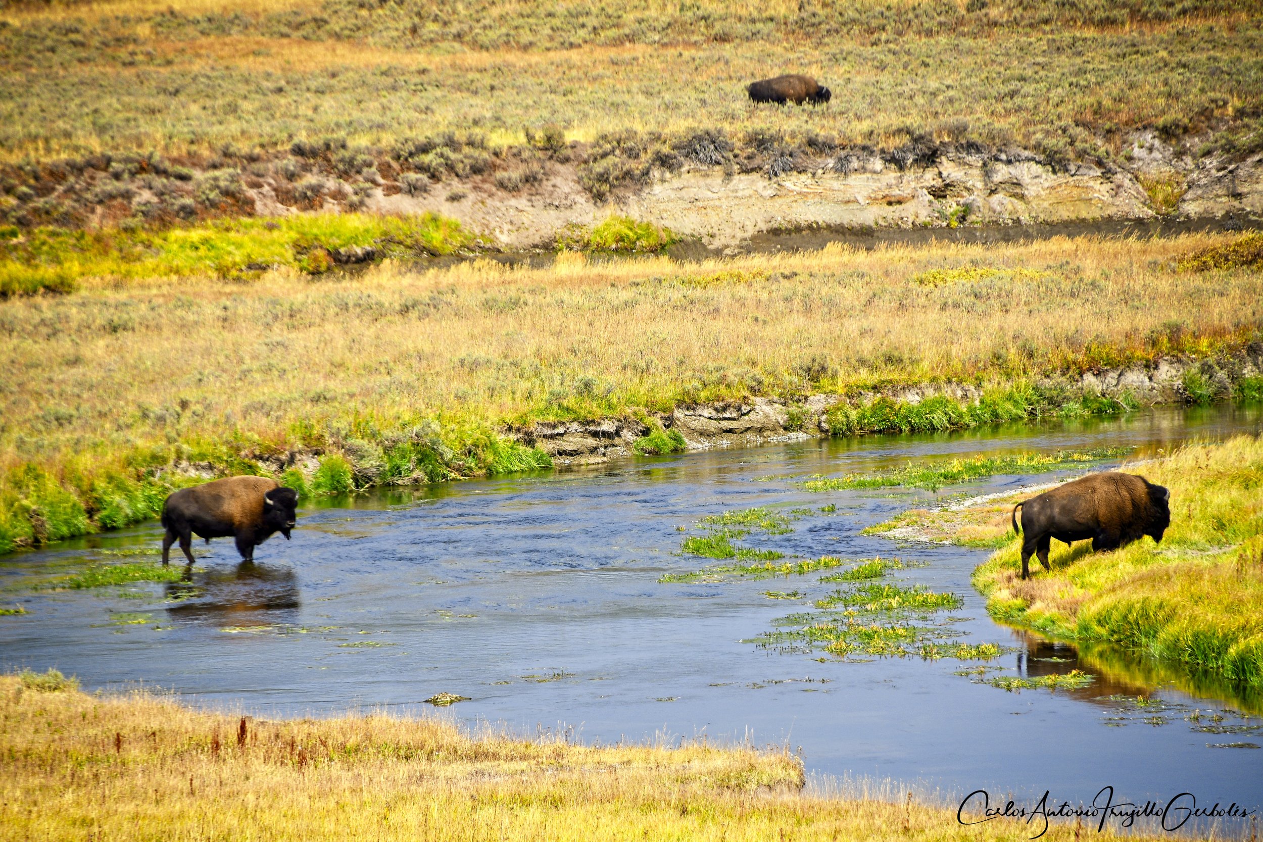
Mary Mountain East (in red): This is the other half of the Mary Mountain trail for those that can’t do a point to point hike. This is completely different than the west side, wide open views. If you start early, there is a chance you will hear wolves, but starting early is a risk for other critter so best to hike in a group. The trail is pretty wet, small creeks from the right just end at the flat land. There are lots of lone bison at the start of the trail, but once you hike past Violet Creek (careful, that water is pretty hot), you will definitely find large herds of bison (hundreds), just like you would in Lamar Valley. Just find a hill, have lunch and enjoy the bison herd. I think I want to hike close to Mary Lake and return, but that is a long day hike. Colors in fall are amazing and the valley is immense.
The Good: TBD.
The Bad: TBD
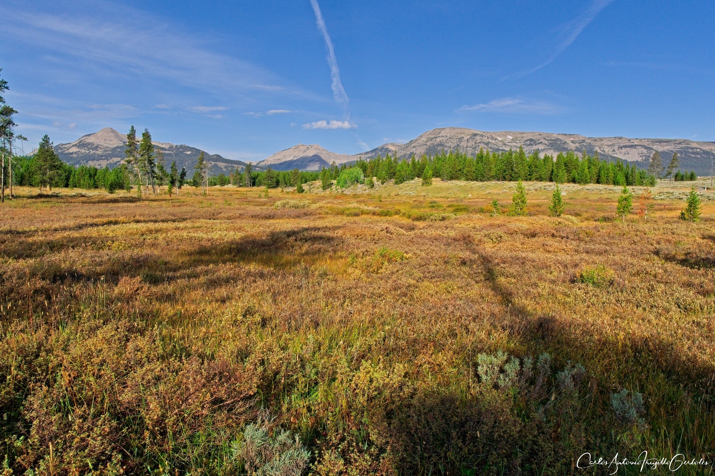
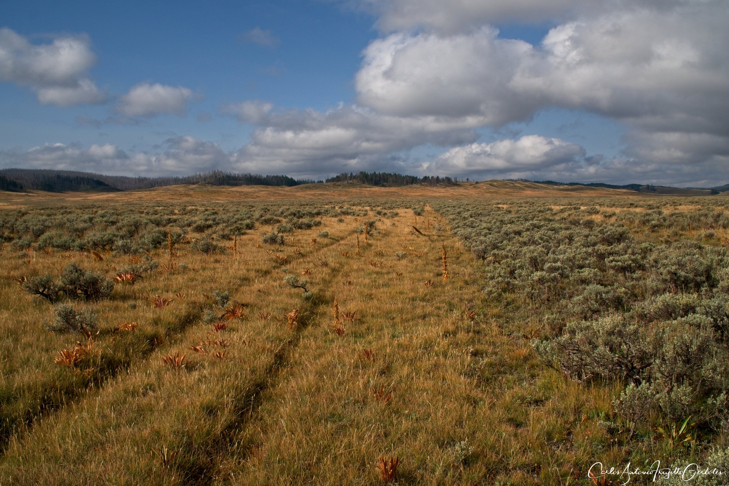
Hayden Valley (in violet): Hayden Valley, oh my !!!! This is a completely off trail hike, but there “is” a trail so I list it here. First, this is super dangerous for casual people: the park doesn’t monitor off trail carcasses and bears in there so whatever is waiting for you in there, you will not be warned about it. The ‘trail’ that I refer to is the old wagon trail that took people across Hayden to the other side of the park. You can actually see it on Google Earth and that is what I used to map my hike. Again, bison, creek crossings, wide open views. You will definitely be the only people there, no one will come to help you if something happens.
The Good: TBD.
The Bad: TBD
Clear/Ribbon Lakes, Seven Mile Hole, Observation Point/Greble Lake

Clear and Ribbon lakes (in black): This is a leisurely hike that takes you to two nice lakes. If you want a safe route, this is a good one. You can also connect to the paved trail that overlooks the river on the south shore. I found some thermal areas on the way, nice.
The Good: TBD.
The Bad: TBD
Seven Mile Hole (in red): Do this hike !!! This is a hike that slowly takes you down to the shores of the Yellowstone River. For the first 3 miles the hike is mostly level and in a forested area. Then it is all downhill, with occasional views of the river. But the payoff is at the bottom, when you cross a creek and reach the beach. In that area the river is noisy and not tranquil at all. Best place to find a large rock and have lunch and enjoy the roar of the river. There is a potential side trip to the Washburn Hot Springs (I have not done it yet).
The Good: TBD.
The Bad: TBD
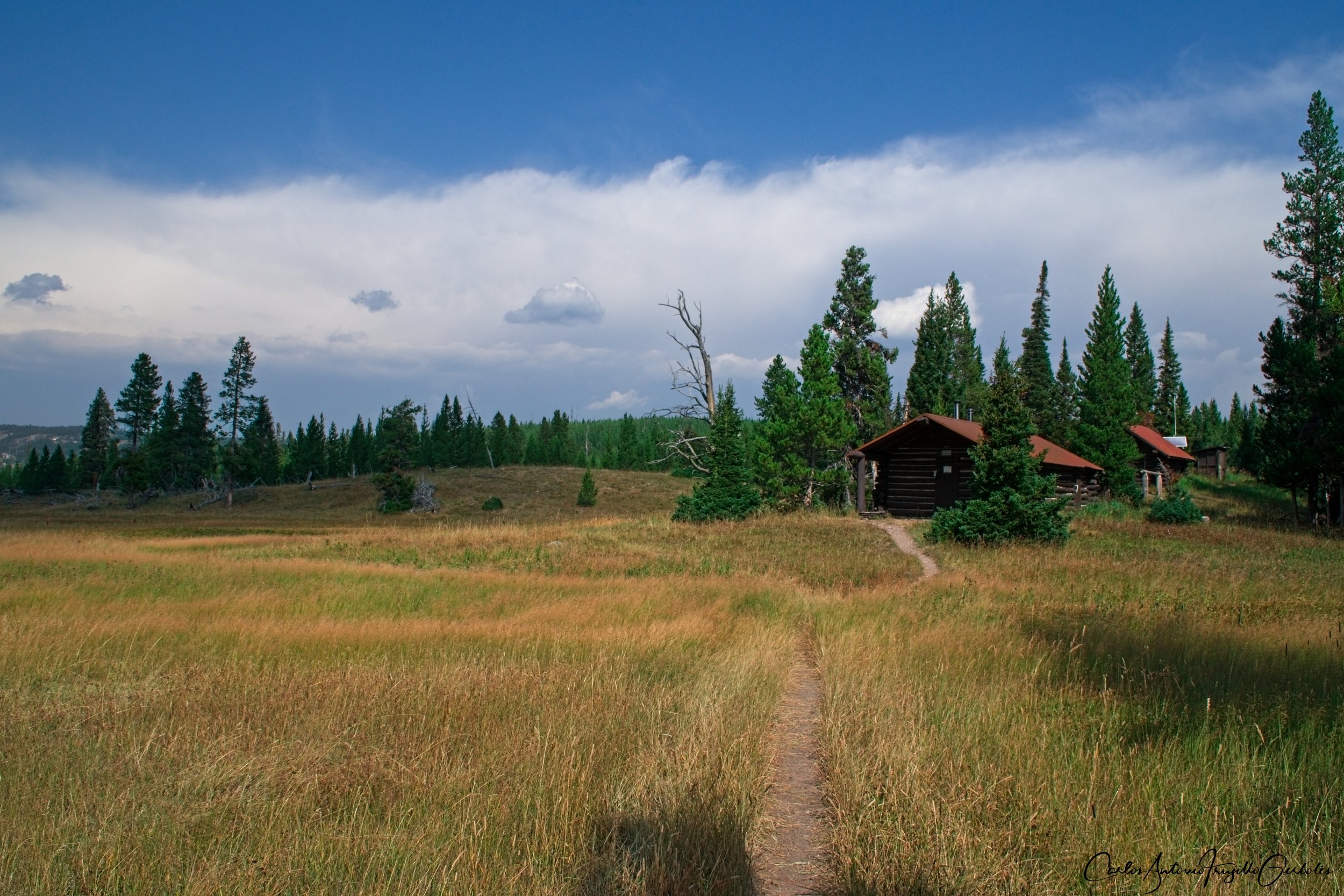
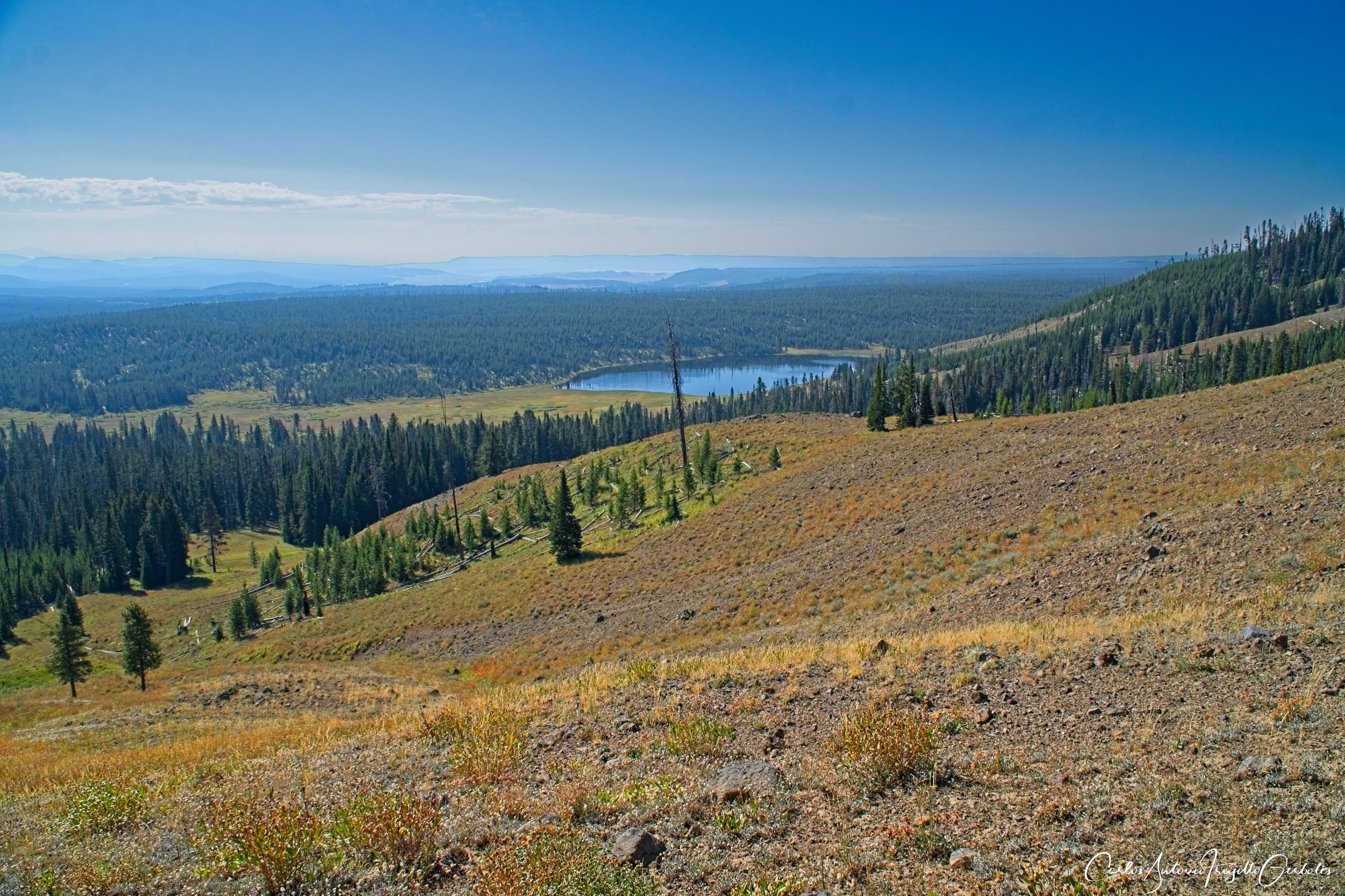
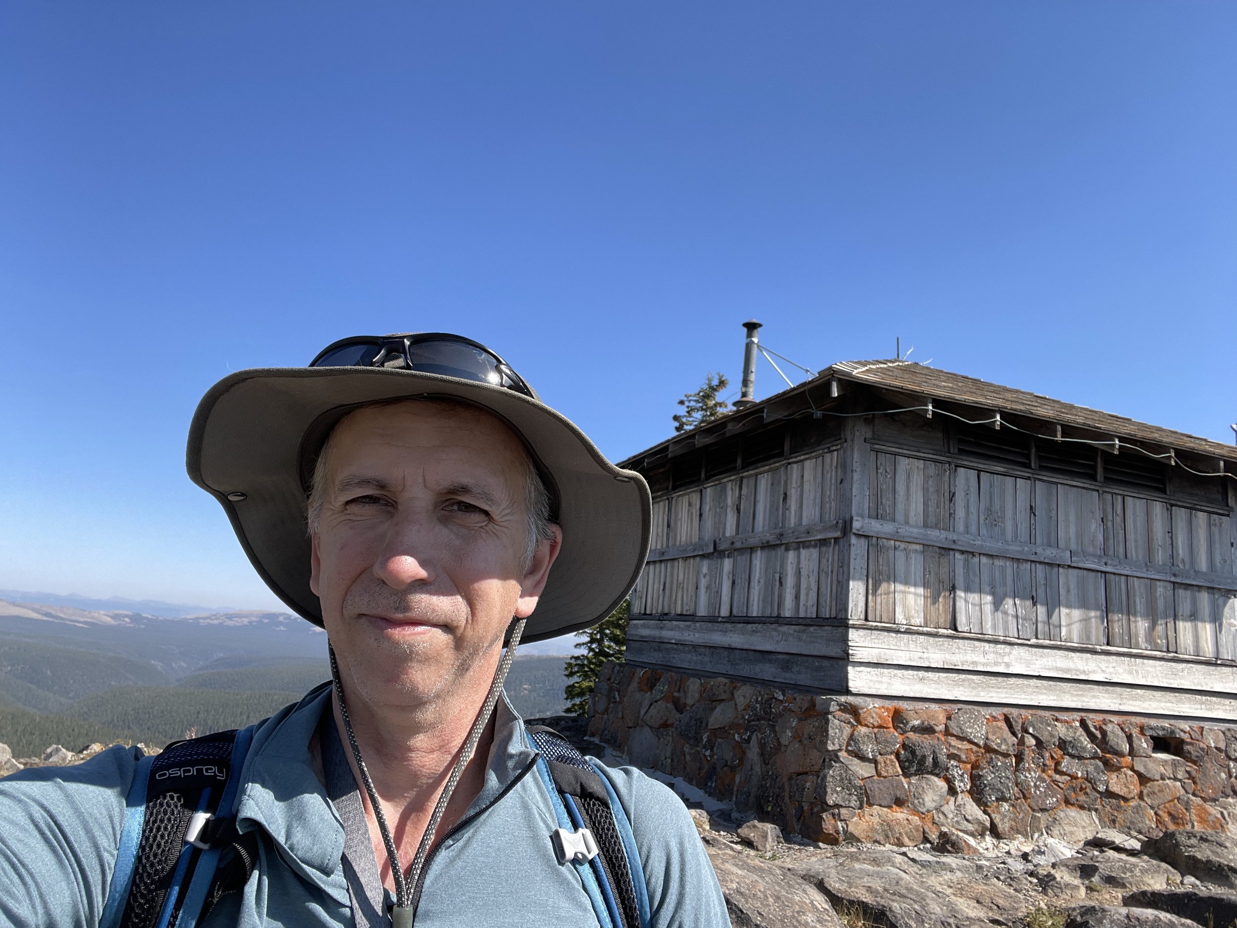
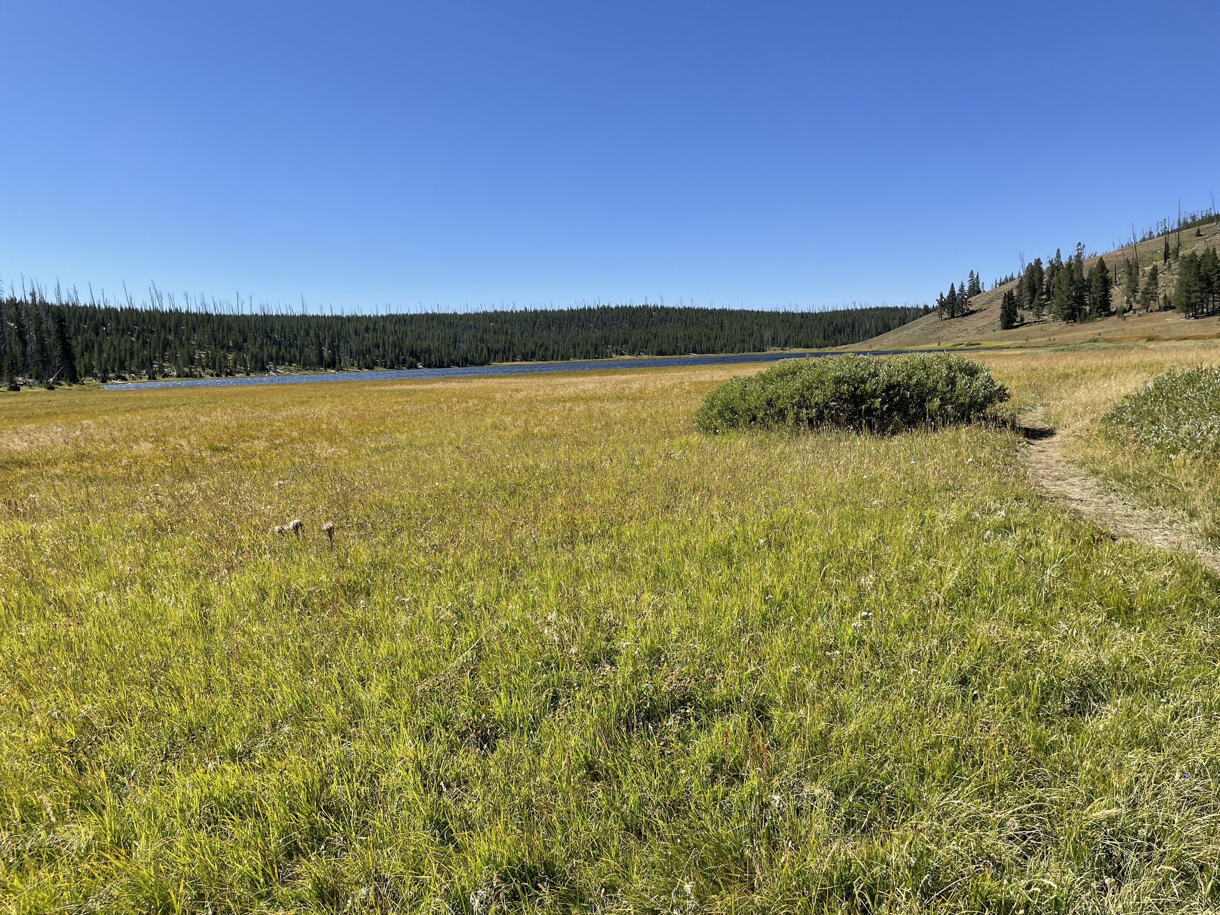
Observation Point, Cascade and Greble Lakes (in blue): I started this hike from a trailhead on the road to Washburn. There is another trailhead that takes you to Greble and skips Cascade Lake if you take the road from Canyon to Norris. That is an option since you can make it to Wolf Lake also. I decided to hike to Cascade Lake (where people fish) and then enter a forested area to get to Greble (and see people fishing also). This is an area that gets bear warnings and closures, so keep an eye on the park service webpage. On the way back from Greble I went up to Observation Point, where there is a fire lookout (not sure if it is active) and you can see from there Greble lake too. It is a nice side trip but hard on the legs. I am sucker for lakes, so the other route sounds appealing to do on another trip.
The Good: TBD.
The Bad: TBD
Mt Washburn, Specimen Ridge

Mount Washburn (in blue): this is a tourist hike and after I hiked Avalanche, it doesn’t appeal to me as a must do hike. But many people hike it. The trail was an old paved road that took cars all the way to the top (really, cars drove to the top), so it feels weird to call it a trail. The views from the top are great and you can see all the way to Hayden Valley. The top is windy. There is a side trip that I wished I did take, take the Mount Washburn Spur going East; it looks like going on a ridgeline, so the views could be great too from there and with less people around. There are bears in that mountain, but the traffic of people will scare the bears away.
The Good: TBD.
The Bad: TBD
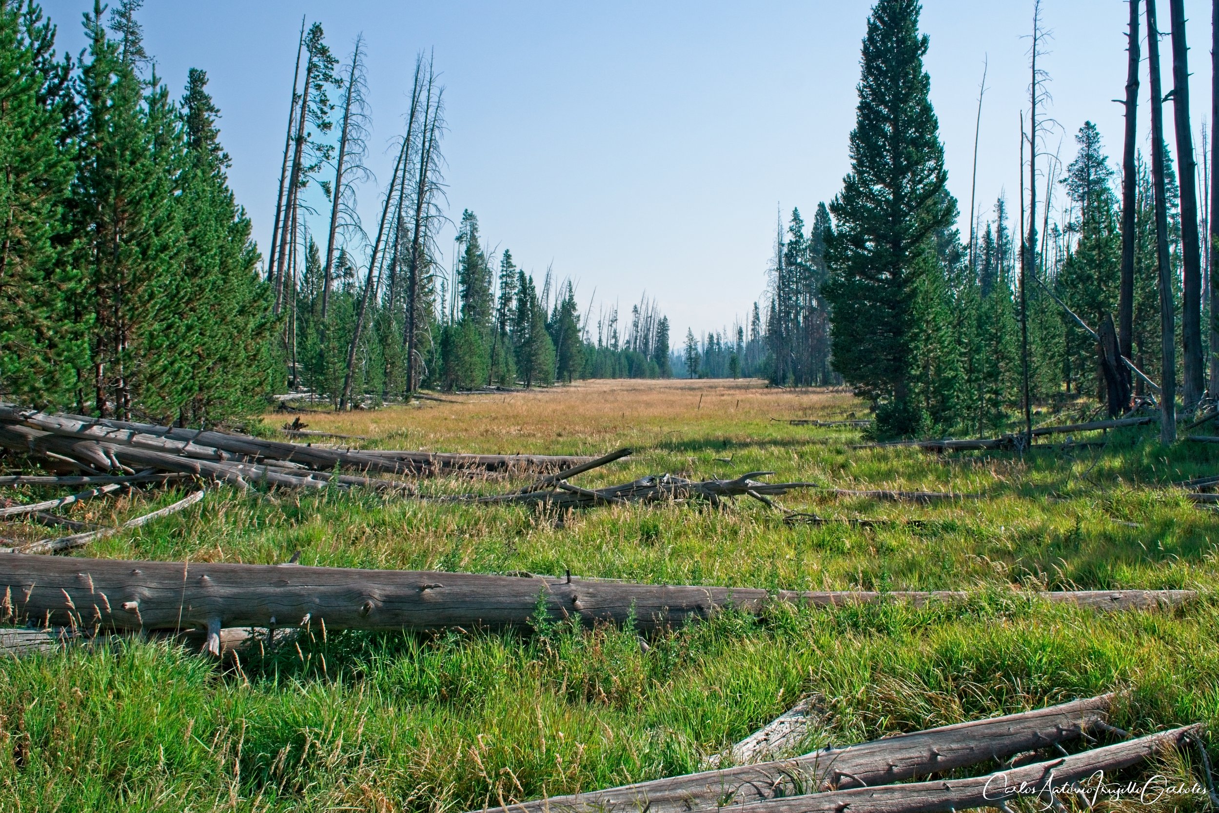
Specimen Ridge (in red): I have done this trail twice, in and out for about 6-7 miles from the Yellowstone picnic area (don’t start the hike from there, but from the real trailhead further down the road. The path from the picnic area is steep). Again, you get up on a plateau, but this time you need to pay attention since there are dozens of bison trails that will mask the real trail and make you hike more than you should on the way up. At the top, it is all wide open and you have a nice valley to your right (I am thinking of exploring it). You are just hiking from marker to marker, but many times the bison will push them down; you could loose track of the trail for a while but you will eventually find another marker (the direction of the trail is constant, you will not miss a curve within the first few miles). The real feature of this trail is the antelope, each time that I have hiked it I have seen small 5-10 individual herds lounging on the grass. I just picked a spot that looks over them and enjoy the view. There is another segment of the trail that starts in Lamar Valley, crosses the river and gets up to Amethyst Mountain. I think the views of Lamar Valley from there must be spectacular so I will be doing this in summer of 2024. The total length of the trail is about 18-20 miles, but it is point to point. Be aware that the Lamar River section needs to be navigated later in the summer so crossing the river is not a pain.
The Good: TBD.
The Bad: TBD
Slough Creek, Buffalo Plateau

Slough Creek (in violet): The perfect time to hike this area is fall, there are plenty of trees that become marvels of colors during fall. You park past the toilets next to the main road, don’t worry, that dirt road that takes you to the trailhead is flat and usable by any vehicle. Once you arrive at the creek you will be hiking next to it and eventually leave Wyoming and enter Montana. The highlight for me was watching so many backpackers fishing in the creek. There is no elevation gain (except at the start), so the hike is peaceful and relaxing. I kept looking at the other side of the creek in case I could spot wolves, but no dice.
The Good: TBD.
The Bad: TBD
Buffalo Plateau (in red): Instead of hiking Hellroaring you can decide to hike into the wide open areas of Buffalo Plateau. You reach a Y and then take a right. Keep going and take another right (left takes you to Coyote Creek), where you will run into plenty bison. Once you start gaining elevation at the plateau, look back and the views are amazing. You will not run into anyone since everyone is hiking Hellroaring, but I prefer these expansive views. At mile 6 you enter a forested area and for a lone hiker it gets sketchy, so you need to be alert. I highly recommend it. Be aware that trails that look like trails are just bison tracks and funny enough one of the straight ones is not real, the crooked path is the real one.
The Good: TBD.
The Bad: TBD
Blacktail Deer, Rescue Creek

Blacktail Deer (in green): This is a hidden gem !!!! This trail shares the trailhead with the Rescue Creek trail. The parking area is small, but across the road there is a larger one that also has bathrooms. While many take a left turn towards Rescue Creek, I took a right and ran into an incredible amount of wolf tracks; I have never seen so many wolf track (fresh) hiking in Yellowstone. You start at a large meadow and then the trail narrows next to a creek. You start losing elevation since you will be approaching the Yellowstone River A nice bridge takes you over the Yellowstone River and then you get down to the river itself. At that point the trail follows next to the river, passing by a beautiful lake (Crevice Lake). For those that don’t know, this area is prime prairie rattlesnake country and those are venomous. I ran into one and stopping fast enough saved me from a bite, so walk slowly and be alert to the noise of a rattle. There are some falls when you hike along the river, plus I only saw backpackers on the trail.
The Good: TBD.
The Bad: TBD
Rescue Creek (in red): Next year I will take a left and hike this area.
What else is there to do that I haven’t hiked yet ?
Colonnade Falls, Dunanda Falls, Robinson Creek
Lamar Valley/Specimen Ridge
Hellroaring